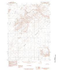
1985 Map of Bering Glacier B-7
USGS Topo · Published 1985About this map
Bering Glacier and Steller Glacier dominate this remote Alaskan coastal landscape, recorded during the mid-1980s. The map illustrates a massive glacial system in flux, characterized by extensive Moraine deposits that trace the historical movement of ice across the terrain. Rising above the frozen expanse, the Khitrov Hills and Grindle Hills serve as prominent terrestrial landmarks amidst the white and blue of the ice fields. This provisional survey, compiled from aerial photography taken in the early 1970s, captures a wilderness devoid of roads or permanent settlements. Instead, the focus remains entirely on the natural geography of the region, providing a detailed record of the glacial margins and the rocky outcrops that define this portion of the Yakutat area.
Find a feature on this map
6 named features on this map. Tap any name to fly to it.
Don’t see what you’re looking for? This feature index may not catch every label — zoom into the map to look around manually.
Map Details
Editions of this 1985 Bering Glacier B-7 Map
This is the sole edition of this map. No revisions or reprints were ever made.
Other maps of this area

1950 · Bering Glacier
USGS Topo · 1:250,000

1951 · Bering Glacier
USGS Topo · 1:250,000

1959 · Bering Glacier
USGS Topo · 1:250,000
1984 · Bering Glacier A-8
USGS Topo · 1:63,360
1984 · Bering Glacier A-6
USGS Topo · 1:63,360
1984 · Bering Glacier A-7
USGS Topo · 1:63,360
1985 · Bering Glacier C-7
USGS Topo · 1:63,360
1985 · Bering Glacier B-6
USGS Topo · 1:63,360
1985 · Bering Glacier B-8
USGS Topo · 1:63,360
1985 · Bering Glacier C-8
USGS Topo · 1:63,360