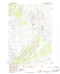
1984 Map of Bering Glacier A-8
USGS Topo · Published 1984About this map
The massive Bering Glacier dominates the northern reaches of this coastal landscape, its ice fields and moraine patterns descending toward the Gulf of Alaska. Near the shoreline, Cape Suckling marks a prominent point where the land meets the sea, flanked by the shifting sands and tidal influences of the Kwinlatah Slough and Kiklukh River. The interior is defined by the Suckling Hills and the eastern edge of the Chugach National Forest, creating a transition from glacial ice to wooded slopes and drainage basins.
Find a feature on this map
19 named features on this map. Tap any name to fly to it.
Don’t see what you’re looking for? This feature index may not catch every label — zoom into the map to look around manually.
Map Details
Editions of this 1984 Bering Glacier A-8 Map
2 editions found
Other maps of this area

1948 · Cordova
USGS Topo · 1:250,000

1948 · Middleton Island
USGS Topo · 1:250,000

1950 · Middleton Island
USGS Topo · 1:250,000

1950 · Bering Glacier
USGS Topo · 1:250,000

1950 · Icy Bay
USGS Topo · 1:250,000

1950 · Cordova A-1
USGS Topo · 1:63,360

1951 · Icy Bay
USGS Topo · 1:250,000

1951 · Bering Glacier
USGS Topo · 1:250,000

1951 · Cordova
USGS Topo · 1:250,000

1951 · Cordova B-1
USGS Topo · 1:63,360