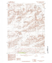
1985 Map of Bering Glacier C-8
USGS Topo · Published 1985About this map
Mount Tom White stands as a prominent landmark in this high-altitude landscape of eastern Alaska during the mid-1980s. The region is defined by massive ice fields and glacial movements, with the Van Cleve Glacier and Wernicke Glacier flowing through the northern reaches. To the south, the expansive Martin River Glacier dominates the terrain, terminating near Canyon Lake. This map captures a transition of land management and conservation, where the boundaries of the Wrangell - Saint Elias National Park and the Wrangell - Saint Elias Wilderness meet the eastern edge of the Chugach National Forest. The absence of roads or permanent settlements highlights the inaccessible nature of these interior mountains and ice flows as they were documented before modern glacial recession trends became more pronounced.
Find a feature on this map
10 named features on this map. Tap any name to fly to it.
Don’t see what you’re looking for? This feature index may not catch every label — zoom into the map to look around manually.
Map Details
Editions of this 1985 Bering Glacier C-8 Map
This is the sole edition of this map. No revisions or reprints were ever made.
Other maps of this area

1948 · Cordova
USGS Topo · 1:250,000

1950 · Bering Glacier
USGS Topo · 1:250,000

1951 · Bering Glacier
USGS Topo · 1:250,000

1951 · Cordova
USGS Topo · 1:250,000

1951 · Cordova B-1
USGS Topo · 1:63,360

1953 · Cordova B-1
USGS Topo · 1:63,360

1959 · Cordova D-1
USGS Topo · 1:63,360

1959 · Cordova C-1
USGS Topo · 1:63,360

1959 · Bering Glacier
USGS Topo · 1:250,000

1959 · Cordova
USGS Topo · 1:250,000