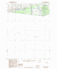
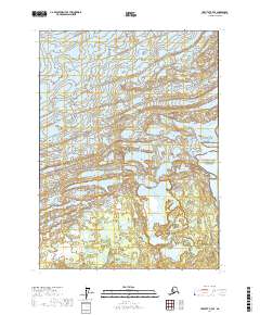
1985 Map of Yakutat C-7
USGS Topo · Published 1985About this map
Malaspina Glacier dominates the northern reaches of this coastal Alaskan landscape, where glacial runoff feeds into the Gulf of Alaska. The map illustrates a complex convergence of conservation boundaries during the mid-1980s, specifically the meeting points of the Wrangell-Saint Elias Wilderness, Wrangell-Saint Elias National Park, and the Wrangell-Saint Elias National Preserve. Along the shoreline, Point Manby serves as a primary geographic anchor where the glacial Moraine gives way to the sea. The hydrological pattern is defined by short, braided waterways like Alder Stream and Manby Stream, which carry sediment from the ice fields to the coast. This cartographic study provides a detailed view of the transitional zone between massive ice sheets and the open ocean before modern climate shifts further altered the glacial terminus.
Find a feature on this map
11 named features on this map. Tap any name to fly to it.
Don’t see what you’re looking for? This feature index may not catch every label — zoom into the map to look around manually.
Map Details
Editions of this 1985 Yakutat C-7 Map
This is the sole edition of this map. No revisions or reprints were ever made.
Other maps of this area

1951 · Yakutat
USGS Topo · 1:250,000

1959 · Yakutat
USGS Topo · 1:250,000
1985 · Yakutat D-6
USGS Topo · 1:63,360
1985 · Yakutat C-6
USGS Topo · 1:63,360
1985 · Yakutat C-8
USGS Topo · 1:63,360
1985 · Yakutat D-8
USGS Topo · 1:63,360
1985 · Yakutat D-7
USGS Topo · 1:63,360
2017 · Yakutat C-6 NW
USGS Topo · 1:25,000
2017 · Yakutat D-6 SW
USGS Topo · 1:25,000
2017 · Yakutat D-7 SE
USGS Topo · 1:25,000