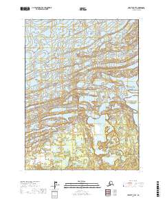
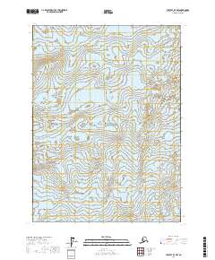
2017 Map of Yakutat D-7 SE
USGS Topo · Published 2017About this map
Malaspina Glacier dominates the northern reaches of this landscape, its presence defining the hydrography and topography of the coastal Alaskan wilderness. The ice field transitions into a complex network of wetlands and drainage patterns as it nears the coast, feeding into Malaspina Lake and the winding Manby Stream. This 2017 survey details the intersection of the Wrangell-Saint Elias National Park and the adjacent Wrangell-Saint Elias National Preserve, illustrating a terrain defined by glacial movement rather than human settlement. The absence of roads or structures highlights the remote nature of this protected corridor, where the natural forces of the ice and tidal influence shape the land.
Find a feature on this map
12 named features on this map. Tap any name to fly to it.
Don’t see what you’re looking for? This feature index may not catch every label — zoom into the map to look around manually.
Map Details
Editions of this 2017 Yakutat D-7 SE Map
This is the sole edition of this map. No revisions or reprints were ever made.
Other maps of this area

1951 · Yakutat
USGS Topo · 1:250,000

1959 · Yakutat
USGS Topo · 1:250,000
1985 · Yakutat D-6
USGS Topo · 1:63,360
1985 · Yakutat C-6
USGS Topo · 1:63,360
1985 · Yakutat C-7
USGS Topo · 1:63,360
1985 · Yakutat D-7
USGS Topo · 1:63,360
2017 · Yakutat C-6 NW
USGS Topo · 1:25,000
2017 · Yakutat D-6 SW
USGS Topo · 1:25,000
2017 · Yakutat C-7 NW
USGS Topo · 1:25,000
2017 · Yakutat D-7 NW
USGS Topo · 1:25,000