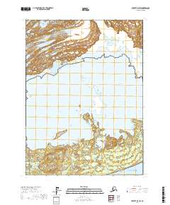
2017 Map of Yakutat D-6 SW
USGS Topo · Published 2017About this map
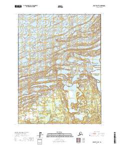
Malaspina Glacier dominates the northern reaches of this coastal landscape, showing the dramatic interface between the ice field and the massive Malaspina Lake. This 2017 survey documents a dynamic glacial environment where the ice meets the water across a broad front. To the south, the terrain transitions into the Wrangell-Saint Elias National Preserve, a complex network of wetlands and braided waterways including Forney Stream and Osar Stream. The map concludes at the edge of the Gulf of Alaska, marked by the narrow stretch of Schooner Beach. This coastal boundary within the Wrangell-Saint Elias National Park illustrates the active geological processes and shifting shorelines of the Yakutat region.
Find a feature on this map
15 named features on this map. Tap any name to fly to it.
Don’t see what you’re looking for? This feature index may not catch every label — zoom into the map to look around manually.
Map Details
Editions of this 2017 Yakutat D-6 SW Map
This is the sole edition of this map. No revisions or reprints were ever made.
Other maps of this area

1951 · Yakutat
USGS Topo · 1:250,000

1959 · Yakutat
USGS Topo · 1:250,000
1985 · Yakutat D-6
USGS Topo · 1:63,360
1985 · Yakutat C-6
USGS Topo · 1:63,360
1985 · Yakutat C-7
USGS Topo · 1:63,360
1985 · Yakutat D-7
USGS Topo · 1:63,360
2017 · Yakutat D-6 NE
USGS Topo · 1:25,000
2017 · Yakutat D-6 SE
USGS Topo · 1:25,000
2017 · Yakutat C-6 NW
USGS Topo · 1:25,000
2017 · Yakutat D-7 SE
USGS Topo · 1:25,000