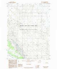
1985 Map of Yakutat D-8
USGS Topo · Published 1985About this map
The massive ice fields of the Malaspina Glacier dominate this coastal Alaskan landscape, where the glacial ice meets the rugged waters of the Gulf of Alaska. Compiled from aerial photography taken in the early 1970s, the map reveals a complex system of Moraine formations along the southern edge of the glacier, indicating the shifting boundaries of the ice sheet during this era. Most of the territory shown is protected as part of the Wrangell - Saint Elias National Park and the dedicated Wrangell - Saint Elias Wilderness. The note indicating that the Boundary Follows Shoreline highlights the dynamic nature of this environment, where the tide-water glacier and the sea are in constant contact, unmarred by roads or permanent human settlements.
Find a feature on this map
6 named features on this map. Tap any name to fly to it.
Don’t see what you’re looking for? This feature index may not catch every label — zoom into the map to look around manually.
Map Details
Editions of this 1985 Yakutat D-8 Map
This is the sole edition of this map. No revisions or reprints were ever made.
Other maps of this area

1950 · Bering Glacier
USGS Topo · 1:250,000

1950 · Icy Bay
USGS Topo · 1:250,000

1951 · Icy Bay
USGS Topo · 1:250,000

1951 · Bering Glacier
USGS Topo · 1:250,000

1951 · Yakutat
USGS Topo · 1:250,000

1951 · Mt Saint Elias
USGS Topo · 1:250,000

1959 · Yakutat
USGS Topo · 1:250,000

1959 · Bering Glacier
USGS Topo · 1:250,000

1959 · Mt Saint Elias
USGS Topo · 1:250,000

1961 · Icy Bay
USGS Topo · 1:250,000