1950s Maps of Yakutat, Alaska
Explore 33 historic maps of Yakutat from the 1950s. These maps offer a rare glimpse into what life looked like during the 1950s — showing old roads, neighborhoods, homes, and landmarks that have changed or disappeared over time.
Whether you're researching your family's past, planning a metal detecting trip, or studying how Yakutat's landscape evolved across the 1950s, these high-resolution maps are a powerful tool for exploring the history of this region.
- Focus on a specific era: All maps on this page are from the 1950s, giving you a focused view of this time period.
- See what’s changed: Compare century-old streets, trails, and buildings to today's modern landscape using overlays and satellite layers.
- Research with precision: Use these maps for genealogy, historical research, land use analysis, or educational projects.
- View, download, or print: Maps are fully viewable online in high resolution, and can be downloaded or printed for your own records.
Start exploring Yakutat's history through authentic maps from the 1950s. This is your window into the past.
Yakutat, AK maps
(33)- 1950 Map of Bering Glacier A-3, 1952 Print
 1950 Bering Glacier A-31952 Print · USGSThe mid-century Alaskan coast is defined here by massive ice fields and high alpine peaks. Trace the coastal wilderness from the Guyot Glacier down to the Gulf of Alaska shoreline, identifying landmarks like Umbrella Reef and isolated cabins.2 unique versions available
 - 1950 Map of Bering Glacier, 1958 Print
 1950 Bering Glacier1958 Print · USGSThe Alaskan coast and the immense ice fields of the Chugach Mountains are captured here at the midpoint of the twentieth century. Researchers can trace the isolated outposts at Cape Yakataga, the remote Yakataga Airport, and landmarks like Berg Lake.
 - 1950 Map of Icy Bay, 1961 Print
 1950 Icy Bay1961 Print · USGSThe Alaskan coast in the early 1950s is defined here by the massive Malaspina Glacier meeting the open sea. Researchers can trace the mid-century shoreline from Cape Suckling to the deep waters of Icy Bay and Riou Bay.
 - 1951 Map of Icy Bay D-2 and D-3
 1951 Icy Bay D-2 and D-31951 Print · USGSIcy Bay and the Gulf of Alaska coastline are shown here in the early fifties, following post-war aerial surveys. Local historians can trace remote landmarks like Moraine Reef, isolated coastal Cabin sites, and the mouth of the Priest River.2 unique versions available
 - 1951 Map of Icy Bay
 1951 Icy Bay1951 Print · USGSThe glacial coastline of Yakutat is captured in the early fifties, showing where the ice meets the sea. Researchers can trace the massive Malaspina Glacier and navigate coastal landmarks like Icy Cape and Riou Bay.
 - 1951 Map of Bering Glacier
 1951 Bering Glacier1951 Print · USGSThe Gulf of Alaska coastline and its massive ice fields appear in this early fifties survey before modern development reached the region. Researchers can locate remote outposts like Cape Yakataga, the Yakataga Airport, and coastal markers like Umbrella Reef.
 - 1951 Map of Bering Glacier A-4
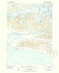 1951 Bering Glacier A-41951 Print · USGSCoastal Alaska at the mid-century reveals a dynamic landscape of massive glaciers and braided rivers meeting the sea. Researchers can locate remote outposts like the Yakataga Airport and various cabins along the shore near Cape Yakataga and Oil Creek.2 unique versions available
 - 1951 Map of Bering Glacier A-2, 1952 Print
 1951 Bering Glacier A-21952 Print · USGSThe Alaskan coast near Yakutat comes to life in the early 1950s, showing a world of ice and tide. Geologists and researchers can trace the massive Guyot Glacier and the drainage of Big Sandy Creek into Icy Bay.3 unique versions available
 - 1951 Map of Yakutat, 1952 Print
 1951 Yakutat1952 Print · USGSThe coastal village of Yakutat is surveyed here in the early fifties, caught between massive ice fields and the sea. Researchers can trace the mid-century Military Airport and remote features like Harlequin Lake and the Alsek River.4 unique versions available
 - 1951 Map of Mt Saint Elias, 1952 Print
 1951 Mt Saint Elias1952 Print · USGSThe Alaska-Canada borderlands appear in mid-century detail during this 1951 survey of the high peaks and ice fields near Yakutat. Researchers can trace the massive Malaspina Glacier, the towering Mt St Elias, and the shores of Disenchantment Bay.3 unique versions available
 - 1951 Map of Mt Fairweather, 1953 Print
 1951 Mt Fairweather1953 Print · USGSCoastal Alaska at the mid-century remains a landscape of massive ice and isolated outposts. Researchers can trace the remote Solomon Railroad and early settlements like Pelican and Elfin Cove nestled along the glacial waterways.2 unique versions available
 - 1952 Map of Skagway, 1953 Print
 1952 Skagway1953 Print · USGSThe northern reaches of the Alaska Panhandle come alive in the early fifties, showing the vital rail and road links to the Yukon. Trace the historic White Pass & Yukon Route or locate remote camps like Pleasant Camp and Klukwan.4 unique versions available
 - 1959 Map of Yakutat A-1
 1959 Yakutat A-11959 Print · USGSThe coastal wilderness of the Gulf of Alaska is documented here in the late fifties, showing a landscape shaped by ice and water. Researchers can trace the massive Alsek Glacier and its impact on features like Lower Doame Lake and the Deception Hills.3 unique versions available
 - 1959 Map of Yakutat C-3, 1963 Print
 1959 Yakutat C-31963 Print · USGSYakutat, Alaska, was a landscape of massive ice and unnamed peaks when this survey was field annotated in the late fifties. Geologists and researchers can trace the mid-century extent of the Hidden Glacier, West Nunatak Glacier, and Black Tit.2 unique versions available
 - 1959 Map of Yakutat B-5, 1963 Print
 1959 Yakutat B-51963 Print · USGSThe coastal Alaskan wilderness near Yakutat is captured here in the late fifties as a landscape of glacial rivers and seasonal industry. Researchers can find traditional landmarks like Chief Situk Grave alongside the Yakutat Airport and a remote Cannery.2 unique versions available
 - 1959 Map of Yakutat D-3, 1963 Print
 1959 Yakutat D-31963 Print · USGSCoastal Alaska's glaciated wilderness is captured here in the late fifties, showing the intricate ice fields along the international boundary. Researchers can trace the massive flows of the Art Lewis Glacier and Butler Glacier as they move toward Nunatak Fiord.2 unique versions available
 - 1959 Map of Yakutat A-2, 1963 Print
 1959 Yakutat A-21963 Print · USGSCoastal Yakutat in the late fifties shows a landscape of braided rivers and shifting deltas at the edge of the Gulf. Local historians can trace the remnants of early industry at the Cannery (Aband) and follow the Old RR Grade through the Tongass National Forest.3 unique versions available
 - 1959 Map of Yakutat C-5, 1963 Print
 1959 Yakutat C-51963 Print · USGSCoastal life in the late 1950s centered around the fishing and transit hub of Yakutat as it looked before major modernization. Researchers can trace the Yakutat and Southern rail route or locate local landmarks like the Khantaak Light and Cem.2 unique versions available
 - 1959 Map of Yakutat D-4, 1963 Print
 1959 Yakutat D-41963 Print · USGSCoastal Alaska during the late fifties reveals a dynamic landscape of massive ice flows and tidal inlets. Researchers can trace the mid-century extent of Variegated Glacier and Hidden Glacier as they meet Russell Fiord and Seal Bay.2 unique versions available
 - 1959 Map of Yakutat A-3, 1963 Print
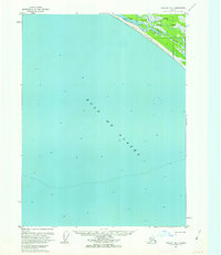 1959 Yakutat A-31963 Print · USGSThe coastal wilderness of the Gulf of Alaska is documented here in the late fifties, showing a landscape defined by tidal rivers and forest. Researchers can trace the path of the Tractor Trail to isolated Cabins near the Akwe River.3 unique versions available
 - 1959 Map of Yakutat C-4, 1963 Print
 1959 Yakutat C-41963 Print · USGSThe Yakutat Forelands and the deep waters of Russell Fiord are captured here in the late fifties, showing a landscape defined by retreating ice and coastal forest. Researchers can trace the path of a Tractor Trail or locate the remote waters of Situk Lake and Chicago Harbor.2 unique versions available
 - 1959 Map of Yakutat B-3, 1963 Print
 1959 Yakutat B-31963 Print · USGSGlacial waters meet the Gulf of Alaska in the mid-twentieth century, revealing a dynamic coastal landscape of ice and braided rivers. Map collectors can trace the Tractor Trail along the shore or locate the remote Cabin near the Brabazon Range.2 unique versions available
 - 1959 Map of Yakutat B-2, 1963 Print
 1959 Yakutat B-21963 Print · USGSSoutheast Alaska in the late fifties was a landscape of immense moving ice and untouched forests. Glaciologists and historians can trace the extent of Novatak Glacier, Chamberlain Glacier, and the headwaters of the Tanis River.3 unique versions available
 - 1959 Map of Yakutat B-4, 1963 Print
 1959 Yakutat B-41963 Print · USGSThe coastal wilderness of the Yakutat Foreland is captured here in the late fifties, showcasing a complex network of braided rivers and tidal flats. Researchers can locate an isolated Oil Well, a remote Landing Strip, and scattered Cabins along the Blacksand Spit.2 unique versions available
 - 1959 Map of Yakutat B-1, 1963 Print
 1959 Yakutat B-11963 Print · USGSSoutheast Alaska and the Canadian border meet in the late fifties along the massive braided channels of the Alsek River. Researchers can trace the proximity of the Novatak Glacier to the Brabazon Range and the bounds of the Tongass National Forest.2 unique versions available
Showing maps 1-25 of 33
Top cities of Yakutat
Frequently asked questions
- What are the different types of historical maps available for Yakutat?
- What is the oldest map of Yakutat?
- Where can I purchase historical maps of Yakutat for my home or office?
- Where can I download high-res historical maps of Yakutat?
- Are there historical topographic maps available for Yakutat?
- Is there historical aerial imagery available for Yakutat?
- Where are historical maps of Yakutat sourced from?