2000s (21st Century) Maps of Yakutat, Alaska
Explore 262 historic maps of Yakutat from the 2000s (21st Century). These maps offer a rare glimpse into what life looked like during the 2000s — showing old roads, neighborhoods, homes, and landmarks that have changed or disappeared over time.
Whether you're researching your family's past, planning a metal detecting trip, or studying how Yakutat's landscape evolved across the 2000s, these high-resolution maps are a powerful tool for exploring the history of this region.
- Focus on a specific era: All maps on this page are from the 2000s, giving you a focused view of this time period.
- See what’s changed: Compare century-old streets, trails, and buildings to today's modern landscape using overlays and satellite layers.
- Research with precision: Use these maps for genealogy, historical research, land use analysis, or educational projects.
- View, download, or print: Maps are fully viewable online in high resolution, and can be downloaded or printed for your own records.
Start exploring Yakutat's history through authentic maps from the 2000s. This is your window into the past.
Yakutat, AK maps
(262)- 2014 Map of Bering Glacier C-6 SW, 2014 Print
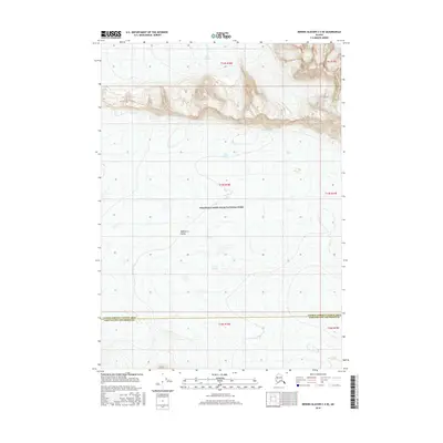
 2014 Bering Glacier C-6 SW2014 Print · USGSHigh-altitude glacial fields and ice-covered peaks define this Alaskan wilderness in the early twenty-first century. Researchers can trace the massive Steller Glacier and Waxell Glacier as they flow around the towering Mount Steller.
 - 2014 Map of Bering Glacier B-7 NE, 2014 Print
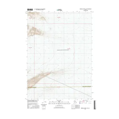
 2014 Bering Glacier B-7 NE2014 Print · USGSThe glacial wilderness of south-central Alaska is captured here during the early twenty-first century. Researchers can trace the massive reaches of Steller Glacier, Waxell Glacier, and the remote Hohlinsock Lake.
 - 2014 Map of Bering Glacier A-8 SE, 2014 Print
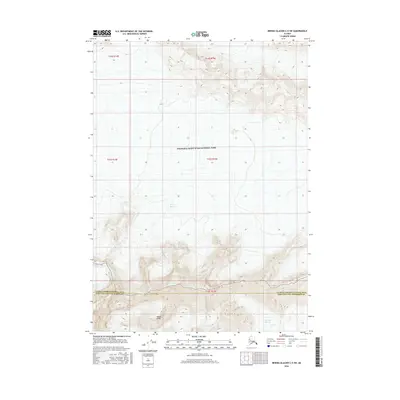
 2014 Bering Glacier A-8 SE2014 Print · USGSThe Alaskan coast near the Suckling Hills is captured in the early twenty-first century, showing a wilderness of glacial rivers and maritime flats. Trace the winding paths of the Okalee River, Kiklukh River, and the shores of Vitus Lake as they meet the Gulf of Alaska.
 - 2014 Map of Bering Glacier A-8 SW, 2014 Print
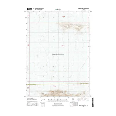
 2014 Bering Glacier A-8 SW2014 Print · USGSThe coastal frontier of the Chugach National Forest is captured here in the early twenty-first century, where the mountains meet the sea. Researchers can trace the shifting course of the Okalee River and the Kiklukh River as they flow into the Gulf of Alaska.
 - 2014 Map of Bering Glacier A-8 OE S NW, 2014 Print
 2014 Bering Glacier A-8 OE S NW2014 Print · USGSThe Gulf of Alaska shoreline meets the wilderness in the early twenty-first century, documenting a remote stretch of the coast. Researchers can trace the precise boundary between Valdez-Cordova and Yakutat near Cape Suckling.
 - 2014 Map of Bering Glacier A-8 NE, 2014 Print
 2014 Bering Glacier A-8 NE2014 Print · USGSThe glacial landscape of the Yakutat City and Borough is captured here in the early twenty-first century, showing the intersection of ice and ocean. Trace the massive Central Medial Moraine Band as it flows toward the Seal River and the waters of Tashalich Arm.
 - 2014 Map of Bering Glacier B-6 NW, 2014 Print
 2014 Bering Glacier B-6 NW2014 Print · USGSCoastal Alaska's glaciated wilderness is captured here in the early twenty-first century, showing the intersection of the Chugach Range and massive ice fields. Researchers can trace the path of the Waxell Glacier and the distinct Central Medial Moraine Band within the Bering Glacier.
 - 2016 Map of Bering Glacier B-5 NE, 2016 Print
 2016 Bering Glacier B-5 NE2016 Print · USGSThe immense Bering Glacier meets the high peaks of the Chugach Mountains in this modern survey of the Alaskan wilderness. Researchers can trace glacial movement and the topography of Barkley Ridge in this remote coastal reach.
 - 2016 Map of Bering Glacier C-4 SE, 2016 Print
 2016 Bering Glacier C-4 SE2016 Print · USGSCovers Yakutat, including Unorganized Borough, United States, and other nearby areas
 - 2016 Map of Bering Glacier A-4 SW, 2016 Print
 2016 Bering Glacier A-4 SW2016 Print · USGSThe Yakutat coastline meets the northern Gulf in this 2010s survey, showing a landscape defined by braided rivers and glacial peaks. Trace the coastal infrastructure around Yakataga Airport and the complex drainage of the South Channel Yakataga River and Mink Cr.
 - 2016 Map of Bering Glacier A-5 SE, 2016 Print
 2016 Bering Glacier A-5 SE2016 Print · USGSThe remote coastline of the Yakutat City and Borough is documented here in the early twenty-first century as glacial rivers meet the Pacific. Researchers can trace the braided paths of the Kaliakh River and Duktoth River or locate the vital Yakataga Airport along the shore.
 - 2016 Map of Bering Glacier B-4 SW, 2016 Print
 2016 Bering Glacier B-4 SW2016 Print · USGSThe glaciers and river valleys of the Robinson Mountains are captured in this recent survey of the Yakutat region. Researchers and collectors can trace the path of the Duktoth River as it flows between the Bering Glacier and the Leeper Glacier.
 - 2016 Map of Bering Glacier A-6 NE, 2016 Print
 2016 Bering Glacier A-6 NE2016 Print · USGSCoastal Yakutat is shown in the mid-2010s as a complex network of glacial rivers and wetlands before they meet the Gulf. Researchers can trace the shifting braided channels of the Tsivat River, Kaliakh River, and the remote Kosakuts River.
 - 2016 Map of Bering Glacier A-6 NW, 2016 Print
 2016 Bering Glacier A-6 NW2016 Print · USGSCoastal Alaska near the Bering Glacier comes into focus during this mid-2010s survey of a shifting glacial landscape. Researchers can trace the complex watercourses of the Abandoned River and identify named terrain like Donald Ridge and Bentwood Island.
 - 2016 Map of Bering Glacier B-7 SE, 2016 Print
 2016 Bering Glacier B-7 SE2016 Print · USGSIn the southeastern reaches of Alaska during the mid-2010s, this area showcases a massive glaciated landscape where the ice meets the sea. Researchers can trace the shifting margins of the Bering Glacier and study the terrain around the Grindle Hills.
 - 2016 Map of Bering Glacier B-4 NW, 2016 Print
 2016 Bering Glacier B-4 NW2016 Print · USGSAlaskan wilderness and massive ice fields are captured in this mid-2010s survey of the Chugach Mountains. Researchers can trace the massive flow of the Bering Glacier and identify high-altitude landmarks like Mt Miller and Barkley Ridge.
 - 2016 Map of Bering Glacier C-5 SE, 2016 Print
 2016 Bering Glacier C-5 SE2016 Print · USGSCovers Yakutat, including Unorganized Borough, United States, and other nearby areas
 - 2016 Map of Bering Glacier A-7 NE, 2016 Print
 2016 Bering Glacier A-7 NE2016 Print · USGSThe Yakutat coast at the edge of the glacial ice field reveals a shifting landscape of islands and tidal inlets in 2016. Trace the unique geography of The Wallypogs, Whaleback Island, and the mouth of the Abandoned River.
 - 2016 Map of Bering Glacier B-6 NE, 2016 Print
 2016 Bering Glacier B-6 NE2016 Print · USGSIn the wilderness of coastal Alaska during the mid-2010s, this survey documents a landscape dominated by ice and rock. Researchers can trace the massive expanse of the Bering Glacier and the high peaks of Waxell Ridge in this remote territory.
 - 2016 Map of Bering Glacier C-5 SW, 2016 Print
 2016 Bering Glacier C-5 SW2016 Print · USGSCovers Yakutat, including Unorganized Borough, United States, and other nearby areas
 - 2016 Map of Bering Glacier A-4 NW, 2016 Print
 2016 Bering Glacier A-4 NW2016 Print · USGSCoastal Alaska in the early twenty-first century is defined here by high-altitude ice and glacial meltwater. Researchers can trace the descent of the Leeper Glacier into a network of mountain streams like Boulder Creek and the North Channel Yakataga River.
 - 2016 Map of Bering Glacier A-4 SE, 2016 Print
 2016 Bering Glacier A-4 SE2016 Print · USGSThe Yakutat coastline meets the glacial runoff of the Robinson Mountains in this 2016 survey of the Alaskan wilderness. Researchers can trace the braided paths of the White River and South Channel Yakataga River as they flow past Yakataga Ridge.
 - 2016 Map of Bering Glacier B-7 SW, 2016 Print
 2016 Bering Glacier B-7 SW2016 Print · USGSThe glacial frontier of the Gulf of Alaska is captured here during the mid-2010s. Trace the convergence of the Bering Glacier and Steller Glacier near Lake Safron to see how ice and meltwater redefine this remote coastal landscape.
 - 2016 Map of Bering Glacier B-6 SW, 2016 Print
 2016 Bering Glacier B-6 SW2016 Print · USGSThe glacial ice and jagged ridges of the Yakutat coast are captured here in the early twenty-first century. Researchers can trace the massive Bering Glacier as it meets landmarks like Hanna Lake, Grindle Gap, and Override Ridge.
 - 2016 Map of Bering Glacier C-4 SW, 2016 Print
 2016 Bering Glacier C-4 SW2016 Print · USGSCovers Yakutat, including Unorganized Borough, United States, and other nearby areas
Showing maps 1-25 of 262
Top cities of Yakutat
Frequently asked questions
- What are the different types of historical maps available for Yakutat?
- What is the oldest map of Yakutat?
- Where can I purchase historical maps of Yakutat for my home or office?
- Where can I download high-res historical maps of Yakutat?
- Are there historical topographic maps available for Yakutat?
- Is there historical aerial imagery available for Yakutat?
- Where are historical maps of Yakutat sourced from?