
1951 Map of Icy Bay D-2 and D-3
USGS Topo · Published 1951About this map
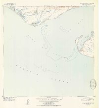
The Robinson Mountains define the northern limit of this coastal landscape, where the southern slopes meet the shifting waters of the Gulf of Alaska. Surveyed just after the war, the map reveals a remote maritime environment dominated by glacial drainage and intricate shoreline features like Claybluff Point and Icy Cape. The eastern portion of the sheet is centered on the complex of Riou Bay, protected by the treacherous Moraine Reef and the isolated Moraine Island. Small isolated Cabin symbols near Mud Bay and Carson Cr indicate the rare human footprints in this wilderness, likely used by hunters, fishers, or early coastal surveyors. These structures, along with the North Base and South Base landmarks, provide specific points of interest for historical researchers and cartographic enthusiasts studying the evolution of the Alaskan coastline before modern development.
Find a feature on this map
21 named features on this map. Tap any name to fly to it.
Don’t see what you’re looking for? This feature index may not catch every label — zoom into the map to look around manually.
Map Details
Editions of this 1951 Icy Bay D-2 and D-3 Map
2 editions found
Other maps of this area

1948 · Icy Bay D-2 and D-3
USGS Topo · 1:63,360

1950 · Bering Glacier A-3
USGS Topo · 1:63,360

1950 · Bering Glacier
USGS Topo · 1:250,000

1950 · Icy Bay
USGS Topo · 1:250,000

1951 · Icy Bay
USGS Topo · 1:250,000

1951 · Bering Glacier
USGS Topo · 1:250,000

1951 · Bering Glacier A-2
USGS Topo · 1:63,360
1959 · Icy Bay D-2 and D-3
USGS Topo · 1:63,360

1959 · Bering Glacier
USGS Topo · 1:250,000
1959 · Bering Glacier A-3
USGS Topo · 1:63,360