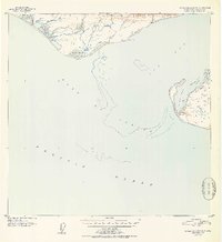
1951 Map of Icy Bay D-2 and D-3
USGS Topo · Published 1951About this map
Icy Cape and the coastal interface of Mud Bay anchor this 1951 survey of the Alaskan coastline where the Robinson Mountains meet the Gulf of Alaska. The map documents a dynamic glacial environment, specifically around the expansive Icy Bay and Riou Bay, where landforms like Moraine Reef and Isle Moraine Island suggest the movement of ice and sediment. Hydrographic data from USC&GS charts and 1948 aerial photography detail a complex drainage system including the Big River, Priest River, and Crystal Creek, which fan out into braided deltas before reaching the sea. Small signs of human presence are noted by scattered cabin locations and established survey markers at North Base and South Base, providing rare fixed points in this shifting wilderness of the Alaska-Third Judicial Division.
Find a feature on this map
21 named features on this map. Tap any name to fly to it.
Don’t see what you’re looking for? This feature index may not catch every label — zoom into the map to look around manually.
Map Details
Editions of this 1951 Icy Bay D-2 and D-3 Map
2 editions found
Other maps of this area

1948 · Icy Bay D-2 and D-3
USGS Topo · 1:63,360

1950 · Bering Glacier A-3
USGS Topo · 1:63,360

1950 · Bering Glacier
USGS Topo · 1:250,000

1950 · Icy Bay
USGS Topo · 1:250,000

1951 · Icy Bay D-2 and D-3
USGS Topo · 1:63,360

1951 · Icy Bay
USGS Topo · 1:250,000

1951 · Bering Glacier
USGS Topo · 1:250,000

1951 · Bering Glacier A-2
USGS Topo · 1:63,360
1959 · Icy Bay D-2 and D-3
USGS Topo · 1:63,360

1959 · Bering Glacier
USGS Topo · 1:250,000