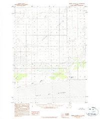
1984 Map of Bering Glacier A-7
USGS Topo · Published 1984About this map
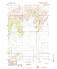
Bering Glacier dominates this coastal landscape, where the massive ice sheet transitions into a complex system of glacial deposits and water bodies. The sheet illustrates the terminus of the glacier as it meets the Gulf of Alaska, characterized by extensive Moraine fields and specific Moraine on Glacier formations that reveal the movement and sediment patterns of the era. To the south, the drainage network becomes more defined as the ice recedes into the Seal River and Tashalich River, which cut through the alluvial flats. This mid-1980s data serves as a vital record of the shoreline and ice position before more recent decades of change. Near the coast, Midtimber Lake sits as a notable landmark amidst the shifting sands and glacial outwash, marking the interface between the massive ice fields to the north and the open waters of the gulf.
Find a feature on this map
13 named features on this map. Tap any name to fly to it.
Don’t see what you’re looking for? This feature index may not catch every label — zoom into the map to look around manually.
Map Details
Editions of this 1984 Bering Glacier A-7 Map
This is the sole edition of this map. No revisions or reprints were ever made.
Other maps of this area

1950 · Bering Glacier
USGS Topo · 1:250,000

1950 · Icy Bay
USGS Topo · 1:250,000

1951 · Icy Bay
USGS Topo · 1:250,000

1951 · Bering Glacier
USGS Topo · 1:250,000

1959 · Bering Glacier
USGS Topo · 1:250,000

1961 · Icy Bay
USGS Topo · 1:250,000
1984 · Bering Glacier A-8
USGS Topo · 1:63,360
1984 · Bering Glacier A-6
USGS Topo · 1:63,360
1985 · Bering Glacier B-6
USGS Topo · 1:63,360
1985 · Bering Glacier B-8
USGS Topo · 1:63,360