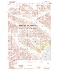
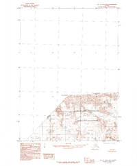
1985 Map of Mount Saint Elias A-5
USGS Topo · Published 1985About this map
Wrangell - Saint Elias National Park dominates this frozen landscape where the international boundary between Alaska and the Yukon Territory cuts across mountain peaks and massive ice fields. The geography is defined by an immense glacial system flowing toward the coast, including the broad Turner Glacier and the distinctively named Valerie Glacier. To the southeast, the ice meets the sea at Disenchantment Bay, where a complex Moraine and Shoreline indicate the dynamic interaction between the glaciers and the Pacific. This 1985 survey illustrates the protected Wrangell - Saint Elias Wilderness as it appeared before modern climate shifts significantly altered these coastal ice fronts, capturing the technical details of tributary flows like Haenke Glacier and Miller Glacier as they converge toward the bay.
Find a feature on this map
13 named features on this map. Tap any name to fly to it.
Don’t see what you’re looking for? This feature index may not catch every label — zoom into the map to look around manually.
Map Details
Editions of this 1985 Mount Saint Elias A-5 Map
This is the sole edition of this map. No revisions or reprints were ever made.
Other maps of this area

1951 · Yakutat
USGS Topo · 1:250,000

1951 · Mt Saint Elias
USGS Topo · 1:250,000

1959 · Yakutat D-4
USGS Topo · 1:63,360

1959 · Yakutat D-5
USGS Topo · 1:63,360

1959 · Yakutat
USGS Topo · 1:250,000

1959 · Mt Saint Elias
USGS Topo · 1:250,000
1985 · Yakutat D-6
USGS Topo · 1:63,360
1985 · Mount Saint Elias B-4
USGS Topo · 1:63,360
1985 · Mount Saint Elias A-4
USGS Topo · 1:63,360
1985 · Mount Saint Elias B-5
USGS Topo · 1:63,360