2020s Maps of Huachuca City, Arizona
Explore 2 historic maps of Huachuca City from the 2020s. These maps offer a rare glimpse into what life looked like during the 2020s — showing old roads, neighborhoods, homes, and landmarks that have changed or disappeared over time.
Whether you're researching your family's past, planning a metal detecting trip, or studying how Huachuca City's landscape evolved across the 2020s, these high-resolution maps are a powerful tool for exploring the history of this region.
- Focus on a specific era: All maps on this page are from the 2020s, giving you a focused view of this time period.
- See what’s changed: Compare century-old streets, trails, and buildings to today's modern landscape using overlays and satellite layers.
- Research with precision: Use these maps for genealogy, historical research, land use analysis, or educational projects.
- View, download, or print: Maps are fully viewable online in high resolution, and can be downloaded or printed for your own records.
Start exploring Huachuca City's history through authentic maps from the 2020s. This is your window into the past.
Huachuca City, AZ maps
(2)- 2021 Map of Fort Huachuca, 2021 Print
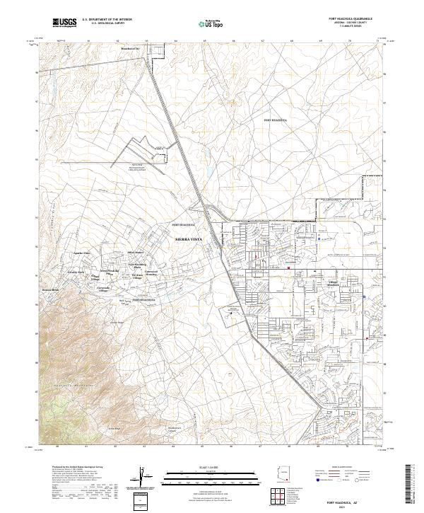 2021 Fort Huachuca2021 Print · USGSSierra Vista and the San Pedro Valley are shown in detail during the early 2020s, reflecting decades of residential and military growth. Researchers can trace local neighborhoods from Miles Manor to Fry, or locate the Southern Arizona Veterans Memorial Cemetery.
 - 2021 Map of Huachuca City, 2021 Print
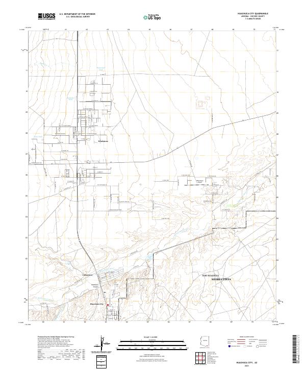 2021 Huachuca City2021 Print · USGSHuachuca City and the surrounding desert plains are shown in this contemporary study of Cochise County's growth. Researchers can trace local development around the Babocomari River, the Whetstone Airport, and the small settlement of Campstone.
End of results
Showing maps 1-2 of 2
Top cities near Huachuca City
Frequently asked questions
- What are the different types of historical maps available for Huachuca City?
- What is the oldest map of Huachuca City?
- Where can I purchase historical maps of Huachuca City for my home or office?
- Where can I download high-res historical maps of Huachuca City?
- Are there historical topographic maps available for Huachuca City?
- Is there historical aerial imagery available for Huachuca City?
- Where are historical maps of Huachuca City sourced from?