Old Maps of Carlton Vista, Arizona for Hiking & Exploration
Hike through history with 13 historic maps of Carlton Vista. Explore old trails, ghost towns, and forgotten backroads — perfect for outdoor adventurers and local explorers.
- Rediscover forgotten places: Map out old mining camps, roads, and footpaths that no longer exist on modern maps.
- Layer with modern tools: Combine with LiDAR or satellite views to plan hikes through historical terrain.
- Made for exploration: Popular among hikers, overlanders, and local history lovers.
Use these maps to find adventure and explore the hidden past of Carlton Vista.
Carlton Vista, AZ maps
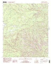
(13)- 1922 Map of Nutrioso
 1922 Nutrioso1922 Print · USGSHigh-altitude ranching and forest service outposts define the Arizona-New Mexico border in the early twenties. Researchers can trace remote family landmarks like Reservation Ranch and Colter's Res. or locate early settlements at Nutrioso and Alpine.
 - 1954 Map of Clifton, 1968 Print
 1954 Clifton1968 Print · USGSThe high timber and copper country of the Arizona-New Mexico border is captured here during the mid-fifties. Genealogists and historians can trace family holdings like the Double Circle Ranch or study the industrial footprint of the Smelting Plant at Clifton.3 unique versions available
 - 1957 Map of Clifton
 1957 Clifton1957 Print · USGSThe copper-mining district around Clifton and Morenci meets the high timberlands of the Mogollon Rim during the mid-1950s. Genealogists and researchers can trace family-named outposts and remote mountain settlements like Reserve, Stargo, and Fort Thomas.
 - 1958 Map of Clifton
 1958 Clifton1958 Print · USGSThe rugged high country of the Arizona-New Mexico border comes into focus in the mid-fifties, showing a landscape of mining camps and forest outposts. Genealogists and researchers can trace old settlements and remote sites like Mogollon, East Fork Mission, and the Tidwell Mine.
 - 1961 Map of Blue, 1963 Print
 1961 Blue1963 Print · USGSThe high Mogollon Rim and the Arizona-New Mexico state line meet in the early 1960s, showing a remote mountain landscape. Researchers can trace historic forest outposts and ranch sites like Blue Ranger Sta, Carlton Vista, and the settlement of Blue.2 unique versions available
 - 1962 Map of Clifton
 1962 Clifton1962 Print · USGSThe copper-rich Arizona-New Mexico borderlands come into focus in the early sixties, centered on the mining complexes of Morenci and Clifton. Researchers can trace the Southern Pacific rail lines and locate remote outposts like Honeymoon and the Double Circle Ranch.
 - 1981 Map of Nutrioso, 1996 Print
 1981 Nutrioso1996 Print · USGSEastern Arizona and the New Mexico borderlands are captured here in the early eighties, showcasing a vast expanse of national forest and tribal lands. Researchers can trace the high-country routes between Nutrioso, Alpine, and Whiteriver, or locate landmarks along the Mogollon Rim and Black River.2 unique versions available
 - 1991 Map of Beaverhead
 1991 Beaverhead1991 Print · USGSEastern Arizona high country is mapped here in the early nineties, showing a landscape defined by the drainage of Beaver Creek and Foote Creek. Trace backcountry routes through Apache National Forest to find Cleveland Spring, Castle Rock, and the Devils Washboard.2 unique versions available
 - 1997 Map of Beaverhead, 2000 Print
 1997 Beaverhead2000 Print · USGSGreenlee County’s high country is captured here during the late twentieth century, showing a landscape of forest management and ranching. Researchers can locate remote landmarks like the Buckalou Corral, Beaverhead settlement, and the Carlton Vista Overlook.
 - 2011 Map of Beaverhead, 2011 Print
 2011 Beaverhead2011 Print · USGSCovers Carlton Vista, including Greenlee County, United States, and other nearby areas
 - 2014 Map of Beaverhead, 2014 Print
 2014 Beaverhead2014 Print · USGSCovers Carlton Vista, including Greenlee County, United States, and other nearby areas
 - 2018 Map of Beaverhead, 2018 Print
 2018 Beaverhead2018 Print · USGSCovers Carlton Vista, including Greenlee County, United States, and other nearby areas
 - 2021 Map of Beaverhead, 2021 Print
 2021 Beaverhead2021 Print · USGSThe high country of Greenlee County comes into focus in this recent survey of the forest lands surrounding Beaverhead. Researchers can trace old timber or range routes like the Horse Ridge Trl and locate named landmarks such as Bell Rock and Fishhook Mesa.
End of results
Showing maps 1-13 of 13
Top cities near Carlton Vista
Frequently asked questions
- What are the different types of historical maps available for Carlton Vista?
- What is the oldest map of Carlton Vista?
- Where can I purchase historical maps of Carlton Vista for my home or office?
- Where can I download high-res historical maps of Carlton Vista?
- Are there historical topographic maps available for Carlton Vista?
- Is there historical aerial imagery available for Carlton Vista?
- Where are historical maps of Carlton Vista sourced from?