
1954 Map of Clifton
USGS Topo · Published 1968About this map
The Mogollon Rim and the Continental Divide define the high country in this mid-century survey of the Arizona-New Mexico borderlands. Industrial activity centers on the copper-producing hubs of Clifton and Morenci, where a Smelting Plant sits near the winding paths of the San Francisco River and Eagle Creek. The landscape transitions from the high peaks of the White Mountains and Escudilla Mountain down to the high desert of the San Agustin Plains.
Find a feature on this map
121 named features on this map. Tap any name to fly to it.
Don’t see what you’re looking for? This feature index may not catch every label — zoom into the map to look around manually.
Map Details
Editions of this 1954 Clifton Map
3 editions found
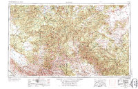
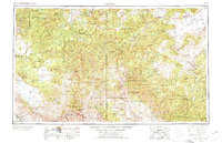
Other maps of this area

1886 · St Johns
USGS Topo · 1:250,000

1886 · Holbrook
USGS Topo · 1:250,000

1892 · St Johns
USGS Topo · 1:250,000

1893 · Holbrook
USGS Topo · 1:250,000

1902 · Clifton
USGS Topo · 1:62,500

1909 · Silver City
USGS Topo · 1:125,000

1910 · Mogollon
USGS Topo · 1:125,000

1911 · Alum Mountain
USGS Topo · 1:125,000

1912 · Mogollon
USGS Topo · 1:125,000

1913 · Alum Mountain
USGS Topo · 1:125,000