1980s Maps of Bouse, Arizona
Explore 4 historic maps of Bouse from the 1980s. These maps offer a rare glimpse into what life looked like during the 1980s — showing old roads, neighborhoods, homes, and landmarks that have changed or disappeared over time.
Whether you're researching your family's past, planning a metal detecting trip, or studying how Bouse's landscape evolved across the 1980s, these high-resolution maps are a powerful tool for exploring the history of this region.
- Focus on a specific era: All maps on this page are from the 1980s, giving you a focused view of this time period.
- See what’s changed: Compare century-old streets, trails, and buildings to today's modern landscape using overlays and satellite layers.
- Research with precision: Use these maps for genealogy, historical research, land use analysis, or educational projects.
- View, download, or print: Maps are fully viewable online in high resolution, and can be downloaded or printed for your own records.
Start exploring Bouse's history through authentic maps from the 1980s. This is your window into the past.
Bouse, AZ maps
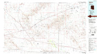
(4)- 1981 Map of Needles, 1987 Print
 1981 Needles1987 Print · USGSThe High Desert and Colorado River valley are seen here in the early 1980s through the unique lens of satellite imagery. Trace the isolated outposts of the AT & SF railroad at Goffs and Essex, or explore the sprawling shores of Lake Havasu.
 - 1984 Map of Salome
 1984 Salome1984 Print · USGSWestern Arizona's desert valleys and mining districts are surveyed here during the mid-eighties, centered on the railroad corridor through the McMullen Valley. Researchers can trace the rail towns of Salome and Wenden or locate historical mineral sites like the Bonanza Mine and Hercules Mine.
 - 1985 Map of Parker
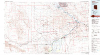 1985 Parker1985 Print · USGSThe Colorado River valley in the mid-eighties was a hub of desert transit, mining, and water management. Researchers can trace the path of the Atchison Topeka and Santa Fe railroad through Vidal Junction and locate numerous historic diggings like the Gold Hill Mine or Billy Mack Mine.2 unique versions available
 - 1986 Map of Blythe
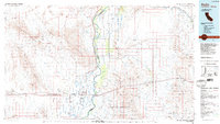 1986 Blythe1986 Print · USGSThe Colorado River valley at the California and Arizona border in the mid-1980s shows a landscape of intensive desert farming and remote mining. Trace the rail lines of the Atchison Topeka and Santa Fe or locate historical workings like the Arlington Mine and Victor Mine.3 unique versions available
End of results
Showing maps 1-4 of 4
Top cities near Bouse
Frequently asked questions
- What are the different types of historical maps available for Bouse?
- What is the oldest map of Bouse?
- Where can I purchase historical maps of Bouse for my home or office?
- Where can I download high-res historical maps of Bouse?
- Are there historical topographic maps available for Bouse?
- Is there historical aerial imagery available for Bouse?
- Where are historical maps of Bouse sourced from?