1990s Maps of Bouse, Arizona
Explore 7 historic maps of Bouse from the 1990s. These maps offer a rare glimpse into what life looked like during the 1990s — showing old roads, neighborhoods, homes, and landmarks that have changed or disappeared over time.
Whether you're researching your family's past, planning a metal detecting trip, or studying how Bouse's landscape evolved across the 1990s, these high-resolution maps are a powerful tool for exploring the history of this region.
- Focus on a specific era: All maps on this page are from the 1990s, giving you a focused view of this time period.
- See what’s changed: Compare century-old streets, trails, and buildings to today's modern landscape using overlays and satellite layers.
- Research with precision: Use these maps for genealogy, historical research, land use analysis, or educational projects.
- View, download, or print: Maps are fully viewable online in high resolution, and can be downloaded or printed for your own records.
Start exploring Bouse's history through authentic maps from the 1990s. This is your window into the past.
Bouse, AZ maps
(7)- 1990 Map of Bouse Hills East
 1990 Bouse Hills East1990 Print · USGSThe high desert landscape of La Paz County is captured here in the early nineties, dominated by the massive Hayden-Rhodes Aqueduct. Researchers can trace the engineering of the era through the Tunnel and Road on Levee or locate remote Mine Shafts near the Granite Wash Mountains.
 - 1990 Map of Bouse Hills West
 1990 Bouse Hills West1990 Print · USGSThe desert landscape of La Paz County was characterized by mineral exploration and modern water engineering in the early nineties. Researchers can trace historic industrial sites like the Barber Gene Mine, the Retort Oven, and an Old Railroad Grade.
 - 1990 Map of Utting
 1990 Utting1990 Print · USGSThe Ranegras Plain in the early 1990s shows a desert landscape of remote wells and water management systems. Genealogists and historians can trace isolated landmarks like Haynes Farm, the settlement of Utting, and a lonely + Grave near the mountains.
 - 1990 Map of Bobs Well
 1990 Bobs Well1990 Print · USGSThis La Paz County desert landscape in the 1990s showcases the critical water infrastructure and sparse outposts of the Arizona interior. Researchers can trace the path of the Hayden-Rhodes Aqueduct and locate remote sites like Bobs Well and Osborne.
 - 1990 Map of Powerline Well
 1990 Powerline Well1990 Print · USGSLa Paz County's high desert is captured here in the 1990s as modern water and power projects began to redefine the traditional landscape. Genealogists and desert historians can trace the Old Railroad Grade and Old Lincoln Ranch Road Grade alongside sites like Midway and Powerline Well.
 - 1990 Map of Bouse
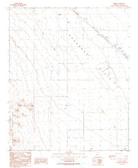
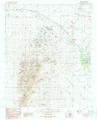 1990 Bouse1990 Print · USGSNear the turn of the 1990s, this area of the Arizona desert shows a landscape defined by mining prospecting and remote outposts. Researchers can trace the layout of Bouse and locate numerous Mine Shafts throughout the Plomosa Mountains.
 - 1990 Map of Ibex Peak
 1990 Ibex Peak1990 Print · USGSThe Plomosa Mountains in the early nineties show a desert landscape defined by intense mineral prospecting and deep isolation. Trace historic mining operations like the Mudersbach Mine, Tough Nut Shafts, and Southern Cross Mine among the arid peaks.
End of results
Showing maps 1-7 of 7
Top cities near Bouse
Frequently asked questions
- What are the different types of historical maps available for Bouse?
- What is the oldest map of Bouse?
- Where can I purchase historical maps of Bouse for my home or office?
- Where can I download high-res historical maps of Bouse?
- Are there historical topographic maps available for Bouse?
- Is there historical aerial imagery available for Bouse?
- Where are historical maps of Bouse sourced from?