1900s (20th Century) Maps of Bouse, Arizona
Explore 41 historic maps of Bouse from the 1900s (20th Century). These maps offer a rare glimpse into what life looked like during the 1900s — showing old roads, neighborhoods, homes, and landmarks that have changed or disappeared over time.
Whether you're researching your family's past, planning a metal detecting trip, or studying how Bouse's landscape evolved across the 1900s, these high-resolution maps are a powerful tool for exploring the history of this region.
- Focus on a specific era: All maps on this page are from the 1900s, giving you a focused view of this time period.
- See what’s changed: Compare century-old streets, trails, and buildings to today's modern landscape using overlays and satellite layers.
- Research with precision: Use these maps for genealogy, historical research, land use analysis, or educational projects.
- View, download, or print: Maps are fully viewable online in high resolution, and can be downloaded or printed for your own records.
Start exploring Bouse's history through authentic maps from the 1900s. This is your window into the past.
Bouse, AZ maps
(41)- 1911 Map of Parker
 1911 Parker1911 Print · USGSThe Arizona-California borderlands are captured here in the early twentieth century as the river and rail networks began to transform the desert. Researchers can trace the development of the Colorado River Indian Reservation, the rail hub at Parker, and early mining sites like the Billy Mack Mine.3 unique versions available
 - 1923 Map of Signal
 1923 Signal1923 Print · USGSWestern Arizona in the early twenties was a landscape of isolated mining camps and vital desert springs. Genealogists and historians can trace the footprint of early settlements like Signal and Swansea or locate remote outposts such as Owen and Butler well.
 - 1930 Map of Linskey
 1930 Linskey1930 Print · USGSArizona's western desert frontier comes into focus in this late 1920s survey of the La Posa Plain. Researchers can trace the path of the Atchison Topeka and Santa Fe railroad through Linskey and locate early water sources like Tenmile Well.2 unique versions available
 - 1942 Map of Signal
 1942 Signal1942 Print · USGSNorthwestern Arizona was a rugged network of mining camps and river crossings during the early years of the war. Researchers can trace the isolated roads connecting Signal, the mines at Bagdad, and the remote desert outposts of Swansea and Alamo.
 - 1942 Map of Blythe
 1942 Blythe1942 Print · USGSThe Lower Colorado River valley appears here in the early 1940s, showcasing the agricultural development of the Palo Verde Mesa alongside a booming mining industry. Researchers can locate remote desert outposts and extraction sites like Midland, the U S Gypsum Mine, and Nortons Landing.2 unique versions available
 - 1942 Map of Vicksburg
 1942 Vicksburg1942 Print · USGSWestern Arizona's desert landscape during the early war years is defined here by isolated rail stops and vital water points. Researchers can trace the Atchison Topeka and Santa Fe line through Salome and Vicksburg or locate remote sites like Reids Ranch and the Kofa Mine.
 - 1950 Map of Prescott, 1951 Print
 1950 Prescott1951 Print · USGSArizona's mining and ranching frontiers were in full operation during the early fifties, from the vertical streets of Jerome to the remote western desert. Genealogists and researchers can trace rural life via the Bland School, the United Verde Mine, and stops along the Atchison Topeka and Santa Fe Railway.
 - 1954 Map of Salton Sea
 1954 Salton Sea1954 Print · USGSThe Colorado River and Imperial Valley desert frontiers are captured here in the 1950s. Trace the irrigation networks of Calipatria and mining sites like Eagle Mountain Mine.
 - 1954 Map of Needles
 1954 Needles1954 Print · USGSThe Mojave Desert at the height of the mid-century era shows a landscape defined by the Atchison Topeka and Santa Fe railroad and the legendary U S Highway 66. Genealogists and historians can trace rail stops like Goffs, mining sites such as the Bonanza King Mine, and the early borders of the Chemehuevi Indian Reservation.
 - 1954 Map of Prescott, 1963 Print
 1954 Prescott1963 Print · USGSYavapai County mining and ranching districts are shown in high detail during the mid-twentieth century. Researchers can trace the legacy of remote camps and transport hubs like Swansea, Octave, and the Bagdad Mine along the desert rail lines.4 unique versions available
 - 1954 Map of Phoenix, 1964 Print
 1954 Phoenix1964 Print · USGSMid-century Arizona is captured here as the Phoenix metropolitan area begins its rapid expansion into the surrounding desert. Genealogists and historians can trace the development of agricultural hubs like Buckeye and Tolleson, or locate remote landmarks like the Vulture Mine and Nottbusch Cem.5 unique versions available
 - 1955 Map of Salton Sea
 1955 Salton Sea1955 Print · USGSThe Colorado River and Imperial Valley desert basins appear here during the mid-fifties, revealing a landscape of remote mines and agricultural irrigation. Genealogists and researchers can trace locations like the Parker Alien Reception Center Unit No 1, Blythe, and the Kane Springs School.2 unique versions available
 - 1956 Map of Needles
 1956 Needles1956 Print · USGSThe Mojave Desert and Colorado River come alive in the mid-fifties, showing the intersection of vital rail lines and massive water projects. Trace the Atchison Topeka and Santa Fe line through Amboy or locate remote sites like the Copper World Mine and Rio Vista Guest Ranch.7 unique versions available
 - 1957 Map of Phoenix
 1957 Phoenix1957 Print · USGSGreater Phoenix and the central Arizona desert during the mid-fifties reveal a landscape of growing suburbs and active desert mines. Researchers can trace the legacy of local landmarks like Wickenburg Prison, the Vulture Mine, and the Tonopah Post Office.
 - 1958 Map of Prescott
 1958 Prescott1958 Print · USGSCentral Arizona's rugged mining and ranching corridors come alive in the late fifties. Genealogists and historians can trace the remote Trout Creek School, the mining operations at Jerome, and the rail stops at Skull Valley and Kirkland.
 - 1958 Map of Phoenix
 1958 Phoenix1958 Print · USGSThe Phoenix Valley enters a period of postwar expansion, where desert irrigation meets massive military aviation footprints. Trace the development of Phoenix and Glendale alongside the legendary Vulture Mine and the auxiliary runways of Luke Air Force Base.
 - 1959 Map of Prescott
 1959 Prescott1959 Print · USGSYavapai County and the central Arizona highlands come alive in the late fifties, showcasing a landscape of mountain mining towns and forest outposts. Researchers can trace the industrial footprints of the United Verde Mine, follow the Atchison Topeka and Santa Fe rails, and locate remote settlements like Swansea or Skull Valley.2 unique versions available
 - 1959 Map of Black Peak, 1961 Print
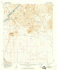 1959 Black Peak1961 Print · USGSThe Colorado River borderlands in the late fifties reveal a landscape of active mining and desert transit. Genealogists and historians can trace industrial activity at the Mineral Hill Mines or locate river-side life at Cross Roads and Cienega Springs.4 unique versions available
 - 1959 Map of Salton Sea, 1968 Print
 1959 Salton Sea1968 Print · USGSThe Colorado River and Salton Sea basin are shown here during a decade of intense military and agricultural activity. Trace family roots in Blythe or Niland, and locate historical mining operations like the Eagle Mountain Mine and Red Cloud Mine.4 unique versions available
 - 1960 Map of Prescott
 1960 Prescott1960 Print · USGSYavapai County and the surrounding high-desert mining districts are captured here during a period of steady industrial and rail activity. Researchers can trace the routes of the Atchison Topeka and Santa Fe Railway and locate historic sites like the United Verde Mine and Bland School.2 unique versions available
 - 1960 Map of Phoenix
 1960 Phoenix1960 Print · USGSCentral Arizona in the mid-fifties reveals a landscape of rapid suburban growth alongside enduring desert mining and ranching. Genealogists and historians can trace rail-side settlements like Vicksburg Junction and Waddell, or locate the Vulture Mine and early sites like Agua Fria School.
 - 1962 Map of Utting, 1963 Print
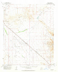 1962 Utting1963 Print · USGSArizona's western desert comes into focus during the early sixties, centered on the vital rail link through the Ran Egras Plain. Genealogists and historians can trace isolated desert outposts like Utting, McVay, and mining operations such as the Barber Gene Mine.2 unique versions available
 - 1962 Map of Bouse, 1964 Print
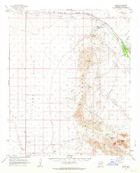 1962 Bouse1964 Print · USGSCovers Bouse, including Parker, La Paz County, and other nearby areas2 unique versions available
 - 1963 Map of Salton Sea
 1963 Salton Sea1963 Print · USGSThe Colorado Desert during the early sixties shows a landscape defined by massive water projects and Cold War military ranges. Trace the growth of Salton City and Brawley, or locate remote desert outposts like the Paymaster Mine and Desert Center.
 - 1965 Map of Salton Sea
 1965 Salton Sea1965 Print · USGSThe Colorado Desert and Imperial Valley are caught in a period of intense irrigation and military expansion during the mid-sixties. Researchers can trace the desert's industrial footprint through the Eagle Mountain Mine, the remote Desert Center, and the Salton Sea Test Base.
Showing maps 1-25 of 41
Top cities near Bouse
Frequently asked questions
- What are the different types of historical maps available for Bouse?
- What is the oldest map of Bouse?
- Where can I purchase historical maps of Bouse for my home or office?
- Where can I download high-res historical maps of Bouse?
- Are there historical topographic maps available for Bouse?
- Is there historical aerial imagery available for Bouse?
- Where are historical maps of Bouse sourced from?