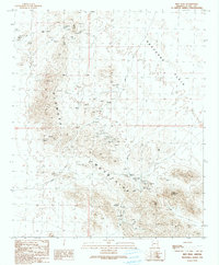
1990 Map of Ibex Peak
USGS Topo · Published 1990About this map
The Plomosa Mountains dominate this 1990 provisional study, revealing a landscape defined by intensive mineral exploration and geological investigation. The terrain is marked by an exceptional concentration of mining activity, from the Mudersbach Mine and Southern Cross Mine to the numerous Prospects and Adits that dot the slopes. These features, alongside specialized labels like the Tough Nut Shafts and various Miner Adit Shafts, offer a detailed look at the resource extraction history within this arid corner of Arizona.
Find a feature on this map
25 named features on this map. Tap any name to fly to it.
Don’t see what you’re looking for? This feature index may not catch every label — zoom into the map to look around manually.
Map Details
Editions of this 1990 Ibex Peak Map
This is the sole edition of this map. No revisions or reprints were ever made.
Other maps of this area

1930 · Linskey
USGS Topo · 1:62,500

1942 · Blythe
USGS Topo · 1:250,000

1942 · Vicksburg
USGS Topo · 1:250,000

1954 · Salton Sea
USGS Topo · 1:250,000

1954 · Phoenix
USGS Topo · 1:250,000

1955 · Salton Sea
USGS Topo · 1:250,000

1957 · Phoenix
USGS Topo · 1:250,000

1958 · Phoenix
USGS Topo · 1:250,000

1959 · Salton Sea
USGS Topo · 1:250,000

1960 · Phoenix
USGS Topo · 1:250,000