1900s (20th Century) Maps of Buckeye, Arizona
Explore 41 historic maps of Buckeye from the 1900s (20th Century). These maps offer a rare glimpse into what life looked like during the 1900s — showing old roads, neighborhoods, homes, and landmarks that have changed or disappeared over time.
Whether you're researching your family's past, planning a metal detecting trip, or studying how Buckeye's landscape evolved across the 1900s, these high-resolution maps are a powerful tool for exploring the history of this region.
- Focus on a specific era: All maps on this page are from the 1900s, giving you a focused view of this time period.
- See what’s changed: Compare century-old streets, trails, and buildings to today's modern landscape using overlays and satellite layers.
- Research with precision: Use these maps for genealogy, historical research, land use analysis, or educational projects.
- View, download, or print: Maps are fully viewable online in high resolution, and can be downloaded or printed for your own records.
Start exploring Buckeye's history through authentic maps from the 1900s. This is your window into the past.
Buckeye, AZ maps
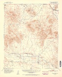
(41)- 1946 Map of Avondale, 1963 Print
 1946 Avondale1963 Print · USGSCovers Buckeye, including Phoenix, Avondale, and other nearby areas2 unique versions available
 - 1948 Map of Cashion
 1948 Cashion1948 Print · USGSCovers Buckeye, including Phoenix, Avondale, and other nearby areas2 unique versions available
 - 1951 Map of Mobile
 1951 Mobile1951 Print · USGSCovers Buckeye, including Goodyear, Mobile, and other nearby areas3 unique versions available
 - 1951 Map of Cotton Center, 1952 Print
 1951 Cotton Center1952 Print · USGSCovers Buckeye, including Gila Bend, San Lucy District, and other nearby areas2 unique versions available
 - 1951 Map of Woolsey Peak, 1952 Print
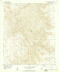
 1951 Woolsey Peak1952 Print · USGSCovers Buckeye, including Harqua, San Lucy District, and other nearby areas3 unique versions available
 - 1954 Map of Phoenix, 1964 Print
 1954 Phoenix1964 Print · USGSCovers Buckeye, including Phoenix, Glendale, and other nearby areas5 unique versions available
 - 1957 Map of Phoenix
 1957 Phoenix1957 Print · USGSCovers Buckeye, including Phoenix, Glendale, and other nearby areas
 - 1957 Map of White Tank Mts. SE, 1958 Print
 1957 White Tank Mts. SE1958 Print · USGSCovers Buckeye, including Verrado, Maricopa County, and other nearby areas5 unique versions available
 - 1957 Map of Valencia, 1958 Print
 1957 Valencia1958 Print · USGSCovers Buckeye, including Verrado, Maricopa County, and other nearby areas6 unique versions available
 - 1957 Map of Perryville, 1958 Print
 1957 Perryville1958 Print · USGSCovers Buckeye, including Goodyear, Estrella, and other nearby areas5 unique versions available
 - 1957 Map of White Tank Mts. NE, 1958 Print
 1957 White Tank Mts. NE1958 Print · USGSCovers Buckeye, including Surprise, Maricopa County, and other nearby areas4 unique versions available
 - 1957 Map of Waddell, 1958 Print
 1957 Waddell1958 Print · USGSCovers Buckeye, including Glendale, Surprise, and other nearby areas4 unique versions available
 - 1957 Map of Avondale SW, 1958 Print
 1957 Avondale SW1958 Print · USGSCovers Buckeye, including Goodyear, Estrella, and other nearby areas5 unique versions available
 - 1957 Map of White Tank Mts., 1959 Print
 1957 White Tank Mts.1959 Print · USGSCovers Buckeye, including Surprise, Verrado, and other nearby areas3 unique versions available
 - 1958 Map of Phoenix
 1958 Phoenix1958 Print · USGSCovers Buckeye, including Phoenix, Glendale, and other nearby areas
 - 1958 Map of Buckeye NW, 1959 Print
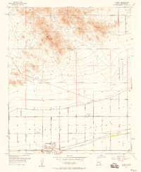
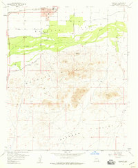
 1958 Buckeye NW1959 Print · USGSCovers Buckeye, including Maricopa County, United States, and other nearby areas3 unique versions available
 - 1958 Map of Hassayampa, 1959 Print
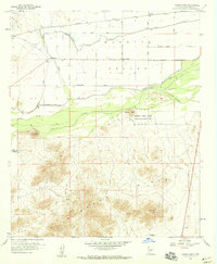 1958 Hassayampa1959 Print · USGSCovers Buckeye, including Hassayampa, Palo Verde, and other nearby areas4 unique versions available
 - 1958 Map of Buckeye, 1959 Print
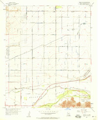
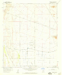
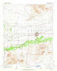
 1958 Buckeye1959 Print · USGSCovers Buckeye, including Maricopa County, United States, and other nearby areas4 unique versions available
 - 1958 Map of Buckeye, 1963 Print
 1958 Buckeye1963 Print · USGSCovers Buckeye, including Hassayampa, Verrado, and other nearby areas2 unique versions available
 - 1960 Map of Phoenix
 1960 Phoenix1960 Print · USGSCovers Buckeye, including Phoenix, Glendale, and other nearby areas
 - 1962 Map of Belmont Mts, 1963 Print
 1962 Belmont Mts1963 Print · USGSCovers Buckeye, including Maricopa County, United States, and other nearby areas2 unique versions available
 - 1962 Map of Arlington, 1964 Print
 1962 Arlington1964 Print · USGSCovers Buckeye, including Tonopah, Gillespie, and other nearby areas2 unique versions available
 - 1965 Map of Wickenburg SW, 1967 Print
 1965 Wickenburg SW1967 Print · USGSCovers Buckeye, including Maricopa County, United States, and other nearby areas3 unique versions available
 - 1969 Map of Phoenix, 1970 Print
 1969 Phoenix1970 Print · USGSCovers Buckeye, including Phoenix, Glendale, and other nearby areas2 unique versions available
 - 1971 Map of Phoenix
 1971 Phoenix1971 Print · USGSCovers Buckeye, including Phoenix, Glendale, and other nearby areas
Showing maps 1-25 of 41
Top cities near Buckeye
- Glendale historical maps
- Peoria historical maps
- Surprise historical maps
- Goodyear historical maps
- Estrella historical maps
- Citrus Park historical maps
Top neighborhoods of Buckeye
- Verrado historical maps
- Conger historical maps
- Copper Falls historical maps
- Festival Foothills historical maps
- Floreo At Teravalis historical maps
- Montiere historical maps
See more
Frequently asked questions
- What are the different types of historical maps available for Buckeye?
- What is the oldest map of Buckeye?
- Where can I purchase historical maps of Buckeye for my home or office?
- Where can I download high-res historical maps of Buckeye?
- Are there historical topographic maps available for Buckeye?
- Is there historical aerial imagery available for Buckeye?
- Where are historical maps of Buckeye sourced from?