1960s Maps of Buckeye, Arizona
Explore 5 historic maps of Buckeye from the 1960s. These maps offer a rare glimpse into what life looked like during the 1960s — showing old roads, neighborhoods, homes, and landmarks that have changed or disappeared over time.
Whether you're researching your family's past, planning a metal detecting trip, or studying how Buckeye's landscape evolved across the 1960s, these high-resolution maps are a powerful tool for exploring the history of this region.
- Focus on a specific era: All maps on this page are from the 1960s, giving you a focused view of this time period.
- See what’s changed: Compare century-old streets, trails, and buildings to today's modern landscape using overlays and satellite layers.
- Research with precision: Use these maps for genealogy, historical research, land use analysis, or educational projects.
- View, download, or print: Maps are fully viewable online in high resolution, and can be downloaded or printed for your own records.
Start exploring Buckeye's history through authentic maps from the 1960s. This is your window into the past.
Buckeye, AZ maps
(5)- 1960 Map of Phoenix
 1960 Phoenix1960 Print · USGSCentral Arizona in the mid-fifties reveals a landscape of rapid suburban growth alongside enduring desert mining and ranching. Genealogists and historians can trace rail-side settlements like Vicksburg Junction and Waddell, or locate the Vulture Mine and early sites like Agua Fria School.
 - 1962 Map of Belmont Mts, 1963 Print
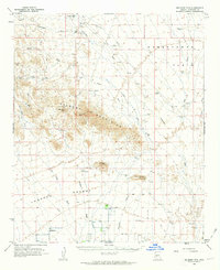 1962 Belmont Mts1963 Print · USGSMaricopa County's arid mining district comes into focus in the early sixties, showing the remote peaks and desert plains before modern expansion. Researchers can trace historic mining operations at the Tonopah-Belmont Mine and find isolated ranching life at Hovis Ranch.2 unique versions available
 - 1962 Map of Arlington, 1964 Print
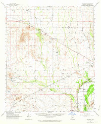 1962 Arlington1964 Print · USGSArlington and the lower Hassayampa River valley are shown here in the early sixties as a burgeoning agricultural and transit corridor. Researchers can trace the Southern Pacific rail line, locate the Arlington School, and find historical sites like the Winters Wells site and ancient Petroglyphs.2 unique versions available
 - 1965 Map of Wickenburg SW, 1967 Print
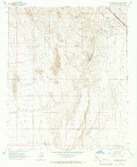 1965 Wickenburg SW1967 Print · USGSCentral Arizona's desert landscape was a hub for mining and aviation in the mid-sixties. Trace historical sites like the Smith Mill (Site), explore the Vulture Mountains, and locate early airfields such as Luke Auxiliary Field No 4.3 unique versions available
 - 1969 Map of Phoenix, 1970 Print
 1969 Phoenix1970 Print · USGSCentral Arizona is seen at a technological turning point in the late sixties, using Apollo 9 space photography to map the desert landscape. Researchers can trace the growth of Sun City, locate old workings at Vulture Mine, and follow the Gila River past Buckeye.2 unique versions available
End of results
Showing maps 1-5 of 5
Top cities near Buckeye
- Glendale historical maps
- Peoria historical maps
- Surprise historical maps
- Goodyear historical maps
- Estrella historical maps
- Citrus Park historical maps
Top neighborhoods of Buckeye
- Verrado historical maps
- Conger historical maps
- Tartesso historical maps
- Blue Horizons historical maps
- Floreo At Teravalis historical maps
- Copper Falls historical maps
See more
Frequently asked questions
- What are the different types of historical maps available for Buckeye?
- What is the oldest map of Buckeye?
- Where can I purchase historical maps of Buckeye for my home or office?
- Where can I download high-res historical maps of Buckeye?
- Are there historical topographic maps available for Buckeye?
- Is there historical aerial imagery available for Buckeye?
- Where are historical maps of Buckeye sourced from?