2020s Maps of Buckeye, Arizona
Explore 20 historic maps of Buckeye from the 2020s. These maps offer a rare glimpse into what life looked like during the 2020s — showing old roads, neighborhoods, homes, and landmarks that have changed or disappeared over time.
Whether you're researching your family's past, planning a metal detecting trip, or studying how Buckeye's landscape evolved across the 2020s, these high-resolution maps are a powerful tool for exploring the history of this region.
- Focus on a specific era: All maps on this page are from the 2020s, giving you a focused view of this time period.
- See what’s changed: Compare century-old streets, trails, and buildings to today's modern landscape using overlays and satellite layers.
- Research with precision: Use these maps for genealogy, historical research, land use analysis, or educational projects.
- View, download, or print: Maps are fully viewable online in high resolution, and can be downloaded or printed for your own records.
Start exploring Buckeye's history through authentic maps from the 2020s. This is your window into the past.
Buckeye, AZ maps
(20)- 2021 Map of Wagner Wash Well, 2021 Print
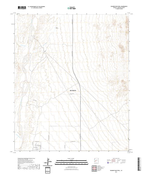 2021 Wagner Wash Well2021 Print · USGSMaricopa County shows the advance of desert development near the Hassayampa River in the early twenty-first century. Researchers can trace the path of the Sun Valley Pkwy through the arid flats toward Wagner Wash Well.
 - 2021 Map of Margies Peak, 2021 Print
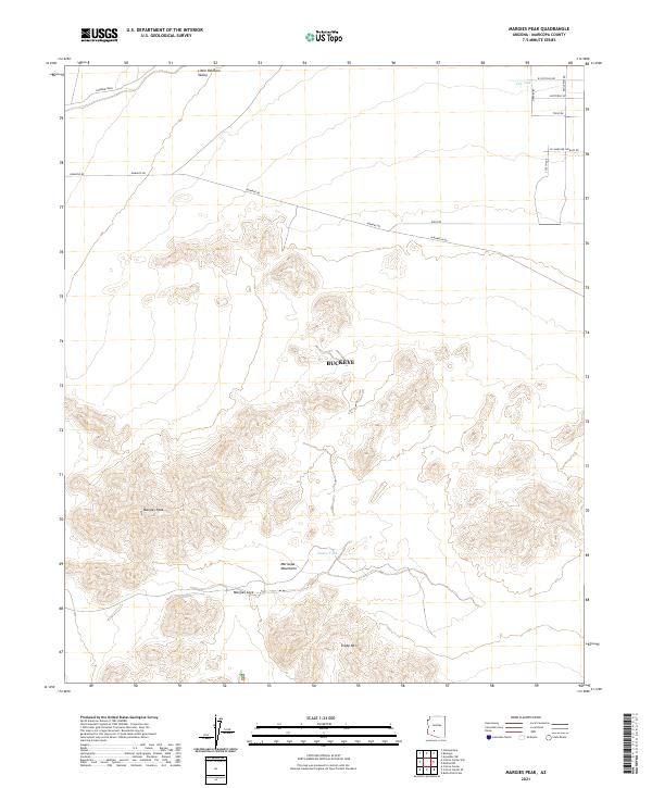 2021 Margies Peak2021 Print · USGSThe Maricopa Mountains south of Buckeye appear in high detail during the early 2020s, showing a landscape of desert peaks and dry washes. Modern researchers can trace access routes like Eagle Pass Rd and locate landmarks such as Margies Peak and Hazen Tank.
 - 2021 Map of Buckeye, 2021 Print
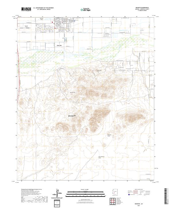 2021 Buckeye2021 Print · USGSMaricopa County near the Gila River corridor is shown here as it transitions from productive agricultural lowlands into the desert peaks. Researchers can locate the settlement of Allenville, the Farm Ag Airport, and the expansive Rainbow Valley south of the Buckeye Hills.
 - 2021 Map of Daggs Tank, 2021 Print
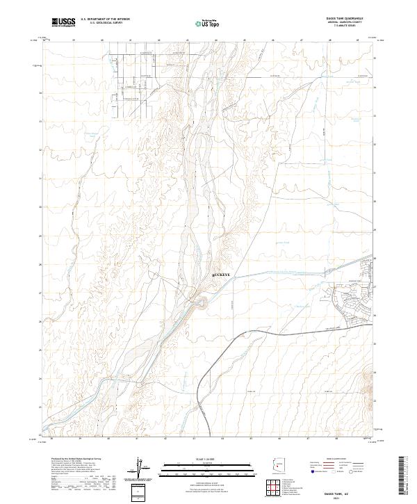 2021 Daggs Tank2021 Print · USGSMaricopa County's western desert edge comes into focus during this period of suburban transition and significant hydraulic engineering. Map collectors can trace the Central Arizona Project Aqueduct as it bypasses the Hassayampa River and numerous local water features like New Daggs Tank.
 - 2021 Map of Star Well, 2021 Print
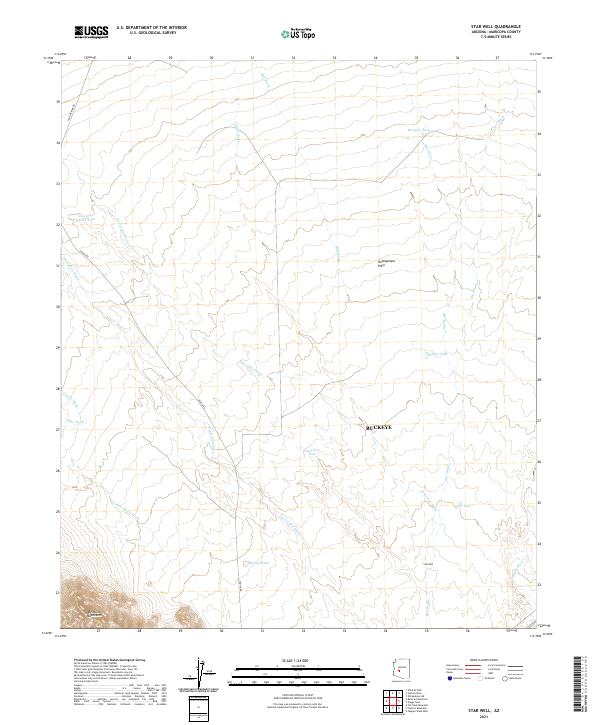 2021 Star Well2021 Print · USGSArizona's desert ranching and mining country comes into focus in this recent survey of the area near the Belmont Mountains. Genealogists and researchers can trace old water sources and desert routes including Star Well, Vulture Mine Rd, and Beer Bottle Wash.
 - 2021 Map of White Tank Mountains, 2021 Print
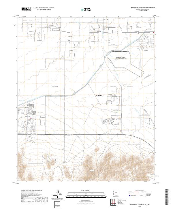
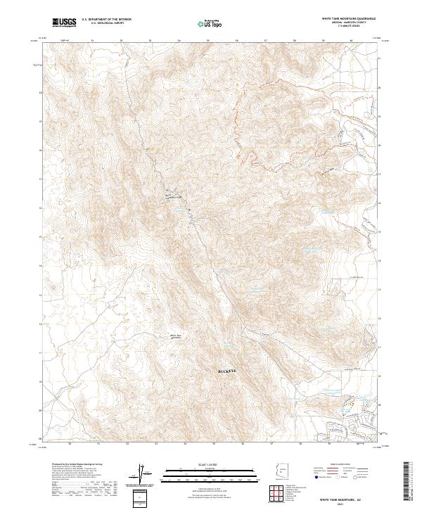 2021 White Tank Mountains2021 Print · USGSThe White Tank Mountains outside Buckeye are captured here at a moment of modern desert expansion and recreational development. Hikers and local historians can trace the paths of Ford Canyon Trl and Mesquite Trl as they climb toward Barry Goldwater Peak.
 - 2021 Map of Mobile NW, 2021 Print
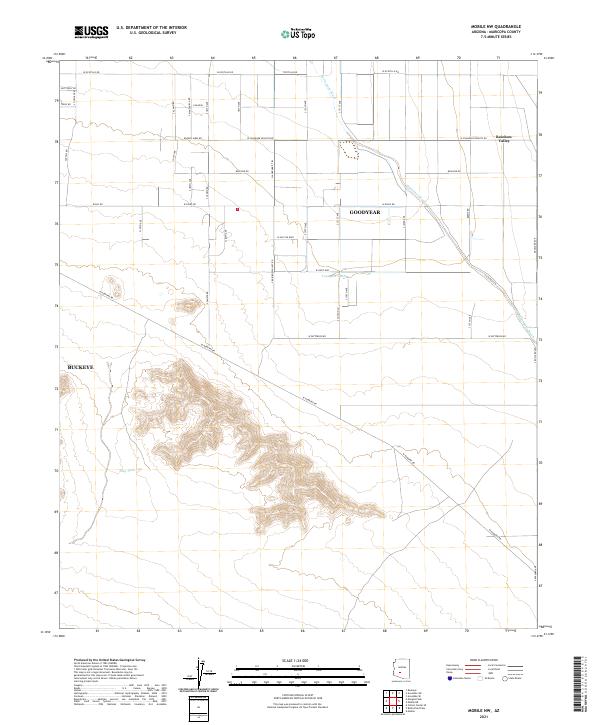 2021 Mobile NW2021 Print · USGSMaricopa County's southern valley transition is documented here in the early twenty-first century, where desert washes meet an expanding road grid. Trace the course of Waterman Wash past local landmarks like Youngker Tank and the settlement at Rainbow Valley.
 - 2021 Map of Spring Mountain, 2021 Print
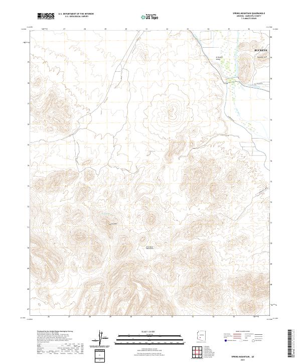 2021 Spring Mountain2021 Print · USGSMaricopa County's western desert and river valleys are captured here in the early twenty-first century as agricultural irrigation meets the rising mountains. Researchers can trace the path of the Gila River and locate landmarks like Moody Spring and Spring Mtn.
 - 2021 Map of Avondale SW, 2021 Print
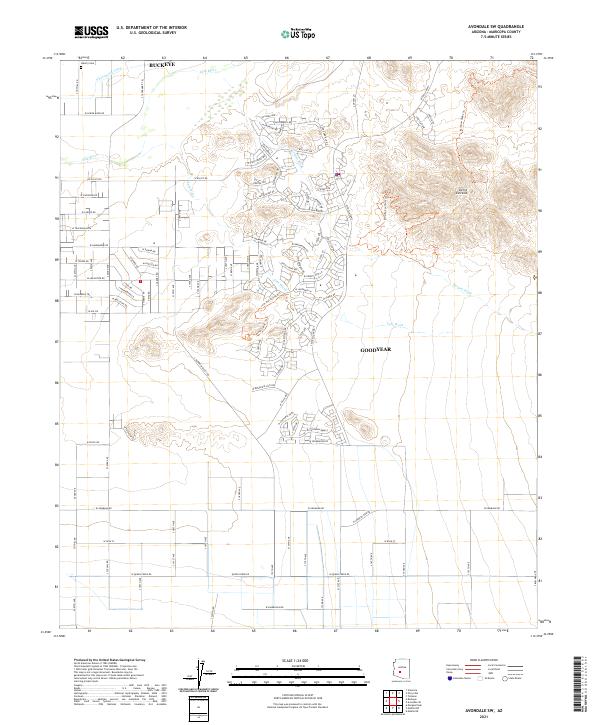 2021 Avondale SW2021 Print · USGSThe Gila River valley south of Buckeye and Goodyear reflects a landscape of desert peaks and modern growth in the early 2020s. Genealogists and researchers can locate the Liberty Cem and trace old routes like W Telegram Path near the Sierra Estrella range.
 - 2021 Map of Wickenburg SW, 2021 Print
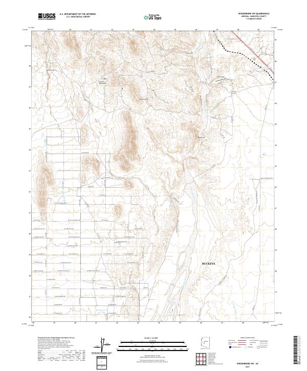 2021 Wickenburg SW2021 Print · USGSNorth of Buckeye in the early 2020s, this area shows the intersection of rugged desert peaks and expanding residential grids. Local historians can trace development along W Carefree Hwy or locate geologic landmarks like Natural Arch and Vulture Arch.
 - 2021 Map of Cotton Center NW, 2021 Print
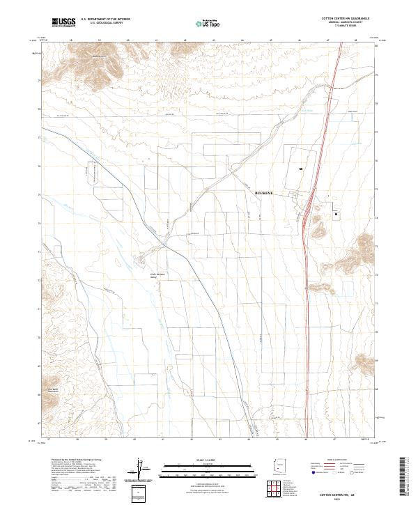 2021 Cotton Center NW2021 Print · USGSMaricopa County during its recent period of expansion shows the intersection of desert agriculture and energy infrastructure. Trace the relationship between the Gila River and the Gila Bend Canal or locate local landmarks like Hog-Hole and Web Water.
 - 2021 Map of Hassayampa, 2021 Print
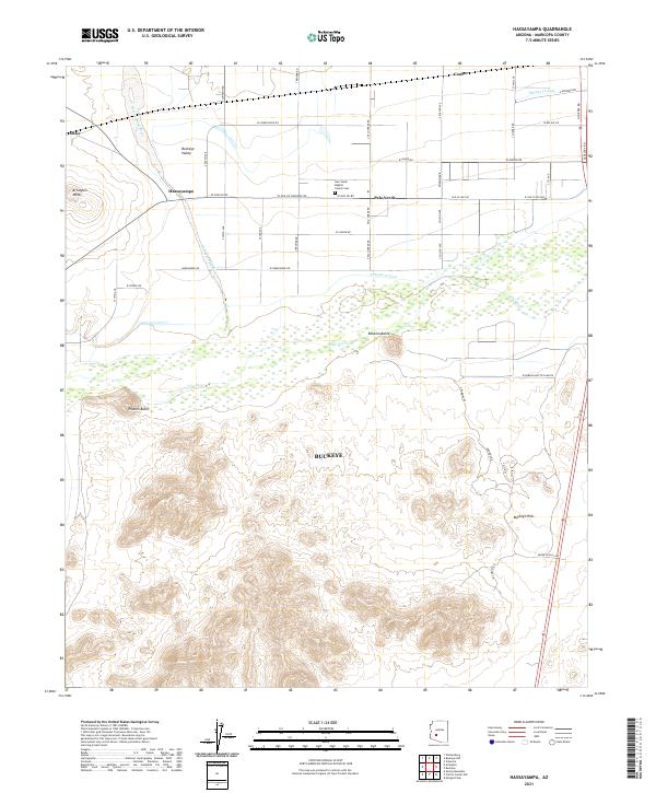 2021 Hassayampa2021 Print · USGSThe convergence of the Hassayampa River and Gila River defines this western Arizona landscape in 2021. Trace the heritage of farming communities through the Palo Verde Baptist Church Cem and historical irrigation via the Arlington Canal.
 - 2021 Map of Flatiron Mountain, 2021 Print
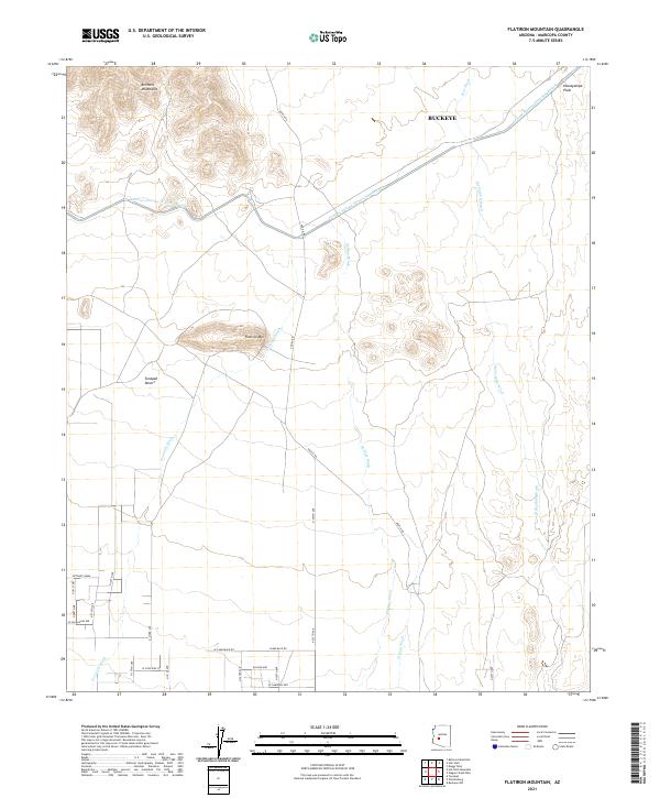 2021 Flatiron Mountain2021 Print · USGSThe western edge of the Salt River Valley meets the desert peaks in the early twenty-first century. Researchers can trace the path of the Central Arizona Project Aqueduct or locate family properties near Flatiron Mtn and Aguila Rd.
 - 2021 Map of Perryville, 2021 Print
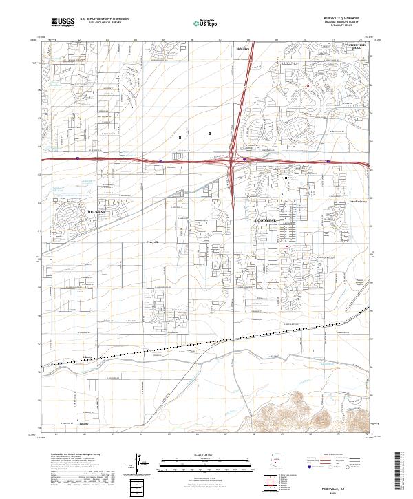 2021 Perryville2021 Print · USGSMaricopa County's western expansion is on full display in this modern survey of the desert landscape south of the White Tank Mountains. Genealogists and local researchers can trace the development of Goodyear and Buckeye alongside rural landmarks like Liberty and the Phoenix Goodyear Airport.
 - 2021 Map of Valencia, 2021 Print
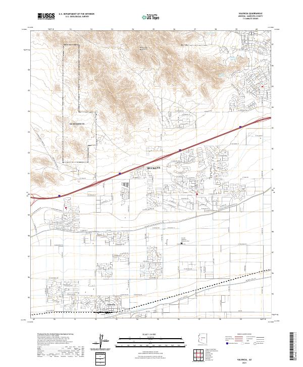 2021 Valencia2021 Print · USGSBuckeye and Valencia are shown in their modern desert setting, where residential growth meets long-standing agricultural irrigation. Researchers can locate the Louis B Hazelton Memorial Cem and trace water routes like the Buckeye Canal and Bulldozer Wash.
 - 2021 Map of Buckeye NW, 2021 Print
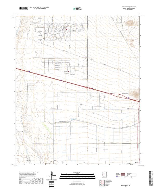 2021 Buckeye NW2021 Print · USGSMaricopa County's western valley is captured here in the early twenty-first century as agricultural roots meet suburban expansion. Researchers can trace the critical path of the Roosevelt Canal and locate landmarks like Buckeye Municipal Airport.
 - 2021 Map of Waddell, 2021 Print
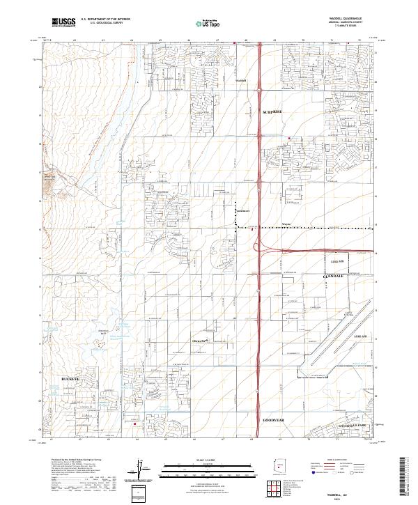 2021 Waddell2021 Print · USGSThe West Valley transitions from the rugged White Tank Mountains into the burgeoning residential grids of Surprise and Glendale in the early 2020s. Researchers can trace the desert drainage system through Waterfall Wash or locate the sprawling grounds of Luke Air Force Base.
 - 2021 Map of Arlington, 2021 Print
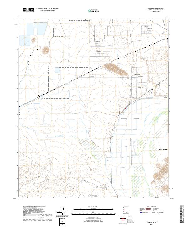 2021 Arlington2021 Print · USGSArlington and the surrounding Gila River valley are captured here during a period of steady agricultural development. Local historians can trace the path of the Arlington Canal, the historic route of W Old US 80, and the small settlement at Dixie.
 - 2021 Map of White Tank Mountains NE, 2021 Print
 2021 White Tank Mountains NE2021 Print · USGSMaricopa County's western edge is captured here during a period of rapid suburban expansion into the desert. Researchers can trace the sophisticated water network of the Central Arizona Project Aqueduct and locate facilities like the Volvo Proving Grounds and Wagner Tank.
 - 2021 Map of Wintersburg, 2021 Print
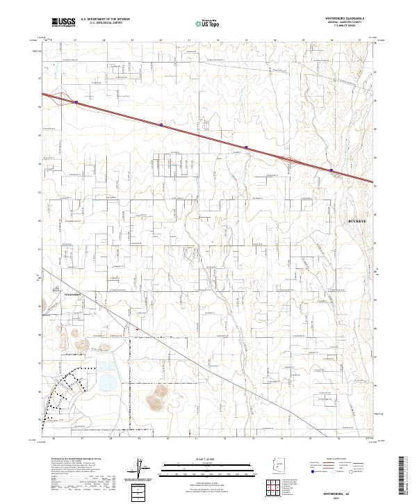 2021 Wintersburg2021 Print · USGSMaricopa County's western valley remains a blend of desert washes and agricultural grids in this contemporary survey. Genealogists and local historians can trace the development of Wintersburg and the rural road network near the Hassayampa River and Dickey Wash.
End of results
Showing maps 1-20 of 20
Top cities near Buckeye
- Glendale historical maps
- Peoria historical maps
- Surprise historical maps
- Goodyear historical maps
- Estrella historical maps
- Citrus Park historical maps
Top neighborhoods of Buckeye
- Verrado historical maps
- Conger historical maps
- Tartesso historical maps
- Blue Horizons historical maps
- Floreo At Teravalis historical maps
- Copper Falls historical maps
See more
Frequently asked questions
- What are the different types of historical maps available for Buckeye?
- What is the oldest map of Buckeye?
- Where can I purchase historical maps of Buckeye for my home or office?
- Where can I download high-res historical maps of Buckeye?
- Are there historical topographic maps available for Buckeye?
- Is there historical aerial imagery available for Buckeye?
- Where are historical maps of Buckeye sourced from?