1970s Maps of Buckeye, Arizona
Explore 8 historic maps of Buckeye from the 1970s. These maps offer a rare glimpse into what life looked like during the 1970s — showing old roads, neighborhoods, homes, and landmarks that have changed or disappeared over time.
Whether you're researching your family's past, planning a metal detecting trip, or studying how Buckeye's landscape evolved across the 1970s, these high-resolution maps are a powerful tool for exploring the history of this region.
- Focus on a specific era: All maps on this page are from the 1970s, giving you a focused view of this time period.
- See what’s changed: Compare century-old streets, trails, and buildings to today's modern landscape using overlays and satellite layers.
- Research with precision: Use these maps for genealogy, historical research, land use analysis, or educational projects.
- View, download, or print: Maps are fully viewable online in high resolution, and can be downloaded or printed for your own records.
Start exploring Buckeye's history through authentic maps from the 1970s. This is your window into the past.
Buckeye, AZ maps
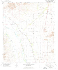
(8)- 1971 Map of Phoenix
 1971 Phoenix1971 Print · USGSCentral Arizona at the start of the seventies shows a desert metropolis expanding toward the Sun Valley retirement boom. Trace the growth of Sun City and Glendale, or locate remote historic sites like the Vulture Gold Mine and Nottbusch Cemetery.
 - 1971 Map of Perryville, 1972 Print
 1971 Perryville1972 Print · USGSAgricultural grids and desert irrigation define the Maricopa County landscape in the early seventies. Researchers can trace the layout of Perryville and Liberty or follow the natural course of the Gila River.
 - 1971 Map of Waddell, 1972 Print
 1971 Waddell1972 Print · USGSMaricopa County agriculture and military operations are captured in the early seventies, showing a landscape defined by desert irrigation. Trace the growth of Waddell and Citrus Park alongside the runways of Luke Air Force Base.
 - 1971 Map of Avondale SW, 1972 Print
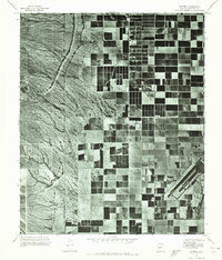
 1971 Avondale SW1972 Print · USGSMaricopa County agriculture meets the desert at the start of the 1970s, where irrigated fields push against the rugged Sierra Estrella. Trace the desert drainages of Waterman Wash and Corgett Wash as they approach the Gila River.
 - 1973 Map of Margies Peak, 1975 Print
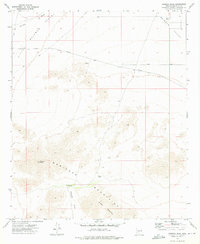 1973 Margies Peak1975 Print · USGSMaricopa County's arid highlands are captured here in the early 1970s, showcasing a landscape of high peaks and vital desert water stops. Trace the routes of old Jeep Trails to isolated landmarks like Margies Peak, Sheep Mountain, and the CCC Tank.2 unique versions available
 - 1973 Map of Cotton Center NW, 1976 Print
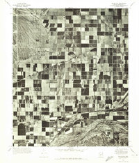
 1973 Cotton Center NW1976 Print · USGSMaricopa County's desert agricultural frontier is captured here in the early seventies as irrigation systems transformed the valley floor. Researchers can trace the water-driven economy of the day through the Gila River canals, the Enterprise Ranch, and the local Cotton Gin.
 - 1973 Map of Spring Mtn., 1976 Print
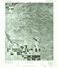
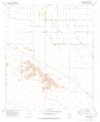
 1973 Spring Mtn.1976 Print · USGSMaricopa County during the early 1970s shows a landscape of desert industry and complex irrigation along the Gila River. Trace historical water management at Gillespie Dam or locate mining activity at the Buckeye Copper Mine.2 unique versions available
 - 1973 Map of Mobile NW, 1977 Print
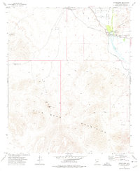
 1973 Mobile NW1977 Print · USGSThe Rainbow Valley region of Arizona is captured here in the early seventies as infrastructure began to cross the desert floor. Genealogists and researchers can trace local water rights and land use via Youngker Tank, the Landing Strip, and Waterman Wash.2 unique versions available
End of results
Showing maps 1-8 of 8
Top cities near Buckeye
- Glendale historical maps
- Peoria historical maps
- Surprise historical maps
- Goodyear historical maps
- Estrella historical maps
- Citrus Park historical maps
Top neighborhoods of Buckeye
- Verrado historical maps
- Conger historical maps
- Tartesso historical maps
- Blue Horizons historical maps
- Floreo At Teravalis historical maps
- Copper Falls historical maps
See more
Frequently asked questions
- What are the different types of historical maps available for Buckeye?
- What is the oldest map of Buckeye?
- Where can I purchase historical maps of Buckeye for my home or office?
- Where can I download high-res historical maps of Buckeye?
- Are there historical topographic maps available for Buckeye?
- Is there historical aerial imagery available for Buckeye?
- Where are historical maps of Buckeye sourced from?