Old Maps of Mesa, Arizona for Hiking & Exploration
Hike through history with 75 historic maps of Mesa. Explore old trails, ghost towns, and forgotten backroads — perfect for outdoor adventurers and local explorers.
- Rediscover forgotten places: Map out old mining camps, roads, and footpaths that no longer exist on modern maps.
- Layer with modern tools: Combine with LiDAR or satellite views to plan hikes through historical terrain.
- Made for exploration: Popular among hikers, overlanders, and local history lovers.
Use these maps to find adventure and explore the hidden past of Mesa.
Mesa, AZ maps
(75)- 1904 Map of Desert Well, 1958 Print
 1904 Desert Well1958 Print · USGSArizona's Salt River Valley comes to life in the early 1900s as a landscape of irrigation canals and desert outposts. Local historians can trace the early footprint of Higley, locate the specific Desert Well, and follow the path of the Santa Fe Prescott and Phoenix RR.
 - 1904 Map of Ft. McDowell, 1960 Print
 1904 Ft. McDowell1960 Print · USGSMaricopa County's river valleys and early ranching outposts are captured here at the turn of the century. Genealogists and historians can locate early homesteads like Asher's Ranch and the site of the Limekiln near the Salt River.
 - 1906 Map of Ft. McDowell
 1906 Ft. McDowell1906 Print · USGSMaricopa County's river valleys and desert foothills were defined by a network of ranching homesteads and tribal lands in the early 1900s. Researchers can trace the early foundations of Arizona water management near the Arizona Dam and locate family outposts like Otero's Ranch and Stewarts Ranch.3 unique versions available
 - 1906 Map of Desert Well
 1906 Desert Well1906 Print · USGSArizona's Salt River valley was transitioning from open range to an irrigated landscape in the years after the turn of the century. Trace the early routes of the Santa Fe Prescott and Phoenix RR and locate pioneer outposts like Buchanan's Ranch and the Desert Well.3 unique versions available
 - 1913 Map of Mesa, 1955 Print
 1913 Mesa1955 Print · USGSMaricopa County's irrigation and early rail networks are meticulously detailed in this pre-war survey of the Salt River Valley. Genealogists can trace family names at local landmarks like Alma School, the settlement of Creamery, and the Kyrene School.
 - 1915 Map of Mesa
 1915 Mesa1915 Print · USGSMaricopa County's agricultural heartland was defined by a complex web of gravity-fed water systems before the era of modern expansion. Genealogists and historians can trace early settlements and school districts like Kyrene School, Falfa, and the Arizona State Normal School.2 unique versions available
 - 1930 Map of Cave Creek, 1959 Print
 1930 Cave Creek1959 Print · USGSThe Cave Creek and Verde River backcountry comes alive in this survey from the era of guest ranches and remote outposts. Researchers can locate early family homesteads like Lewis Ranch, trace the route to the Mormon Girl Mine, or find the original Spur Cross Dude Ranch.2 unique versions available
 - 1939 Map of Cave Creek
 1939 Cave Creek1939 Print · USGSThe Cave Creek area in the late thirties is a landscape of working cattle ranches and early desert tourism. Genealogists and historians can trace family-named outposts like Sears Kay Ranch and Browns Ranch or the historic Mormon Girl Mine.3 unique versions available
 - 1952 Map of Tempe, 1957 Print
 1952 Tempe1957 Print · USGSGreater Phoenix in the early fifties showcases a landscape defined by expansive irrigation canals and the rising campus of Arizona State College at Tempe. Genealogists and historians can trace the early borders of Scottsdale, the remote Tempe Airport, and the family plots within Guadalupe Cemetery.7 unique versions available
 - 1952 Map of Chandler, 1957 Print
 1952 Chandler1957 Print · USGSCentral Arizona's agricultural heartland is captured here in the early fifties as irrigation and rail networks drove the expansion of the Salt River Valley. Researchers can trace the development of Chandler and Gilbert alongside smaller vanished stops like Falfa and the Water Users Camp 10.5 unique versions available
 - 1952 Map of Mesa, 1957 Print
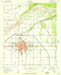 1952 Mesa1957 Print · USGSMid-century Mesa and the surrounding Salt River Valley are seen here during a period of agricultural productivity and steady growth. Researchers can trace the extensive irrigation network of the Consolidated Canal and locate neighborhood landmarks like the LDS Temple and Taylor Field.5 unique versions available
 - 1952 Map of Guadalupe, 1957 Print
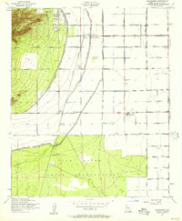 1952 Guadalupe1957 Print · USGSThe Salt River Valley's agricultural and industrial growth is captured here in the early fifties. Genealogists and historians can trace old settlements like Guadalupe and West Chandler alongside the Kyrene Steam Generating Plant and Southern Pacific rail line.6 unique versions available
 - 1952 Map of Mesa, 1960 Print
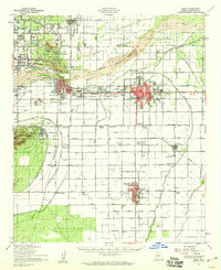 1952 Mesa1960 Print · USGSThe East Valley was a burgeoning network of irrigation canals and growing citrus towns in the early fifties. Genealogists and historians can trace old community centers like Sonora Town, Falfa, and Winfield Scott Sch alongside the early campus of Arizona State College.
 - 1954 Map of Mesa, 1968 Print
 1954 Mesa1968 Print · USGSCentral Arizona in the mid-fifties reveals the rapid growth of the Valley of the Sun alongside the deep-rooted mining districts of the eastern mountains. Genealogists and researchers can trace the expansion of Mesa and Chandler or locate legacy operations at Inspiration Mine and the Magma Arizona railroad.4 unique versions available
 - 1956 Map of Buckhorn, 1959 Print
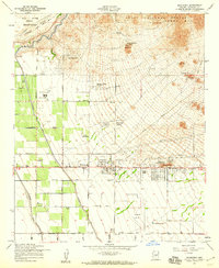 1956 Buckhorn1959 Print · USGSMaricopa County during the mid-fifties shows a fascinating mix of aviation history and desert agriculture as the suburban fringe began to take shape. Researchers can trace early landing strips like Oasis Airport and find the site of the Arizona Girls Ranch near the Apache Trail.5 unique versions available
 - 1956 Map of Desert Well, 1959 Print
 1956 Desert Well1959 Print · USGSThe arid borderlands of Maricopa and Pinal counties are shown in the mid-1950s as a hub for military and technical testing. Researchers can trace the massive Desert Proving Grounds and locate local landmarks like Desert Well and Hawk Rock.4 unique versions available
 - 1956 Map of Higley, 1959 Print
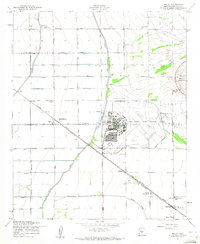 1956 Higley1959 Print · USGSSoutheastern Maricopa County is captured during its mid-century transition from a desert railroad corridor to a significant military and agricultural hub. Researchers can trace the layout of Williams Air Force Base and the rural origins of Higley and Queen Creek.5 unique versions available
 - 1956 Map of Apache Junction, 1959 Print
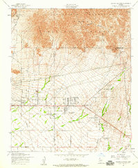 1956 Apache Junction1959 Print · USGSApache Junction and the Goldfield foothills come to life in the mid-1950s as desert ranching and early tourism began to shape the region. Researchers can locate the historic Apache Trail, the Bulldog Mine, and the site of the Superstition Mtn School before the desert floor was fully developed.5 unique versions available
 - 1957 Map of Mesa
 1957 Mesa1957 Print · USGSCentral Arizona's desert valleys and high-mountain mining districts come alive in the mid-fifties. Researchers can trace the early layout of Mesa and Phoenix or locate remote sites like Inspiration Mine and Arizona State College.
 - 1958 Map of Mesa
 1958 Mesa1958 Print · USGSMid-century Arizona comes alive in this survey of the valley and high desert, where urban growth begins to transform the landscape. Genealogists and researchers can trace the rail-and-mine economy through Inspiration Mine and old stops like Rittenhouse and Magma.
 - 1958 Map of Tempe, 1968 Print
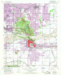 1958 Tempe1968 Print · USGSGreater Phoenix and Tempe undergo rapid transformation during the post-war era as irrigation and industry reshape the desert. Genealogists and historians can trace early campus footprints at Arizona State College at Tempe or locate St Francis Cemetery.
 - 1960 Map of Mesa
 1960 Mesa1960 Print · USGSThe Salt River Valley and Superstition wilderness are captured here during a era of rapid post-war growth. Researchers can trace the mid-century footprints of Williams AF Base and Arizona State College or locate the deep-rock shafts of the Old Dominion Mine and Magma Mine.
 - 1964 Map of Mesa
 1964 Mesa1964 Print · USGSCentral Arizona in the mid-1960s reveals a landscape defined by rapid desert urbanization and a massive copper mining industry. Genealogists and historians can trace the growth of Phoenix or explore the mining camps and operations at Miami Mine and Magma Mine.
 - 1964 Map of Granite Reef Dam, 1965 Print
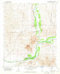 1964 Granite Reef Dam1965 Print · USGSThe confluence of the Salt and Verde rivers is documented here in the mid-1960s, showing the vital irrigation infrastructure of the burgeoning Phoenix region. Researchers can trace historical sites like the Jim Hart Memorial Monument, the P Bar Ranch, and the early layout of the Arizona Canal.3 unique versions available
 - 1971 Map of Chandler, 1972 Print
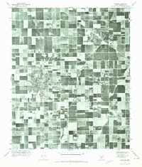 1971 Chandler1972 Print · USGSMaricopa County is captured during its mid-century agricultural prime before the surge of suburban sprawl. Researchers can trace the early layouts of Chandler and Gilbert alongside vital irrigation routes like the Eastern Canal.
Showing maps 1-25 of 75
Top cities near Mesa
- Phoenix historical maps
- Chandler historical maps
- Scottsdale historical maps
- Gilbert historical maps
- Tempe historical maps
- San Tan Valley historical maps
See more
Top neighborhoods of Mesa
- Venture Out historical maps
- Rancho de Arboleda historical maps
- Pleasant Grove Homeowners historical maps
- Kingsgate historical maps
- Continental at Superstition Springs historical maps
- Silver Spur Ranch historical maps
See more
Frequently asked questions
- What are the different types of historical maps available for Mesa?
- What is the oldest map of Mesa?
- Where can I purchase historical maps of Mesa for my home or office?
- Where can I download high-res historical maps of Mesa?
- Are there historical topographic maps available for Mesa?
- Is there historical aerial imagery available for Mesa?
- Where are historical maps of Mesa sourced from?