
1956 Map of Desert Well
USGS Topo · Published 1959About this map
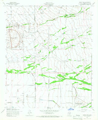
The Desert Proving Grounds and its prominent circular testing track dominate the arid landscape along the border of Maricopa and Pinal counties in the mid-1950s. This desert expanse is defined by complex water management and aviation infrastructure, ranging from the wide Diversion Dike to the Rittenhouse Air Force Auxiliary Field in the southeast corner. Sparse but vital human outposts like Desert Well and Anderson Ranch anchor the local geography, while a series of isolated Landing Fields and a surprising Swimming Pool near the county line suggest a landscape transitioning from ranching to specialized military and technical use. Natural drainage patterns, including Weekes Wash and Siphon Draw, are clearly delineated as they cut through the terrain near landmarks like Hawk Rock.
Find a feature on this map
14 named features on this map. Tap any name to fly to it.
Don’t see what you’re looking for? This feature index may not catch every label — zoom into the map to look around manually.
Map Details
Editions of this 1956 Desert Well Map
4 editions found
Other maps of this area

1900 · Florence
USGS Topo · 1:125,000

1902 · Florence
USGS Topo · 1:125,000

1904 · Desert Well
USGS Topo · 1:62,500

1906 · Desert Well
USGS Topo · 1:62,500

1907 · Sacaton
USGS Topo · 1:62,500

1954 · Mesa
USGS Topo · 1:250,000

1956 · Sacaton NE
USGS Topo · 1:24,000
1956 · Buckhorn
USGS Topo · 1:24,000

1956 · Goldfield
USGS Topo · 1:24,000

1956 · Magma
USGS Topo · 1:24,000