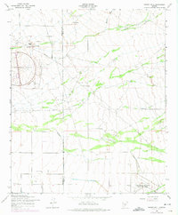
1956 Map of Desert Well
USGS Topo · Published 1975About this map
Desert Well and Anderson Ranch anchor this mid-century desert landscape, where the agricultural and military development of the region is clearly visible. The map captures a transition from traditional ranching to specialized government land use, most notably with the large oval of the Desert Proving Grounds and the Rittenhouse Air Force Auxiliary Field in the south. These military footprints share the terrain with infrastructure designed to manage the arid environment, including a significant Diversion Dike and numerous catchment features like the Siphon Draw and Weekes Wash.
Find a feature on this map
13 named features on this map. Tap any name to fly to it.
Don’t see what you’re looking for? This feature index may not catch every label — zoom into the map to look around manually.
Map Details
Editions of this 1956 Desert Well Map
4 editions found

Other maps of this area

1900 · Florence
USGS Topo · 1:125,000

1902 · Florence
USGS Topo · 1:125,000

1904 · Desert Well
USGS Topo · 1:62,500

1906 · Desert Well
USGS Topo · 1:62,500

1907 · Sacaton
USGS Topo · 1:62,500

1954 · Mesa
USGS Topo · 1:250,000

1956 · Sacaton NE
USGS Topo · 1:24,000
1956 · Buckhorn
USGS Topo · 1:24,000

1956 · Goldfield
USGS Topo · 1:24,000

1956 · Magma
USGS Topo · 1:24,000