Old Maps of Kingman, Arizona for Hiking & Exploration
Hike through history with 36 historic maps of Kingman. Explore old trails, ghost towns, and forgotten backroads — perfect for outdoor adventurers and local explorers.
- Rediscover forgotten places: Map out old mining camps, roads, and footpaths that no longer exist on modern maps.
- Layer with modern tools: Combine with LiDAR or satellite views to plan hikes through historical terrain.
- Made for exploration: Popular among hikers, overlanders, and local history lovers.
Use these maps to find adventure and explore the hidden past of Kingman.
Kingman, AZ maps
(36)- 1886 Map of Diamond Creek
 1886 Diamond Creek1886 Print · USGSMohave County was a land of expanding rails and rugged canyon rims in the mid-1880s. Genealogists and historians can trace the early path of the Atlantic and Pacific Railroad and locate frontier sites like Old Hackberry, American Flag Mine, and Camp Willow Grove.
 - 1886 Map of Camp Mohave
 1886 Camp Mohave1886 Print · USGSThe Colorado River and the Cerbat mining districts define this territory during the mid-1880s. Genealogists and historians can trace the early rail stops at Kingman and Beale, or find the locations of frontier mining camps like Chloride and Mineral Park.
 - 1892 Map of Diamond Creek
 1892 Diamond Creek1892 Print · USGSNorthwestern Arizona comes alive in this late nineteenth-century survey during the height of the steam rail era. Genealogists and historians can trace the early path of the Atlantic and Pacific Railroad and locate vanished outposts like Camp Willow Grove, Cottonwood Station, and Old Hackberry.6 unique versions available
 - 1892 Map of Camp Mohave
 1892 Camp Mohave1892 Print · USGSThe Colorado River frontier in the 1890s reveals a network of isolated mining camps and military outposts. Trace the early river-crossing economy and mining boomtowns through Eldorado Ferry, the Patterson Mine, and the military station at Camp Mohave.8 unique versions available
 - 1939 Map of Chloride
 1939 Chloride1939 Print · USGSArizona's Cerbat Mountains come alive in the 1930s as a high-desert mining hub centered on the town of Chloride. Genealogists and historians can trace family ranching lands like Neal Ranch and the locations of major silver and lead producers such as the Tennessee Mine and Stockton Mine.3 unique versions available
 - 1942 Map of Camp Mohave
 1942 Camp Mohave1942 Print · USGSThe tri-state borderlands of Nevada, Arizona, and California are captured here in the early 1940s, highlighting a landscape of deep canyons and high-desert mining camps. Researchers can trace historic rail lines and find remote outposts like Searchlight, Nelson, and the riverfront Fort Mohave Indian Reservation.
 - 1944 Map of Chloride
 1944 Chloride1944 Print · USGSThe Cerbat Mountains were a hive of mining and ranching activity in the late thirties. Researchers can trace the legacies of family outposts like Lewis Ranch and historic mining operations including the Tennessee Mine and the Stockton Mine.2 unique versions available
 - 1947 Map of Kingman, 1948 Print
 1947 Kingman1948 Print · USGSThe tri-state Mojave desert region comes into focus during the late 1940s, as post-war travel began to surge along U S 66. Genealogists and historians can trace the mining-and-rail economy through the Atchison Topeka and Santa Fe line, the Copper World Mine, and old settlements like Oatman or Goodsprings.2 unique versions available
 - 1948 Map of Kingman
 1948 Kingman1948 Print · USGSThe Mojave Desert at the dawn of the fifties shows a landscape of deep canyons and booming mines along the Arizona and Nevada border. Genealogists and historians can trace rail-stop towns and mining claims like Oatman, Searchlight, and the Mohawk Mine.
 - 1948 Map of Williams
 1948 Williams1948 Print · USGSNorthern Arizona is captured here during the post-war era of roadside travel and heavy rail transport along the Santa Fe line. Researchers can trace the path of Route 66 through settlements like Seligman, Valentine, and Hackberry while exploring the vast terrain of the Hualpai Indian Reservation.2 unique versions available
 - 1954 Map of Kingman, 1964 Print
 1954 Kingman1964 Print · USGSThe High Desert borderlands come to life in the mid-fifties, showing the intersection of mining legacies and massive river projects. Researchers can trace old rail stops like Roach Station, mining sites such as Chloride, and river landmarks like Searchlight Ferry.4 unique versions available
 - 1954 Map of Williams, 1972 Print
 1954 Williams1972 Print · USGSThe high plateau of Northern Arizona is captured here during the mid-fifties, showing the rail-and-road corridor before the interstate era. You can trace family roots through remote railroad stops like Audley and Pica or locate early landmarks such as Grand Canyon Caverns and Frazier Wells.
 - 1955 Map of Kingman
 1955 Kingman1955 Print · USGSThe Mojave Desert and Colorado River corridor come alive in the mid-fifties, showing a landscape of mining camps and rail junctions. Trace the river to the Searchlight Ferry or locate old desert mining sites like Goldroad and the Great Monster Mine.
 - 1956 Map of Williams, 1963 Print
 1956 Williams1963 Print · USGSNorthern Arizona in the mid-fifties reveals a landscape shaped by the Atchison Topeka and Santa Fe railroad and the iconic Highway 66. Trace the route of early travelers through Peach Springs, Seligman, and Ash Fork, or find remote sites like the Music Mountain Mine (Gold).3 unique versions available
 - 1958 Map of Kingman
 1958 Kingman1958 Print · USGSThe tri-state desert borders of Arizona, Nevada, and California are shown in the late fifties as a network of mining camps and river crossings. Genealogists and historians can trace the legacy of remote outposts like Oatman, Chloride, and the Searchlight Ferry along the Colorado River.2 unique versions available
 - 1960 Map of Williams
 1960 Williams1960 Print · USGSNorthern Arizona in the mid-twentieth century was defined by its massive canyons and the vital rail line connecting its remote ranches. Genealogists and historians can trace the development of Peach Springs, the high-altitude Bill Williams Mountain, and isolated outposts like Diamond Bar Ranch.
 - 1960 Map of Kingman
 1960 Kingman1960 Print · USGSThe high desert landscape of the Arizona-Nevada border comes alive in the mid-twentieth century, showcasing the rise of recreation alongside deep-rooted mining history. Genealogists and historians can trace the roots of towns like Kingman and Oatman, or locate remote sites like the Lucky Dutchman Mine and Santa Claus.3 unique versions available
 - 1961 Map of Williams
 1961 Williams1961 Print · USGSNorthern Arizona in the mid-fifties reveals a high-desert landscape of rail towns and deep canyons along the Atchison Topeka and Santa Fe. Researchers can trace old Route 66 through Peach Springs, Seligman, and Ash Fork, or find remote sites like Music Mountain Mine.
 - 1967 Map of Kingman, 1968 Print
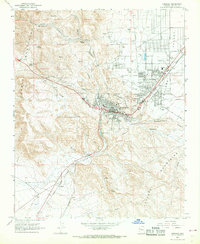 1967 Kingman1968 Print · USGSKingman and the surrounding Mohave County highlands come alive in this late-sixties survey as the town expanded into the Sacramento Valley. Genealogists and historians can trace the development of Hilltop, locate the Mountain View Cem, and follow the Atchison Topeka and Santa Fe RR through McConnico.2 unique versions available
 - 1968 Map of Rattlesnake Hill, 1971 Print
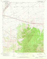 1968 Rattlesnake Hill1971 Print · USGSArizona's high desert meets the mountains in the late 1960s, showing the vital corridors of the Hualapai Valley. Genealogists and historians can locate remote ranch sites like the Lazy Yu Ranch and D-W Ranch alongside the landmark Rattlesnake Hill.3 unique versions available
 - 1968 Map of Stockton Hill, 1971 Print
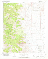 1968 Stockton Hill1971 Print · USGSThe Cerbat Mountains north of Kingman appear in the late 1960s as a hub of mining activity and high-desert desert peaks. Genealogists and historians can trace numerous named claims such as the Stockton Mine, C O D Mine, and Western Union Mine.4 unique versions available
 - 1982 Map of Davis Dam, 1983 Print
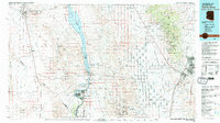 1982 Davis Dam1983 Print · USGSThe Colorado River corridor and the Tri-State area come into focus in the early eighties, showing the growth of Bullhead City and Laughlin near the Davis Dam. Researchers can trace extensive mining operations like the Searchlight Mine or follow the Atchison Topeka and Santa Fe rail line into Kingman.2 unique versions available
 - 1984 Map of Valentine
 1984 Valentine1984 Print · USGSNorthern Arizona's high desert comes into focus in the mid-1980s as the rail and road network connects remote outposts. Trace the path of the Atchison Topeka and Santa Fe through Valentine and locate mining sites like the Sunshine Mine.2 unique versions available
 - 2011 Map of Stockton Hill, 2011 Print
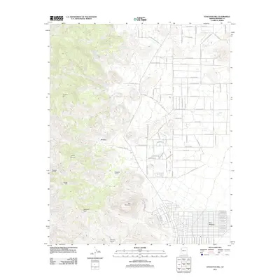 2011 Stockton Hill2011 Print · USGSThe high desert landscape north of Kingman comes into focus here, showing the transition from the rugged Cerbat Mountains to growing residential developments. Researchers can trace the layout of New Kingman, locate historical water sources like C O D Spring, and explore the topography around Stockton Hill.
 - 2011 Map of Rattlesnake Hill, 2011 Print
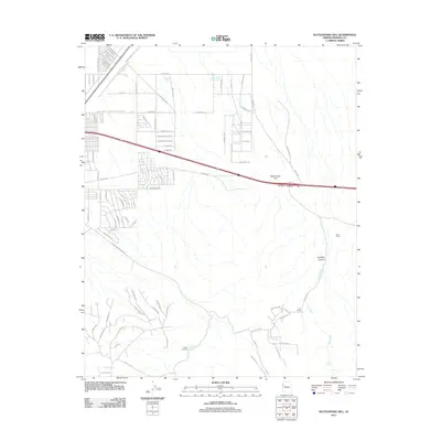 2011 Rattlesnake Hill2011 Print · USGSNortheast of Kingman during the early twenty-first century, this survey captures the point where suburban development meets the cattle ranching history of Mohave County. Researchers can trace land use through features like the Lady Y U Ranch, Berry Tank, and Hualapai Canyon.
Showing maps 1-25 of 36
Top cities near Kingman
- New Kingman-Butler historical maps
- Golden Valley historical maps
- Valle Vista historical maps
- Walnut Creek historical maps
- Lazy Y U historical maps
- So-Hi historical maps
See more
Top neighborhoods of Kingman
Frequently asked questions
- What are the different types of historical maps available for Kingman?
- What is the oldest map of Kingman?
- Where can I purchase historical maps of Kingman for my home or office?
- Where can I download high-res historical maps of Kingman?
- Are there historical topographic maps available for Kingman?
- Is there historical aerial imagery available for Kingman?
- Where are historical maps of Kingman sourced from?