1990s Maps of Casa Grande, Arizona
Explore 7 historic maps of Casa Grande from the 1990s. These maps offer a rare glimpse into what life looked like during the 1990s — showing old roads, neighborhoods, homes, and landmarks that have changed or disappeared over time.
Whether you're researching your family's past, planning a metal detecting trip, or studying how Casa Grande's landscape evolved across the 1990s, these high-resolution maps are a powerful tool for exploring the history of this region.
- Focus on a specific era: All maps on this page are from the 1990s, giving you a focused view of this time period.
- See what’s changed: Compare century-old streets, trails, and buildings to today's modern landscape using overlays and satellite layers.
- Research with precision: Use these maps for genealogy, historical research, land use analysis, or educational projects.
- View, download, or print: Maps are fully viewable online in high resolution, and can be downloaded or printed for your own records.
Start exploring Casa Grande's history through authentic maps from the 1990s. This is your window into the past.
Casa Grande, AZ maps
(7)- 1992 Map of Casa Grande West
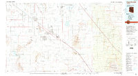
 1992 Casa Grande West1992 Print · USGSCasa Grande is shown in the early nineties during a period of transition between its mining roots and modern expansion. Researchers can trace the extensive Open Pit Mine works or locate local landmarks like Saguaro Sch and the Mormon Battalion Historical Monument.
 - 1992 Map of Double Peak, 1995 Print
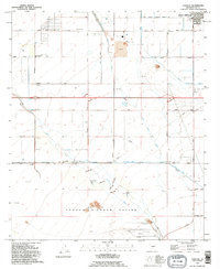
 1992 Double Peak1995 Print · USGSPinal County agriculture and desert terrain meet in the early nineties, where a complex irrigation system supports the arid basin. Researchers can trace the path of the Santa Rosa Canal and find local landmarks like Double Peak and the Landing Strip.
 - 1992 Map of Chuichu, 1995 Print
 1992 Chuichu1995 Print · USGSThe Pinal County desert south of Casa Grande is documented here in the early nineties, showing the vital water systems and communities of the Tohono O'odham Nation. Genealogists and historians can trace local landmarks like the Ocatillo Sch, the Chuichu settlement, and the local Cemetery.
 - 1992 Map of Stanfield, 1995 Print
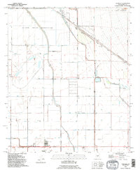 1992 Stanfield1995 Print · USGSThe Pinal County desert and its irrigation-fed fields come alive in the early nineties, centered on the community of Stanfield. Genealogists and historians can trace local landmarks like the Stanfield Sch, the Community Center, and the border of the Ak-Chin Indian Reservation.
 - 1992 Map of Casa Grande East, 1995 Print
 1992 Casa Grande East1995 Print · USGSMid-century expansion and desert hydrology define this portion of Pinal County in the early nineties. Genealogists and local historians can trace the development of Casa Grande and find landmarks like Central Arizona College and Ironwood Sch.
 - 1992 Map of Casa Grande Mountains, 1995 Print
 1992 Casa Grande Mountains1995 Print · USGSPinal County at the start of the nineties shows a desert landscape transformed by irrigation and rail, from the city of Casa Grande to the Santa Cruz Flats. Researchers can trace early settlements like Arizola and historic sites such as Weaver Pioneer Cemetery and St Anthony Sch.
 - 1994 Map of Casa Grande
 1994 Casa Grande1994 Print · USGSPinal County in the early nineties shows a desert landscape shaped by massive irrigation projects and ancient heritage. Trace the path of the Southern Pacific past Casa Grande National Monument Ruins and the Silver Reef Mine.3 unique versions available
End of results
Showing maps 1-7 of 7
Top cities near Casa Grande
- Maricopa historical maps
- Eloy historical maps
- Coolidge historical maps
- Arizona City historical maps
- Chuichu historical maps
Top neighborhoods of Casa Grande
- Bon historical maps
- Desert Sky Ranch historical maps
- Mission Royale historical maps
- Villago historical maps
- Tamaron historical maps
- Los Portales historical maps
Frequently asked questions
- What are the different types of historical maps available for Casa Grande?
- What is the oldest map of Casa Grande?
- Where can I purchase historical maps of Casa Grande for my home or office?
- Where can I download high-res historical maps of Casa Grande?
- Are there historical topographic maps available for Casa Grande?
- Is there historical aerial imagery available for Casa Grande?
- Where are historical maps of Casa Grande sourced from?