Old Maps of Maricopa, Arizona for Hiking & Exploration
Hike through history with 69 historic maps of Maricopa. Explore old trails, ghost towns, and forgotten backroads — perfect for outdoor adventurers and local explorers.
- Rediscover forgotten places: Map out old mining camps, roads, and footpaths that no longer exist on modern maps.
- Layer with modern tools: Combine with LiDAR or satellite views to plan hikes through historical terrain.
- Made for exploration: Popular among hikers, overlanders, and local history lovers.
Use these maps to find adventure and explore the hidden past of Maricopa.
Maricopa, AZ maps
(69)- 1913 Map of Maricopa, 1958 Print
 1913 Maricopa1958 Print · USGSArizona's desert interior comes to life in this early twentieth-century survey of the Gila River Valley. Researchers can trace the shifting rail lines through Maricopa and locate the historic site of Maricopa Wells (Abandoned) or Pima Village.
 - 1914 Map of Gila Butte
 1914 Gila Butte1914 Print · USGSThe Gila River valley in the early twentieth century shows a landscape defined by desert trading posts and the rise of managed irrigation. Researchers can locate family roots and early commerce at the Sweetwater Store Indian Trading Post, Snaketown, and the Casa Blanca Indian School.
 - 1915 Map of Maricopa
 1915 Maricopa1915 Print · USGSThe Gila River Valley and its early twentieth-century reservations are captured here as the railroad began to redefine Arizona's desert hubs. Genealogists and historians can trace old stops like Maricopa Wells (Abandoned), the rail junction at Maricopa, and the peaks of the Sierra Estrella.2 unique versions available
 - 1917 Map of Gila Butte
 1917 Gila Butte1917 Print · USGSThe Pinal County desert comes into focus during the early twentieth century as irrigation and rail lines began to reshape the Gila River valley. Genealogists and historians can locate early trading hubs like the North Line Trading Post and tribal landmarks including Snaketown and the Casa Blanca Indian School.2 unique versions available
 - 1922 Map of Casa Grande, 1956 Print
 1922 Casa Grande1956 Print · USGSPinal County in the early twenties shows a landscape shaped by tribal lands and the railroad. Genealogists and historians can trace the early layout of Casa Grande, the rail siding at Nunez, and the village of Chuichu.2 unique versions available
 - 1924 Map of Casa Grande
 1924 Casa Grande1924 Print · USGSThe Santa Cruz River valley in the early 1920s shows the convergence of rail travel and early desert irrigation. Genealogists and historians can trace the rail sidings of Bon and Nunez or locate the village of Chiu Chuischu within the Papago Indian Reservation.
 - 1946 Map of Antelope Peak, 1955 Print
 1946 Antelope Peak1955 Print · USGSThe high desert of Pinal County in the late 1940s is captured here, showing the intersection of tribal lands and the open basin. Researchers can trace early routes like Route 84 past prominent landmarks like Antelope Peak, Table Top, and the watering holes of Hidden Valley.3 unique versions available
 - 1948 Map of Antelope Peak
 1948 Antelope Peak1948 Print · USGSThe high desert south of Phoenix comes alive in the late 1940s, showing the dramatic rise of Antelope Peak and Table Top above the valley floor. Researchers can trace the early borders of the Maricopa Indian Reservation and locate isolated desert Well sites and the winding Vekol Wash.2 unique versions available
 - 1952 Map of Maricopa, 1957 Print
 1952 Maricopa1957 Print · USGSPinal County at the dawn of the fifties shows a desert landscape shaped by tribal lands and the railroad. Genealogists and researchers can locate Ak Chin, the St Francis Mission, and the rail infrastructure in Maricopa.3 unique versions available
 - 1952 Map of Sacaton Butte, 1957 Print
 1952 Sacaton Butte1957 Print · USGSThe Gila River Indian Reservation and its mid-century irrigation networks are mapped here just after the war. Local historians can trace the community of Casa Blanca, its Cemetery, and the operations at the Papago Gin.3 unique versions available
 - 1952 Map of Enid, 1957 Print
 1952 Enid1957 Print · USGSThe Pinal County desert comes into focus in the early 1950s, showing the intersection of tribal lands and railroad expansion. Researchers can trace the rail stops at Enid and Heaton or locate historical sites like Wiley Ranch and a Race Track (Aban'd).3 unique versions available
 - 1952 Map of Maricopa, 1959 Print
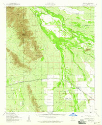 1952 Maricopa1959 Print · USGSArizona's Sonoran Desert meets the iron rail in the early 1950s, showing a landscape defined by tribal reservations and mountain peaks. Researchers can trace the Southern Pacific line through Maricopa or locate the St Francis Mission and Wiley Ranch.2 unique versions available
 - 1952 Map of Gila Butte, 1960 Print
 1952 Gila Butte1960 Print · USGSCentral Arizona's desert valleys show a distinct transition during the early fifties as irrigation canals reshaped the Gila River basin. Genealogists can trace family footprints at Bapchule, St Peters Mission Sch, and the Goodyear Cemetery.2 unique versions available
 - 1953 Map of Ajo, 1971 Print
 1953 Ajo1971 Print · USGSThe Arizona desert at mid-century reveals a landscape of massive copper mines, tribal reservations, and military testing grounds. Genealogists and historians can trace rail stopovers like Dateland and Mohawk or locate remote sites like the Reward Mine and Gu Achi (Santa Rosa).2 unique versions available
 - 1954 Map of Phoenix, 1964 Print
 1954 Phoenix1964 Print · USGSMid-century Arizona is captured here as the Phoenix metropolitan area begins its rapid expansion into the surrounding desert. Genealogists and historians can trace the development of agricultural hubs like Buckeye and Tolleson, or locate remote landmarks like the Vulture Mine and Nottbusch Cem.5 unique versions available
 - 1954 Map of Mesa, 1968 Print
 1954 Mesa1968 Print · USGSCentral Arizona in the mid-fifties reveals the rapid growth of the Valley of the Sun alongside the deep-rooted mining districts of the eastern mountains. Genealogists and researchers can trace the expansion of Mesa and Chandler or locate legacy operations at Inspiration Mine and the Magma Arizona railroad.4 unique versions available
 - 1956 Map of Tucson, 1967 Print
 1956 Tucson1967 Print · USGSPost-war Southern Arizona comes into focus as the copper and aviation industries expand around Tucson. Trace family roots in South Tucson or locate early mining sites like the San Manuel Mine and Silver Bell Mine near the Santa Cruz River.3 unique versions available
 - 1957 Map of Mesa
 1957 Mesa1957 Print · USGSCentral Arizona's desert valleys and high-mountain mining districts come alive in the mid-fifties. Researchers can trace the early layout of Mesa and Phoenix or locate remote sites like Inspiration Mine and Arizona State College.
 - 1957 Map of Ajo
 1957 Ajo1957 Print · USGSSouthern Arizona in the fifties reveals a landscape of massive copper mines, remote desert wells, and tribal reservations. Genealogists and historians can trace old cattle outposts like Whitewing Ranch, the Tracy's Trading Post, and the copper works at Ajo.
 - 1957 Map of Phoenix
 1957 Phoenix1957 Print · USGSGreater Phoenix and the central Arizona desert during the mid-fifties reveal a landscape of growing suburbs and active desert mines. Researchers can trace the legacy of local landmarks like Wickenburg Prison, the Vulture Mine, and the Tonopah Post Office.
 - 1958 Map of Ajo
 1958 Ajo1958 Print · USGSThe high desert of Pima and Yuma Counties during the late fifties shows a landscape of remote copper mines and military flight paths. Researchers can trace the Southern Pacific Railroad through Gila Bend and find heritage sites like O'Neills Grave or the Christmas Gift Mine.2 unique versions available
 - 1958 Map of Mesa
 1958 Mesa1958 Print · USGSMid-century Arizona comes alive in this survey of the valley and high desert, where urban growth begins to transform the landscape. Genealogists and researchers can trace the rail-and-mine economy through Inspiration Mine and old stops like Rittenhouse and Magma.
 - 1958 Map of Tucson
 1958 Tucson1958 Print · USGSSouthern Arizona in the late fifties reveals a landscape of desert agriculture and rising military aviation. Trace the rail lines of the Southern Pacific or locate the historic San Xavier Del Bac Mission and the Casa Grande Natl Mon.
 - 1958 Map of Phoenix
 1958 Phoenix1958 Print · USGSThe Phoenix Valley enters a period of postwar expansion, where desert irrigation meets massive military aviation footprints. Trace the development of Phoenix and Glendale alongside the legendary Vulture Mine and the auxiliary runways of Luke Air Force Base.
 - 1959 Map of Tucson
 1959 Tucson1959 Print · USGSSouthern Arizona in the late fifties shows a landscape of military growth and desert industry. Genealogists and historians can trace the footprint of Davis-Monthan Air Force Base and old mining sites like the San Manuel Mine near Mammoth.2 unique versions available
Showing maps 1-25 of 69
Top cities near Maricopa
Top neighborhoods of Maricopa
- Heaton historical maps
- Sorrento historical maps
- Rancho El Dorado historical maps
- Cobblestone historical maps
- Santa Rosa Crossings historical maps
- Lakes at Rancho El Dorado historical maps
See more
Frequently asked questions
- What are the different types of historical maps available for Maricopa?
- What is the oldest map of Maricopa?
- Where can I purchase historical maps of Maricopa for my home or office?
- Where can I download high-res historical maps of Maricopa?
- Are there historical topographic maps available for Maricopa?
- Is there historical aerial imagery available for Maricopa?
- Where are historical maps of Maricopa sourced from?