Old Maps of Nogales, Arizona for Academic Research
Study the evolution of Nogales with 19 high-resolution historic maps. Whether you're teaching, researching, or modeling changes in land use, these maps provide essential visual documentation of urban, environmental, and geographic change.
- Analyze long-term change: Track patterns in development, transportation, and natural features.
- Ideal for environmental or urban studies: Support academic projects with primary historical map data.
- Use in the classroom or lab: Educators and researchers rely on these maps to bring historical context to life.
These maps are a powerful tool for teaching, research, and visualizing how Nogales has changed over the decades.
Nogales, AZ maps
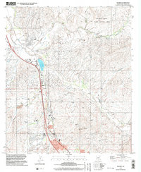
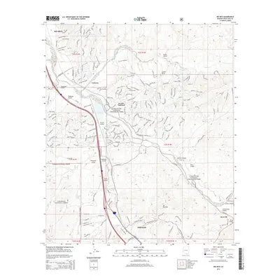
(19)- 1905 Map of Nogales
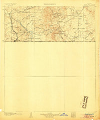 1905 Nogales1905 Print · USGSThe Arizona-Mexico borderlands are captured here at the height of the mining boom and the expansion of the Southern Pacific RR. Genealogists and historians can trace family landholdings from Calabasas to Lochiel or locate remote sites like The Mowry Mine and Fuller's Ranch.4 unique versions available
 - 1933 Map of Calabasas
 1933 Calabasas1933 Print · USGSNogales and the Santa Cruz River valley are shown here in the 1930s, documenting a critical era of border history and ranching. Trace early landmarks like Camp Stephen D. Little, the 3R Mine, and historic family lands at Buena Vista Ranch.2 unique versions available
 - 1956 Map of Nogales, 1963 Print
 1956 Nogales1963 Print · USGSSouthern Arizona in the mid-fifties is captured here from the Papago tribal lands to the San Pedro valley. Genealogists and historians can trace border settlements like Sasabe, the legacy of Tombstone, and old mining sites including the Mary G Mine.4 unique versions available
 - 1958 Map of Nogales
 1958 Nogales1958 Print · USGSSouthern Arizona in the late fifties was a landscape of international borders and high-desert outposts, dominated by the Huachuca Mountains and the Papago Indian Reservation. Local historians can trace old mining camps like Ruby and Greaterville or locate historic military grounds at the Fort Huachuca Military Reservation.
 - 1958 Map of Nogales, 1959 Print
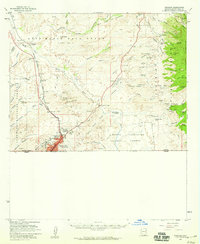 1958 Nogales1959 Print · USGSNogales and the surrounding Santa Cruz River valley are captured in the late fifties as a bustling hub of international commerce and mining. Researchers can trace dozens of hard-rock claims like the Robert E Lee Mine, locate the Calabasas site, and find family landmarks such as Yerba Buena Ranch.3 unique versions available
 - 1959 Map of Nogales
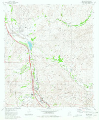
 1959 Nogales1959 Print · USGSThe Southern Arizona borderlands appear in the late fifties as a complex landscape of military ranges, tribal lands, and high-desert mining towns. Local historians can trace the Southern Pacific rail lines connecting Tombstone and Benson or locate family ranches such as Canoa Ranch.
 - 1981 Map of Rio Rico
 1981 Rio Rico1981 Print · USGSSouthern Arizona’s Santa Cruz Valley comes into focus in the early 1980s, showcasing a landscape where ancient Spanish colonial history meets modern ranching and industry. Researchers can find the historic Guevavi Mission (Ruins), old workings like the Lion Mine, and the sprawling Luis Maria Baca land grant.2 unique versions available
 - 1981 Map of Nogales
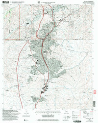
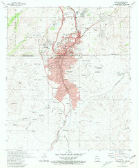 1981 Nogales1981 Print · USGSThe international border at Nogales is captured here in the early eighties, showing a seamless urban flow between Arizona and Sonora. Genealogists can trace family footprints through numerous neighborhoods and schools like Mitchell Sch and Our Lady of Lourdes Academy.
 - 1994 Map of Nogales
 1994 Nogales1994 Print · USGSThe Arizona-Sonora borderlands come into focus in the mid-1990s, showcasing the intricate Spanish land grants and mining districts that shaped the region. Genealogists and historians can trace old mining camps like Washington Camp and Duquesne or locate the historic Mowry Mine.2 unique versions available
 - 1996 Map of Rio Rico, 2003 Print
 1996 Rio Rico2003 Print · USGSThe Santa Cruz River valley comes alive in the mid-1990s as a hub of mining and transport south of Tucson. Researchers can trace the Old Railroad Grade, locate the historic Calabasas (Site), or explore old mining sites like the Uncle Sam Mine and Lion Mine.
 - 2004 Map of Nogales, 2007 Print
 2004 Nogales2007 Print · USGSThe Arizona-Mexico border at Nogales is shown in detail during the early 2000s, capturing the dense urban cross-border landscape. Genealogists and historians can trace neighborhood growth through numerous colonias like Colonia Esperanza and locate civic landmarks such as Sacred Heart Ch and the Arizona National Guard Armory.
 - 2012 Map of Nogales, 2012 Print
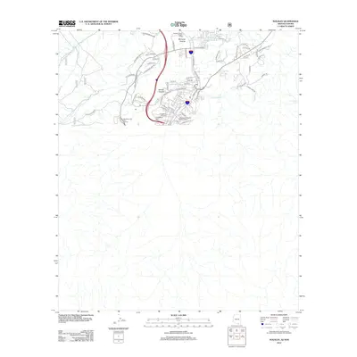 2012 Nogales2012 Print · USGSCovers Nogales, including Heroica Nogales, Recidencial Fuente de Piedra, and other nearby areas
 - 2012 Map of Rio Rico, 2012 Print
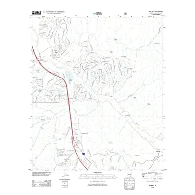 2012 Rio Rico2012 Print · USGSCovers Nogales, including Beyerville, Rio Rico, and other nearby areas
 - 2014 Map of Rio Rico, 2014 Print
 2014 Rio Rico2014 Print · USGSCovers Nogales, including Beyerville, Rio Rico, and other nearby areas
 - 2014 Map of Nogales, 2014 Print
 2014 Nogales2014 Print · USGSCovers Nogales, including Heroica Nogales, Recidencial Fuente de Piedra, and other nearby areas
 - 2018 Map of Rio Rico, 2018 Print
 2018 Rio Rico2018 Print · USGSCovers Nogales, including Beyerville, Rio Rico, and other nearby areas
 - 2018 Map of Nogales, 2018 Print
 2018 Nogales2018 Print · USGSCovers Nogales, including Heroica Nogales, Recidencial Fuente de Piedra, and other nearby areas
 - 2021 Map of Nogales, 2021 Print
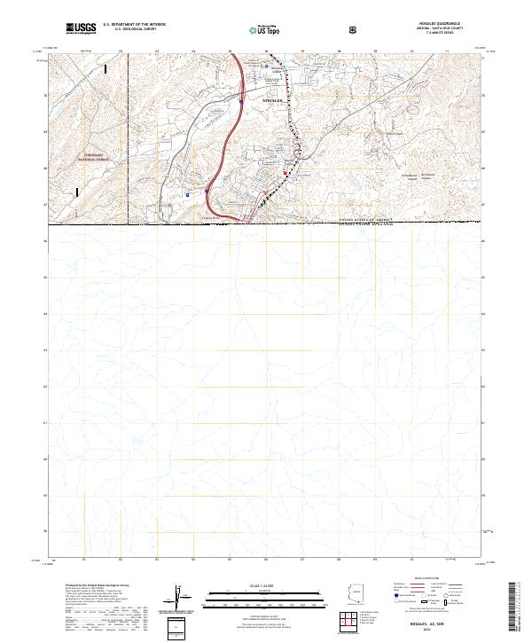 2021 Nogales2021 Print · USGSNogales stands at the southern edge of Arizona at the Mexican border during the early twenty-first century. Researchers can trace the modern street grid past the Santa Cruz County Superior Courthouse and into the canyons of Coronado National Forest.
 - 2021 Map of Rio Rico, 2021 Print
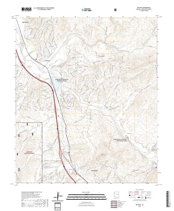 2021 Rio Rico2021 Print · USGSThe Santa Cruz River valley comes alive in this survey of the borderlands south of Tucson, showing the development of Rio Rico and Calabasas. Trace the intersection of modern growth and protected heritage sites like Tumacacori National Historical Park and Mt Benedict.
End of results
Showing maps 1-19 of 19
Top cities near Nogales
Frequently asked questions
- What are the different types of historical maps available for Nogales?
- What is the oldest map of Nogales?
- Where can I purchase historical maps of Nogales for my home or office?
- Where can I download high-res historical maps of Nogales?
- Are there historical topographic maps available for Nogales?
- Is there historical aerial imagery available for Nogales?
- Where are historical maps of Nogales sourced from?