2020s Maps of Seligman, Arizona
Explore 2 historic maps of Seligman from the 2020s. These maps offer a rare glimpse into what life looked like during the 2020s — showing old roads, neighborhoods, homes, and landmarks that have changed or disappeared over time.
Whether you're researching your family's past, planning a metal detecting trip, or studying how Seligman's landscape evolved across the 2020s, these high-resolution maps are a powerful tool for exploring the history of this region.
- Focus on a specific era: All maps on this page are from the 2020s, giving you a focused view of this time period.
- See what’s changed: Compare century-old streets, trails, and buildings to today's modern landscape using overlays and satellite layers.
- Research with precision: Use these maps for genealogy, historical research, land use analysis, or educational projects.
- View, download, or print: Maps are fully viewable online in high resolution, and can be downloaded or printed for your own records.
Start exploring Seligman's history through authentic maps from the 2020s. This is your window into the past.
Seligman, AZ maps
(2)- 2021 Map of Seligman West, 2021 Print
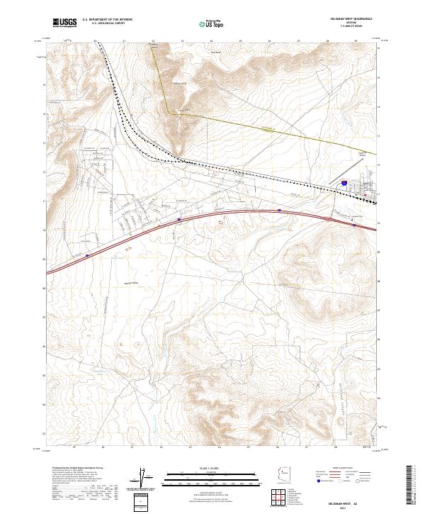 2021 Seligman West2021 Print · USGSThe western outskirts of Seligman, Arizona, are seen here as the high desert landscape meets modern infrastructure in the early 2020s. Researchers can trace local development along Bridge Canyon and locate landmarks like the Seligman Cem and Seligman Airport.
 - 2021 Map of Seligman East, 2021 Print
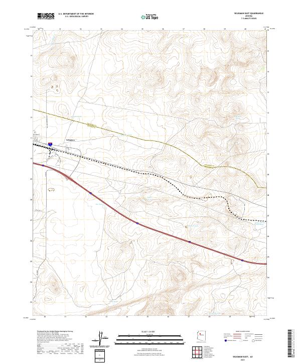 2021 Seligman East2021 Print · USGSThe high plateau of Yavapai County comes into focus in this recent survey, centered on the transit crossroads at Seligman. Researchers can trace the essential water-management network of the region through family-named landmarks like Wagner Tank and Cedar Berry Bob Tank.
End of results
Showing maps 1-2 of 2
Frequently asked questions
- What are the different types of historical maps available for Seligman?
- What is the oldest map of Seligman?
- Where can I purchase historical maps of Seligman for my home or office?
- Where can I download high-res historical maps of Seligman?
- Are there historical topographic maps available for Seligman?
- Is there historical aerial imagery available for Seligman?
- Where are historical maps of Seligman sourced from?