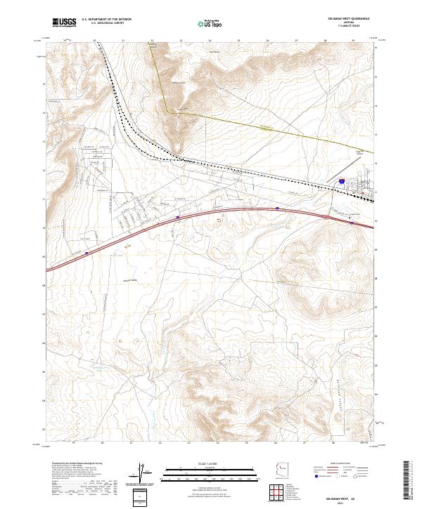
2021 Map of Seligman West
USGS Topo · Published 2021About this map
The Aubrey Cliffs dominate the northern landscape of this western Arizona region, marking a sharp topographic break where the high plateau gives way to the broad Aubrey Valley. This 2021 survey illustrates the modern layout of the rural periphery west of Seligman, where the historic path of Route 66 and the BNSF railway corridor are shadowed by more recent infrastructure. The map details a transition from rugged terrain at Chino Point and Red Mesa to the drainage networks of Chino Wash and Big Chino Wash. Human presence is concentrated along a dense grid of residential roads north of the interstate, including Bridge Canyon Pkwy and Hillcrest Dr. Local history and infrastructure are represented by the Seligman Cem and the Seligman Airport, while the landscape is dotted with vital water points like Shorty Tank and Quintanna Tank.
Find a feature on this map
56 named features on this map. Tap any name to fly to it.
Don’t see what you’re looking for? This feature index may not catch every label — zoom into the map to look around manually.
Map Details
Editions of this 2021 Seligman West Map
This is the sole edition of this map. No revisions or reprints were ever made.
Other maps of this area

1886 · Diamond Creek
USGS Topo · 1:250,000

1886 · Chino
USGS Topo · 1:250,000

1891 · Chino
USGS Topo · 1:250,000

1892 · Diamond Creek
USGS Topo · 1:250,000

1947 · Turkey Canyon
USGS Topo · 1:62,500

1948 · Williams
USGS Topo · 1:250,000

1950 · Turkey Canyon
USGS Topo · 1:62,500

1954 · Williams
USGS Topo · 1:250,000

1956 · Williams
USGS Topo · 1:250,000

1960 · Williams
USGS Topo · 1:250,000