1960s Maps of Yuma, Arizona
Explore 10 historic maps of Yuma from the 1960s. These maps offer a rare glimpse into what life looked like during the 1960s — showing old roads, neighborhoods, homes, and landmarks that have changed or disappeared over time.
Whether you're researching your family's past, planning a metal detecting trip, or studying how Yuma's landscape evolved across the 1960s, these high-resolution maps are a powerful tool for exploring the history of this region.
- Focus on a specific era: All maps on this page are from the 1960s, giving you a focused view of this time period.
- See what’s changed: Compare century-old streets, trails, and buildings to today's modern landscape using overlays and satellite layers.
- Research with precision: Use these maps for genealogy, historical research, land use analysis, or educational projects.
- View, download, or print: Maps are fully viewable online in high resolution, and can be downloaded or printed for your own records.
Start exploring Yuma's history through authentic maps from the 1960s. This is your window into the past.
Yuma, AZ maps
(10)- 1961 Map of El Centro
 1961 El Centro1961 Print · USGSThe California-Arizona borderlands come alive in this early sixties record of desert irrigation and military expansion. Genealogists and researchers can trace the engineering of the All American Canal and locate vanished sites like Araz and the Imperial County Tuberculosis Sanatorium.
 - 1964 Map of El Centro
 1964 El Centro1964 Print · USGSThe agricultural heart of the California desert and the military test ranges of Arizona are revealed in this mid-century study. Genealogists and historians can trace the paths of the Southern Pacific railroad and the All American Canal near El Centro and Yuma.
 - 1964 Map of South of Yuma, 1966 Print
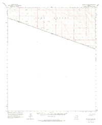 1964 South of Yuma1966 Print · USGSThe international border in the mid-1960s reveals a sparse landscape defined by the Yuma Desert. Researchers can trace the United States-Mexico line past several Test Wells and the edge of the Luke Air Force Range.
 - 1965 Map of Vopoki Ridge, 1966 Print
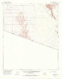 1965 Vopoki Ridge1966 Print · USGSSouthern Arizona in the mid-sixties reveals a landscape defined by military training grounds and ancient desert routes along the Mexican border. Modern researchers can trace the legendary Camino Del Diablo (Jeep Trail) past Spook Tank and the heights of Vopoki Ridge.2 unique versions available
 - 1965 Map of Yuma SE, 1966 Print
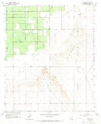 1965 Yuma SE1966 Print · USGSSoutheast of Yuma in the mid-sixties, the landscape reveals a stark contrast between irrigated agriculture and military desert ranges. Researchers can trace the path of the Main Canal and A Canal or locate the boundaries of the Luke Air Force Range.3 unique versions available
 - 1965 Map of Somerton, 1966 Print
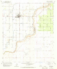 1965 Somerton1966 Print · USGSIn the mid-1960s, the irrigation grid surrounding Somerton transformed the arid valley into a productive agricultural landscape. Researchers can trace the layout of Yuma Indian Homesteads and find early aviation sites like Somerton Airport.2 unique versions available
 - 1965 Map of Fortuna, 1966 Print
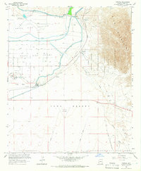 1965 Fortuna1966 Print · USGSYuma County during the mid-sixties showcases a desert landscape of massive irrigation projects and sprawling military ranges. Genealogists and historians can locate the Redondo Ruins (Butterfield Stage Sta), the isolated Blaisdell station, and the historic path of the Camino Del Diablo.4 unique versions available
 - 1965 Map of Fortuna SW, 1966 Print
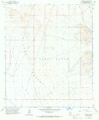 1965 Fortuna SW1966 Print · USGSThe desert frontier south of Yuma comes into focus during the mid-sixties, dominated by military training grounds. Researchers can trace remote survey lines and navigate the arid terrain through markers like Arena 432, Target, and several Jeep Trails.3 unique versions available
 - 1965 Map of Yuma East, 1966 Print
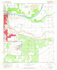 1965 Yuma East1966 Print · USGSThe confluence of the Colorado and Gila Rivers in the mid-1960s reveals a desert landscape transformed by massive irrigation and military infrastructure. Trace the early layout of Yuma, from the Yuma Territorial Prison to the US Marine Corps Air Station.3 unique versions available
 - 1965 Map of Yuma West, 1966 Print
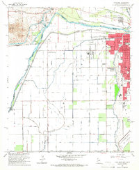 1965 Yuma West1966 Print · USGSYuma and the lower Colorado River valley appear here in the mid-sixties, showcasing a landscape defined by intensive irrigation and military presence. Genealogists and local historians can trace the development of neighborhood schools like Pecan Grove Sch or locate the Old Araz Stage Depot and Andrade (Site).4 unique versions available
End of results
Showing maps 1-10 of 10
Top cities near Yuma
- Fortuna Foothills historical maps
- San Luis historical maps
- Somerton historical maps
- Avenue B & C historical maps
- Donovan Estates historical maps
- Gadsden historical maps
See more
Top neighborhoods of Yuma
- Araby historical maps
- Hacienda Estates historical maps
- Rancho Caballo historical maps
- Kofa Acres historical maps
- Desert View historical maps
- Hansberger historical maps
See more
Frequently asked questions
- What are the different types of historical maps available for Yuma?
- What is the oldest map of Yuma?
- Where can I purchase historical maps of Yuma for my home or office?
- Where can I download high-res historical maps of Yuma?
- Are there historical topographic maps available for Yuma?
- Is there historical aerial imagery available for Yuma?
- Where are historical maps of Yuma sourced from?