1960s Maps of Ashley County, Arkansas
Explore 11 historic maps of Ashley County from the 1960s. These maps offer a rare glimpse into what life looked like during the 1960s — showing old roads, neighborhoods, homes, and landmarks that have changed or disappeared over time.
Whether you're researching your family's past, planning a metal detecting trip, or studying how Ashley County's landscape evolved across the 1960s, these high-resolution maps are a powerful tool for exploring the history of this region.
- Focus on a specific era: All maps on this page are from the 1960s, giving you a focused view of this time period.
- See what’s changed: Compare century-old streets, trails, and buildings to today's modern landscape using overlays and satellite layers.
- Research with precision: Use these maps for genealogy, historical research, land use analysis, or educational projects.
- View, download, or print: Maps are fully viewable online in high resolution, and can be downloaded or printed for your own records.
Start exploring Ashley County's history through authentic maps from the 1960s. This is your window into the past.
Ashley County, AR maps
(11)- 1960 Map of El Dorado
 1960 El Dorado1960 Print · USGSSouth Central Arkansas in the late fifties was a hub of energy production and defense industry. Researchers can trace the extensive Oil and Gas Fields around El Dorado or locate family landmarks like Old Park Cem and New Hope Church.
 - 1960 Map of Snyder, 1961 Print
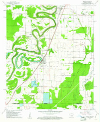
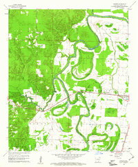 1960 Snyder1961 Print · USGSIn the early 1960s, the Ashley County delta landscape was defined by the meandering Bayou Bartholomew and the vital Missouri Pacific rail line. Researchers can trace the layout of small settlements like Montrose and Snyder or locate rural landmarks such as Evening Star Ch.2 unique versions available
 - 1960 Map of Mist, 1961 Print
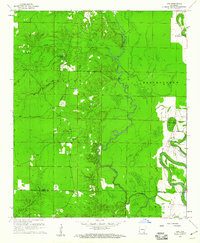
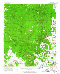 1960 Mist1961 Print · USGSSoutheast Arkansas in the early sixties was a landscape of winding bayous and rail-dependent towns like Montrose and Snyder. Genealogists can locate family-named sites such as Townsend Cem and Judking Cem along the bends of Bayou Bartholomew.2 unique versions available
 - 1960 Map of Wilmot, 1961 Print
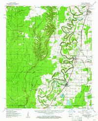 1960 Wilmot1961 Print · USGSThe borderlands of southeast Arkansas and northeast Louisiana are defined by the winding oxbows of Bayou Bartholomew and the Missouri Pacific railroad. Genealogists can trace early rural life through landmarks like Chiller Chapel Cem, Savage High Sch, and the town of Wilmot.2 unique versions available
 - 1960 Map of Portland, 1961 Print
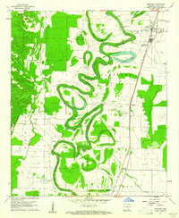 1960 Portland1961 Print · USGSSoutheast Arkansas in the early sixties is defined here by the winding Bayou Bartholomew and the Missouri Pacific rail corridor. Genealogists can locate family landmarks like Tillis High Sch Cem, Holly Grove Ch, and the small community of Sunshine.2 unique versions available
 - 1960 Map of Wilmot NW, 1961 Print
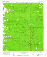
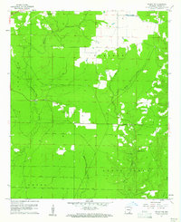 1960 Wilmot NW1961 Print · USGSAshley County timber and bottomlands are mapped in detail during the early sixties, showing a landscape defined by winding watercourses and prairie openings. Genealogists and local historians can locate remote landmarks like New Texas Cem, Beech Creek Ch, and the Lookout tower.2 unique versions available
 - 1960 Map of Wilmot, 1961 Print
 1960 Wilmot1961 Print · USGSThe Arkansas delta near the Louisiana border is captured here in the early sixties, centered on the river-and-rail corridor of the Missouri Pacific. Researchers can trace rural life through sites like Savage High Sch, Wilmot Cem, and the winding Bayou Bartholomew.3 unique versions available
 - 1960 Map of Line, 1961 Print
 1960 Line1961 Print · USGSSoutheast Arkansas in the early sixties is captured here as a landscape of winding waterways and rural outposts. Genealogists can locate family landmarks like Roper Cem, Mt Calvary Ch, and the small settlement of Line near the county border.2 unique versions available
 - 1960 Map of Mist, 1961 Print
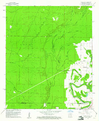
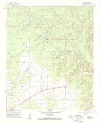 1960 Mist1961 Print · USGSAshley County in the early sixties reveals a landscape shaped by the Missouri Pacific railroad and the vast Banner Prairie. Researchers can trace local genealogy through sites like Central Cem and Mt Olive Ch, or locate the quiet crossroads of Mist and Berea.2 unique versions available
 - 1960 Map of Mist NW, 1961 Print
 1960 Mist NW1961 Print · USGSSoutheast Arkansas in the early sixties reveals a landscape of winding creek bottoms and isolated rural landmarks. Genealogists can trace family footprints at Pleasant Grove Ch, Cotham Cem, and Judkins Cem along the Bearhouse drainage.2 unique versions available
 - 1960 Map of Wilmot SW, 1961 Print
 1960 Wilmot SW1961 Print · USGSThe Arkansas-Louisiana borderlands come alive in the early sixties as a network of brakes and bayous. Researchers can locate remote family burial sites like Poley Bridge Cem and historic congregational centers such as St Matthew Ch near Bayou Bartholomew.2 unique versions available
End of results
Showing maps 1-11 of 11
Top cities of Ashley County
- Crossett historical maps
- Hamburg historical maps
- North Crossett historical maps
- Wilmot historical maps
- Portland historical maps
- Montrose historical maps
See more
Frequently asked questions
- What are the different types of historical maps available for Ashley County?
- What is the oldest map of Ashley County?
- Where can I purchase historical maps of Ashley County for my home or office?
- Where can I download high-res historical maps of Ashley County?
- Are there historical topographic maps available for Ashley County?
- Is there historical aerial imagery available for Ashley County?
- Where are historical maps of Ashley County sourced from?