1980s Maps of Chicot County, Arkansas
Explore 12 historic maps of Chicot County from the 1980s. These maps offer a rare glimpse into what life looked like during the 1980s — showing old roads, neighborhoods, homes, and landmarks that have changed or disappeared over time.
Whether you're researching your family's past, planning a metal detecting trip, or studying how Chicot County's landscape evolved across the 1980s, these high-resolution maps are a powerful tool for exploring the history of this region.
- Focus on a specific era: All maps on this page are from the 1980s, giving you a focused view of this time period.
- See what’s changed: Compare century-old streets, trails, and buildings to today's modern landscape using overlays and satellite layers.
- Research with precision: Use these maps for genealogy, historical research, land use analysis, or educational projects.
- View, download, or print: Maps are fully viewable online in high resolution, and can be downloaded or printed for your own records.
Start exploring Chicot County's history through authentic maps from the 1980s. This is your window into the past.
Chicot County, AR maps
(12)- 1981 Map of Eudora North, 1982 Print
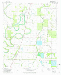
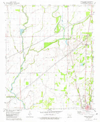 1981 Eudora North1982 Print · USGSChicot County at the start of the 1980s reveals a delta landscape defined by meandering waterways and small agricultural crossroads. Genealogists and local historians can trace family roots through landmarks like Holly Ridge Ch, the Eudora townsite, and the rural junction at Gum Corner.
 - 1981 Map of Macon Lake, 1982 Print
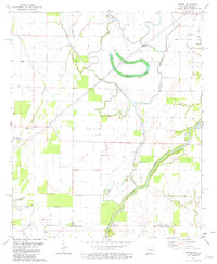
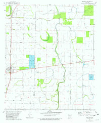
 1981 Macon Lake1982 Print · USGSChicot County's Delta bottomlands are captured here in the early eighties, showcasing a landscape of complex bayous and industrial drainage. Researchers can locate family landmarks like McMillan Corner, the Toliver Cem, and rural churches such as Pleasant Green Ch.
 - 1981 Map of Halley, 1982 Print
 1981 Halley1982 Print · USGSSoutheast Arkansas in the early eighties was defined by the intersection of the Missouri Pacific railroad and the winding Bayou Macon. Researchers can trace the layout of small communities like Halley and Bellaire or find local burial sites including Holly Grove Cem and Anderson Cem.
 - 1981 Map of Eudora South, 1982 Print
 1981 Eudora South1982 Print · USGSThe Arkansas-Louisiana state line is captured here in the early eighties, showcasing a landscape of Delta farming and small-town life. Researchers can locate numerous country churches and cemeteries like Mt Carmel Cem & Ch, Omega Ch, and Masons Cem.
 - 1981 Map of Mc Gehee South, 1982 Print
 1981 Mc Gehee South1982 Print · USGSSoutheast Arkansas in the early eighties shows a landscape of river-bend farms and rail-line towns along the MISSOURI PACIFIC. Genealogists can trace family names at Duncan Cem, Youngs Cem, and the historic Morris-Booker Memorial College in Dermott.
 - 1981 Map of Lake Village, 1982 Print
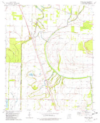
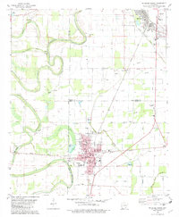
 1981 Lake Village1982 Print · USGSLake Village and the surrounding Chicot County delta lands appear here in the early eighties as the region balanced its agricultural roots with lakefront growth. Genealogists and local historians can locate Liberty Ch, trace the Missouri Pacific rail line, and find family markers at Davies Cem or Greenland Cem.
 - 1981 Map of Empire, 1982 Print
 1981 Empire1982 Print · USGSThe Arkansas-Louisiana borderlands come into focus in the early 1980s, revealing a landscape of delta bayous and small rural settlements. Genealogists and local historians can trace family ties at Millers Chapel Cem or locate the community centers of Empire and Green Grove Ch.
 - 1981 Map of Eudora NW, 1982 Print
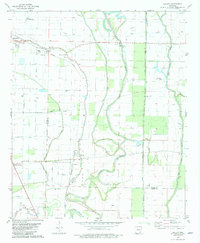
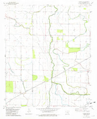 1981 Eudora NW1982 Print · USGSSoutheast Arkansas in the early eighties was a landscape of intricate delta drainage and rural homesteads. Genealogists and local historians can trace the positions of Brown Chapel and Aulds Ch along the winding banks of Big Bayou and Crooked Bayou.
 - 1981 Map of Jerome, 1982 Print
 1981 Jerome1982 Print · USGSSoutheast Arkansas in the late seventies is captured here as a landscape of alluvial bayous and small rail-side settlements. Genealogists and local historians can locate rural landmarks like Silver Mound Cem, Jerome, and the Bellaire Academy.
 - 1981 Map of Montrose, 1982 Print
 1981 Montrose1982 Print · USGSIn the early 1980s, the delta country of southeast Arkansas centered on the railroad town of Montrose during a period of agricultural change. Researchers can trace local lineage through Union Cem and Shady Grove Cem or locate old operations like the Fish Farm near Cosgrove.
 - 1986 Map of Dumas
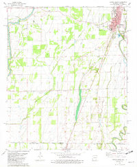
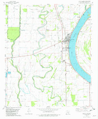
 1986 Dumas1986 Print · USGSSoutheast Arkansas in the mid-eighties shows a landscape defined by the winding Mississippi River and the Missouri Pacific Railroad corridor. Genealogists can trace family roots through river towns like Arkansas City and the rail-junction history of McGehee.2 unique versions available
 - 1986 Map of Crossett
 1986 Crossett1986 Print · USGSSoutheast Arkansas and the Mississippi Delta meet in the mid-1980s, revealing a landscape of rail-linked towns and river bottomlands. Researchers can trace the Missouri Pacific line through Hamburg and Parkdale or locate Millers Chapel and Winterville Mounds State Park.2 unique versions available
End of results
Showing maps 1-12 of 12
Top cities of Chicot County
Frequently asked questions
- What are the different types of historical maps available for Chicot County?
- What is the oldest map of Chicot County?
- Where can I purchase historical maps of Chicot County for my home or office?
- Where can I download high-res historical maps of Chicot County?
- Are there historical topographic maps available for Chicot County?
- Is there historical aerial imagery available for Chicot County?
- Where are historical maps of Chicot County sourced from?