1900s (20th Century) Maps of Cleburne County, Arkansas
Explore 40 historic maps of Cleburne County from the 1900s (20th Century). These maps offer a rare glimpse into what life looked like during the 1900s — showing old roads, neighborhoods, homes, and landmarks that have changed or disappeared over time.
Whether you're researching your family's past, planning a metal detecting trip, or studying how Cleburne County's landscape evolved across the 1900s, these high-resolution maps are a powerful tool for exploring the history of this region.
- Focus on a specific era: All maps on this page are from the 1900s, giving you a focused view of this time period.
- See what’s changed: Compare century-old streets, trails, and buildings to today's modern landscape using overlays and satellite layers.
- Research with precision: Use these maps for genealogy, historical research, land use analysis, or educational projects.
- View, download, or print: Maps are fully viewable online in high resolution, and can be downloaded or printed for your own records.
Start exploring Cleburne County's history through authentic maps from the 1900s. This is your window into the past.
Cleburne County, AR maps
(40)- 1942 Map of Almond, 1945 Print
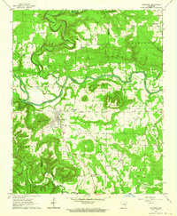
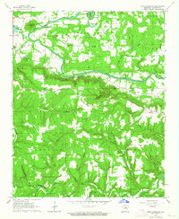
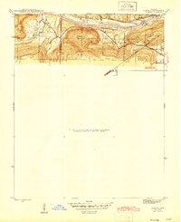 1942 Almond1945 Print · USGSThe river-and-rail corridor along the White River defines this 1940s landscape where Independence and Cleburne Counties meet. Genealogists and historians can trace old transit points like Earnhearts Ferry and the Old Cherokee Line boundary.3 unique versions available
 - 1953 Map of Memphis, 1966 Print
 1953 Memphis1966 Print · USGSEastern Arkansas and the Memphis riverfront are shown here during the mid-century period of regional growth and river management. Local historians can trace the paths of the Chicago Rock Island & Pacific RR through Forrest City or locate river landmarks like President's Island.3 unique versions available
 - 1956 Map of Memphis
 1956 Memphis1956 Print · USGSThe Mississippi Delta and the bluffs of West Tennessee meet in the mid-fifties, showing a landscape defined by massive river systems and rail hubs. Researchers can trace the path of Crowleys Ridge or locate vanished river landings near Centennial Island and Island No 35.
 - 1956 Map of Russellville
 1956 Russellville1956 Print · USGSThe Arkansas River valley and the surrounding Boston Mountains are captured here in the mid-fifties, showing a landscape of small timber towns and new reservoirs. Genealogists can trace family roots through upland settlements like Pelsor and Witts Springs or locate the campus of Arkansas Polytechnic College.2 unique versions available
 - 1961 Map of Bee Branch, 1963 Print
 1961 Bee Branch1963 Print · USGSCentral Arkansas settlements and highland ridges are mapped in the early sixties, showing the rural network of the Van Buren and Faulkner county lines. Researchers can find numerous family landmarks such as Quattlebaum Cem, Pinnacle Springs Tabernacle, and the Solomon Grove Sch.2 unique versions available
 - 1961 Map of Morganton, 1966 Print
 1961 Morganton1966 Print · USGSVan Buren County and the Cleburne County line are shown here in the early sixties, a landscape of winding creek valleys and isolated ridge settlements. Genealogists can trace family connections through local landmarks like Morganton, Hardin Cem, and Mount Zion Ch.2 unique versions available
 - 1961 Map of Guy, 1966 Print
 1961 Guy1966 Print · USGSThe hills and valleys of Faulkner County are captured here in the early sixties as rural life centered around the town of Guy. Researchers can locate family landmarks like the Copperas Springs Cem, New Home Sch, and Bennett Lake.2 unique versions available
 - 1962 Map of Pangburn, 1964 Print
 1962 Pangburn1964 Print · USGSAcross the Little Red River valley in the early sixties, this area shows a landscape of upland ridges and river-bottom farms. Genealogists can locate family landmarks like Barnett Cem and Hickory Flat, or trace the Old Railroad Grade through Pangburn.3 unique versions available
 - 1962 Map of Letona, 1964 Print
 1962 Letona1964 Print · USGSIn the early sixties, this portion of White County remained a landscape of small settlements and traditional rural life. Genealogists can trace family footprints at New Hope Cem, the Morris Institute, or the remote community of Albion.3 unique versions available
 - 1963 Map of Rose Bud, 1964 Print
 1963 Rose Bud1964 Print · USGSThe rolling hills of White County are captured here in the early sixties, centered on the rural crossroads of Rose Bud. Genealogists can locate family landmarks like Moon Cem and Liberty Hill Cem or trace the early paths of ARK 25 and ARK 31.2 unique versions available
 - 1963 Map of Quitman, 1964 Print
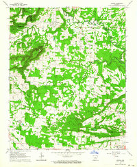
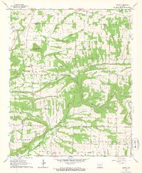
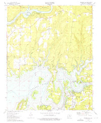
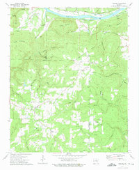
 1963 Quitman1964 Print · USGSThe Cleburne County hills meet the rising waters of the new reservoir in the early sixties. Researchers can trace family sites near Quitman and Pearson or locate rural landmarks like Wesley Chapel and the Aldridge Cem.3 unique versions available
 - 1963 Map of West Pangburn, 1964 Print
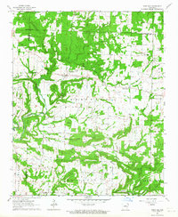
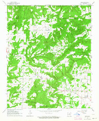
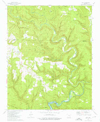
 1963 West Pangburn1964 Print · USGSCleburne County at the start of the 1960s reveals a landscape of river bends and rural crossroads tied together by fords and old rail lines. Researchers can trace family history through sites like Goff Cem, Center Ridge Ch, and river crossings at Whitehead Ford.4 unique versions available
 - 1963 Map of Sidon, 1964 Print
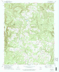
 1963 Sidon1964 Print · USGSThe rural uplands of White County are captured in the early sixties as a network of ridge-top farms and creek-bottom communities. Genealogists and local historians can trace the foundations of Sidon and Center Hill, locating Sidon Cem and Mt Hebron Ch.2 unique versions available
 - 1963 Map of Barney, 1964 Print
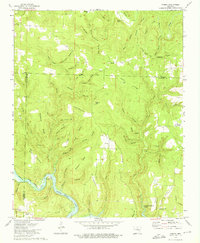
 1963 Barney1964 Print · USGSThe central Arkansas hill country around the Faulkner and Cleburne county line is captured here in the early sixties. Genealogists can trace family footprints through rural centers like Enola, Mount Vernon, and Enders, or locate landmarks such as Mortar Creek Cem and Cedar Hill Ch.2 unique versions available
 - 1963 Map of Heber Springs, 1964 Print
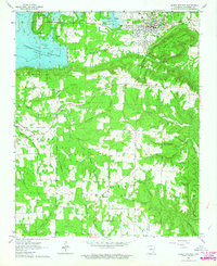 1963 Heber Springs1964 Print · USGSHeber Springs and the surrounding Cleburne County hills are shown during the early sixties as the Greers Ferry Reservoir reshaped the local geography. Researchers can trace the old railroad grade, locate family burial sites like Cove-Kendall Cem, and find rural landmarks like Bridal Veil Falls.3 unique versions available
 - 1964 Map of Russellville
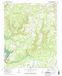
 1964 Russellville1964 Print · USGSMid-century Central Arkansas is defined here by the river-valley towns and the surrounding mountain ranges before the full expansion of the interstate system. Genealogists and historians can trace rail-town development along the Missouri Pacific Railroad and locate landmarks like Arkansas Polytechnic College or Petit Jean State Park.
 - 1973 Map of Brownsville, 1975 Print
 1973 Brownsville1975 Print · USGSThe Greers Ferry reservoir area in the early seventies shows a landscape defined by new recreation and old boundaries. Genealogists can trace local roots at Holland Cemetery or Pleasant Ridge Church, while historians can locate the Indian Treaty Boundary near Brownsville.3 unique versions available
 - 1973 Map of Greers Ferry Dam, 1975 Print
 1973 Greers Ferry Dam1975 Print · USGSCleburne County is shown in the early seventies as the engineering of Greers Ferry Dam and the Little Red River defined the local landscape. Genealogists can trace local roots at Miller Cem, Chastain Chapel, and the settlement of Ida.2 unique versions available
 - 1973 Map of Greers Ferry, 1975 Print
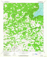
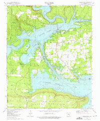 1973 Greers Ferry1975 Print · USGSThe Cleburne County shoreline in the early 1970s shows the growth of lakefront life alongside established mountain settlements. Genealogists and local historians can trace rural roots at Bailey Cemetery and West Side School, or locate the historic Treaty Trail.2 unique versions available
 - 1973 Map of Floral, 1975 Print
 1973 Floral1975 Print · USGSThe rural uplands of Independence County are shown in the early seventies, centered on the community of Floral. Genealogists and local historians can trace family ties through several remote burial grounds and churches, including Warren Cem, Mason Cem, and Harris Chapel.2 unique versions available
 - 1973 Map of Concord, 1975 Print
 1973 Concord1975 Print · USGSNorth central Arkansas highlands meet the river valley in the 1970s, as small mountain communities like Concord and Almond grew near the Indian Treaty Boundary. Genealogists can locate family landmarks such as Bellmore Cem and Banner Ch tucked between the ridges and river sloughs.
 - 1973 Map of Prim, 1975 Print
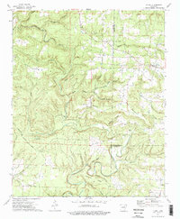
 1973 Prim1975 Print · USGSThe Ozark foothills in Cleburne and Stone Counties are shown here in the early 1970s as the Little Red River winds through the deep hollows. Family history researchers can locate several rural landmarks including the Everett Cem, Signal Hill Ch, and the remote Ramer Ford.
 - 1973 Map of Drasco, 1975 Print
 1973 Drasco1975 Print · USGSThe borderlands of Cleburne and Stone counties appear here in the early 1970s, showing a landscape of family-named ridges and isolated hollows. You can trace early cemetery locations like Macedonia Cem or find the historic Treaty Boundary near Schoolhouse Hill.2 unique versions available
 - 1973 Map of Parma, 1975 Print
 1973 Parma1975 Print · USGSThe northern reaches of the Ozarks meet the rising waters of Greers Ferry Lake in the early seventies. Genealogists and local historians can trace the settlements of Parma and Brewer, or locate the Smart Cem and Sunny Slope Ch.2 unique versions available
 - 1976 Map of Parma, 1977 Print
 1976 Parma1977 Print · USGSNorth-central Arkansas in the mid-seventies is captured in this detailed aerial perspective of the timbered ridges near Parma. Researchers can trace the winding course of the Middle Fork Little Red River and the expanding shoreline of Greers Ferry Lake.
Showing maps 1-25 of 40
Top cities of Cleburne County
- Heber Springs historical maps
- Greers Ferry historical maps
- Quitman historical maps
- Concord historical maps
- Higden historical maps
Frequently asked questions
- What are the different types of historical maps available for Cleburne County?
- What is the oldest map of Cleburne County?
- Where can I purchase historical maps of Cleburne County for my home or office?
- Where can I download high-res historical maps of Cleburne County?
- Are there historical topographic maps available for Cleburne County?
- Is there historical aerial imagery available for Cleburne County?
- Where are historical maps of Cleburne County sourced from?