1950s Maps of Crawford County, Arkansas
Explore 7 historic maps of Crawford County from the 1950s. These maps offer a rare glimpse into what life looked like during the 1950s — showing old roads, neighborhoods, homes, and landmarks that have changed or disappeared over time.
Whether you're researching your family's past, planning a metal detecting trip, or studying how Crawford County's landscape evolved across the 1950s, these high-resolution maps are a powerful tool for exploring the history of this region.
- Focus on a specific era: All maps on this page are from the 1950s, giving you a focused view of this time period.
- See what’s changed: Compare century-old streets, trails, and buildings to today's modern landscape using overlays and satellite layers.
- Research with precision: Use these maps for genealogy, historical research, land use analysis, or educational projects.
- View, download, or print: Maps are fully viewable online in high resolution, and can be downloaded or printed for your own records.
Start exploring Crawford County's history through authentic maps from the 1950s. This is your window into the past.
Crawford County, AR maps
(7)- 1951 Map of Fort Smith
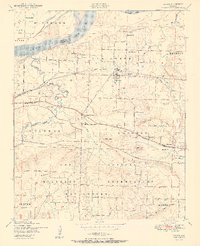
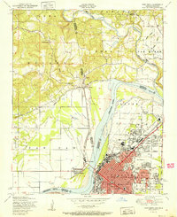 1951 Fort Smith1951 Print · USGSFort Smith and its neighboring Oklahoma borderlands are captured here during a period of significant mid-century growth and industrial connectivity. Researchers can trace the development of urban neighborhoods and rural outposts like Moffett, Dora, and Bluemouse School.2 unique versions available
 - 1951 Map of Van Buren
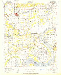
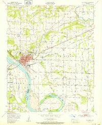 1951 Van Buren1951 Print · USGSCrawford County's river-front industry and rural settlements are captured in the late 1940s, just as the postwar era began to shape the Van Buren landscape. Genealogists and historians can locate family landmarks such as Fairview Cemetery, Wright Town, and the old Zinc smelter.2 unique versions available
 - 1951 Map of Barling
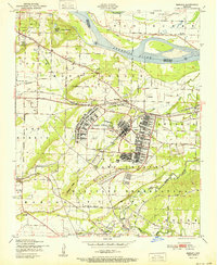 1951 Barling1951 Print · USGSThe military expansion at Camp Chaffee and the riverside life of Sebastian County are captured here in the years following the war. Researchers can trace family sites near New Jenny Lind or locate the St Marys Ch and Sch and various local coal mines.2 unique versions available
 - 1951 Map of Mulberry
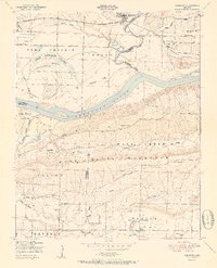 1951 Mulberry1951 Print · USGSThe Arkansas River valley near Mulberry comes alive in this mid-century survey, showcasing a landscape of fertile bottomlands and river islands. Researchers can trace rural genealogy through Pleasant View School, Bethel Church, and the winding Court House Slough.2 unique versions available
 - 1951 Map of Lavaca
 1951 Lavaca1951 Print · USGSSebastian County is captured here in the early fifties as the Arkansas River landscape met the expanding footprint of the military. Genealogists and historians can trace family locations near Lavaca, Bloomer School, and Red Oak Cemetery.2 unique versions available
 - 1951 Map of Alma
 1951 Alma1951 Print · USGSCrawford County and the Arkansas River Valley appear here in the early fifties, showing a landscape of river-bottom farms and emerging industry. Genealogists can trace family landmarks like Simmons Cemetery, Bills Cemetery, and the community at Yoestown.
 - 1956 Map of Russellville
 1956 Russellville1956 Print · USGSThe Arkansas River valley and the surrounding Boston Mountains are captured here in the mid-fifties, showing a landscape of small timber towns and new reservoirs. Genealogists can trace family roots through upland settlements like Pelsor and Witts Springs or locate the campus of Arkansas Polytechnic College.2 unique versions available
End of results
Showing maps 1-7 of 7
Top cities of Crawford County
- Van Buren historical maps
- Alma historical maps
- Mulberry historical maps
- Cedarville historical maps
- Kibler historical maps
- Dyer historical maps
See more
Frequently asked questions
- What are the different types of historical maps available for Crawford County?
- What is the oldest map of Crawford County?
- Where can I purchase historical maps of Crawford County for my home or office?
- Where can I download high-res historical maps of Crawford County?
- Are there historical topographic maps available for Crawford County?
- Is there historical aerial imagery available for Crawford County?
- Where are historical maps of Crawford County sourced from?