1900s (20th Century) Maps of Crawford County, Arkansas
Explore 60 historic maps of Crawford County from the 1900s (20th Century). These maps offer a rare glimpse into what life looked like during the 1900s — showing old roads, neighborhoods, homes, and landmarks that have changed or disappeared over time.
Whether you're researching your family's past, planning a metal detecting trip, or studying how Crawford County's landscape evolved across the 1900s, these high-resolution maps are a powerful tool for exploring the history of this region.
- Focus on a specific era: All maps on this page are from the 1900s, giving you a focused view of this time period.
- See what’s changed: Compare century-old streets, trails, and buildings to today's modern landscape using overlays and satellite layers.
- Research with precision: Use these maps for genealogy, historical research, land use analysis, or educational projects.
- View, download, or print: Maps are fully viewable online in high resolution, and can be downloaded or printed for your own records.
Start exploring Crawford County's history through authentic maps from the 1900s. This is your window into the past.
Crawford County, AR maps
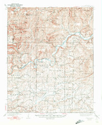
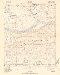
(60)- 1901 Map of Winslow
 1901 Winslow1901 Print · USGSThe Boston Mountains and the Arkansas border are captured here at the close of the nineteenth century, documenting the critical rail passage through the Ozarks. Genealogists and historians can trace the Frisco Line, the historic Old Wire Road, and early settlements like Cove City and Cane Hill.5 unique versions available
 - 1906 Map of Lavaca
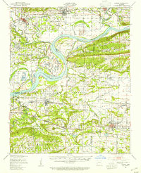
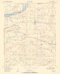
 1906 Lavaca1906 Print · USGSThe Arkansas River valley comes to life in the late nineteenth century as railroads and ridges define the growing settlements of Sebastian County. Researchers can trace the original locations of Lavaca, Alma, and Vesta, or locate family-named landmarks like Butler's Knob and Arbuckles Island.
 - 1939 Map of Watalula
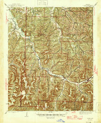
 1939 Watalula1939 Print · USGSFranklin and Crawford counties are shown here in the mid-thirties as a landscape of isolated mountain ridges and river-valley settlements. Trace local history through the Wire Road, remote country churches like Low Gap Church, and family cemeteries including Brewer Cem and Harris Cem.3 unique versions available
 - 1943 Map of Fort Smith
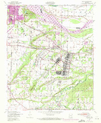
 1943 Fort Smith1943 Print · USGSFort Smith and the Arkansas River valley are shown here during the height of the Second World War as the region became a major military hub. Genealogists and researchers can locate several rural schools and churches, such as St Marys School and Pleasant Ridge Church and Cem, alongside industrial sites like the Strip Mine and Smelter.
 - 1943 Map of St. Paul, 1956 Print
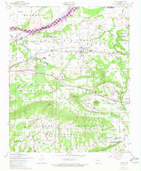
 1943 St. Paul1956 Print · USGSThe upper Ozark highlands of Madison County are captured here in the mid-1940s, showing a landscape of isolated mountain schools and river-valley settlements. Researchers can trace the heritage of rural communities through landmarks like St Paul, Hazel Valley Sch, and the Riverside Cem.5 unique versions available
 - 1946 Map of St. Paul
 1946 St. Paul1946 Print · USGSMadison County's rugged Ozark interior is captured in the mid-forties, showing a landscape of remote hollows and mountain schools. Genealogists can trace family roots through sites like Liberty Cem, Delaney Creek Sch, and the community of St Paul.2 unique versions available
 - 1946 Map of Fort Smith
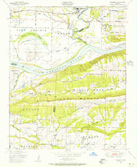
 1946 Fort Smith1946 Print · USGSThe Arkansas-Oklahoma borderlands appear here in the mid-forties, as new reservoirs began to transform the river valleys. Genealogists and historians can trace rail-served towns from Muskogee to Fort Smith and locate landmarks like Camp Chaffee.
 - 1947 Map of Lavaca, 1954 Print
 1947 Lavaca1954 Print · USGSThe Arkansas River valley in the late 1940s reveals a landscape of growing energy production and military expansion. Genealogists can trace family roots through Nixon Cem, Harmony Ch, and the streets of Charleston and Lavaca.
 - 1947 Map of Van Buren, 1954 Print
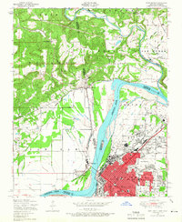
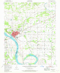
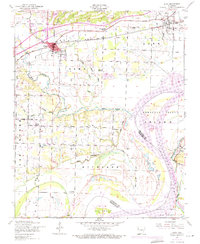
 1947 Van Buren1954 Print · USGSThe riverfront cities of Fort Smith and Van Buren are shown in the late 1940s, just as the regional industrial footprint was expanding. Researchers can trace the rail lines of the Missouri Pacific or locate local landmarks like St Scholastica Academy and the Zinc Smelter.
 - 1947 Map of Fort Smith, 1966 Print
 1947 Fort Smith1966 Print · USGSPost-war Arkansas and Oklahoma meet at the river bend during this era of urban expansion and rail dominance. Researchers can trace the development of FORT SMITH neighborhoods and identify local landmarks like St Boniface Church and School and Twin City Hospital.4 unique versions available
 - 1947 Map of Van Buren, 1969 Print
 1947 Van Buren1969 Print · USGSVan Buren and the northern reaches of Fort Smith are shown in the late 1940s during a period of heavy industrial activity. Researchers can find numerous strip mines, the zinc smelter, and several country churches including Sunnyside Church.3 unique versions available
 - 1947 Map of Barling, 1971 Print
 1947 Barling1971 Print · USGSThe Arkansas River valley south of Fort Smith is shown here during a period of significant military and industrial presence. Genealogists and local historians can trace the foundations of Fort Chaffee and find local landmarks like St Marys Ch and Sch, the tuberculosis sanitorium, and the settlement of Jenny Lind.2 unique versions available
 - 1947 Map of Lavaca, 1972 Print
 1947 Lavaca1972 Print · USGSSebastian County’s riverfront and military landscapes are captured here during the post-war transition. Genealogists and historians can trace the foundations of Lavaca, the grounds of the Fort Smith Military Reservation, and rural landmarks like Mosark Church and Red Oak Cemetery.2 unique versions available
 - 1948 Map of Mulberry, 1956 Print
 1948 Mulberry1956 Print · USGSCrawford and Franklin counties are captured here in the late 1940s as the riverfront economy shifted between timber and transit. Genealogists can locate family landmarks like Harmony Church, Pleasant View Cemetery, and the Union School along the Arkansas River.4 unique versions available
 - 1948 Map of Alma, 1971 Print
 1948 Alma1971 Print · USGSCrawford County settlements and the Arkansas River valley are captured here at mid-century, just as the Ozark Reservoir began to reshape the shoreline. Genealogists can trace family landmarks like Bills Cemetery and Pleasant Home Church or locate the site of an Abandoned mine near Yoestown.2 unique versions available
 - 1951 Map of Fort Smith
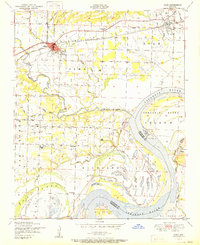
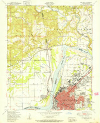 1951 Fort Smith1951 Print · USGSFort Smith and its neighboring Oklahoma borderlands are captured here during a period of significant mid-century growth and industrial connectivity. Researchers can trace the development of urban neighborhoods and rural outposts like Moffett, Dora, and Bluemouse School.2 unique versions available
 - 1951 Map of Van Buren
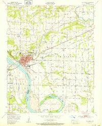 1951 Van Buren1951 Print · USGSCrawford County's river-front industry and rural settlements are captured in the late 1940s, just as the postwar era began to shape the Van Buren landscape. Genealogists and historians can locate family landmarks such as Fairview Cemetery, Wright Town, and the old Zinc smelter.2 unique versions available
 - 1951 Map of Barling
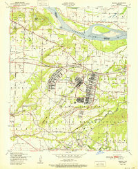 1951 Barling1951 Print · USGSThe military expansion at Camp Chaffee and the riverside life of Sebastian County are captured here in the years following the war. Researchers can trace family sites near New Jenny Lind or locate the St Marys Ch and Sch and various local coal mines.2 unique versions available
 - 1951 Map of Mulberry
 1951 Mulberry1951 Print · USGSThe Arkansas River valley near Mulberry comes alive in this mid-century survey, showcasing a landscape of fertile bottomlands and river islands. Researchers can trace rural genealogy through Pleasant View School, Bethel Church, and the winding Court House Slough.2 unique versions available
 - 1951 Map of Lavaca
 1951 Lavaca1951 Print · USGSSebastian County is captured here in the early fifties as the Arkansas River landscape met the expanding footprint of the military. Genealogists and historians can trace family locations near Lavaca, Bloomer School, and Red Oak Cemetery.2 unique versions available
 - 1951 Map of Alma
 1951 Alma1951 Print · USGSCrawford County and the Arkansas River Valley appear here in the early fifties, showing a landscape of river-bottom farms and emerging industry. Genealogists can trace family landmarks like Simmons Cemetery, Bills Cemetery, and the community at Yoestown.
 - 1956 Map of Russellville
 1956 Russellville1956 Print · USGSThe Arkansas River valley and the surrounding Boston Mountains are captured here in the mid-fifties, showing a landscape of small timber towns and new reservoirs. Genealogists can trace family roots through upland settlements like Pelsor and Witts Springs or locate the campus of Arkansas Polytechnic College.2 unique versions available
 - 1964 Map of Russellville
 1964 Russellville1964 Print · USGSMid-century Central Arkansas is defined here by the river-valley towns and the surrounding mountain ranges before the full expansion of the interstate system. Genealogists and historians can trace rail-town development along the Missouri Pacific Railroad and locate landmarks like Arkansas Polytechnic College or Petit Jean State Park.
 - 1965 Map of Fort Smith
 1965 Fort Smith1965 Print · USGSEastern Oklahoma and Western Arkansas are captured here during a period of massive post-war change as new reservoirs reshaped the river valleys. Genealogists and historians can trace the rail networks of the Midland Valley RR and find established communities like Stilwell, Sallisaw, and Stigler.
 - 1967 Map of Fort Smith
 1967 Fort Smith1967 Print · USGSThe Arkansas River valley and the foothills of the Ozarks are captured here during a period of significant military and industrial activity. Researchers can trace the sprawling bounds of Camp Chaffee and Camp Gruber or locate vanished rail stops along the Midland Valley RR.
Showing maps 1-25 of 60
Top cities of Crawford County
- Van Buren historical maps
- Alma historical maps
- Mulberry historical maps
- Cedarville historical maps
- Kibler historical maps
- Dyer historical maps
See more
Frequently asked questions
- What are the different types of historical maps available for Crawford County?
- What is the oldest map of Crawford County?
- Where can I purchase historical maps of Crawford County for my home or office?
- Where can I download high-res historical maps of Crawford County?
- Are there historical topographic maps available for Crawford County?
- Is there historical aerial imagery available for Crawford County?
- Where are historical maps of Crawford County sourced from?