1970s Maps of Crawford County, Arkansas
Explore 16 historic maps of Crawford County from the 1970s. These maps offer a rare glimpse into what life looked like during the 1970s — showing old roads, neighborhoods, homes, and landmarks that have changed or disappeared over time.
Whether you're researching your family's past, planning a metal detecting trip, or studying how Crawford County's landscape evolved across the 1970s, these high-resolution maps are a powerful tool for exploring the history of this region.
- Focus on a specific era: All maps on this page are from the 1970s, giving you a focused view of this time period.
- See what’s changed: Compare century-old streets, trails, and buildings to today's modern landscape using overlays and satellite layers.
- Research with precision: Use these maps for genealogy, historical research, land use analysis, or educational projects.
- View, download, or print: Maps are fully viewable online in high resolution, and can be downloaded or printed for your own records.
Start exploring Crawford County's history through authentic maps from the 1970s. This is your window into the past.
Crawford County, AR maps
(16)- 1970 Map of Evansville, 1972 Print
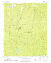
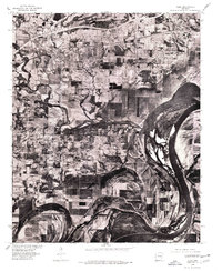
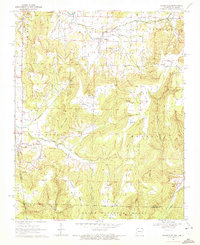 1970 Evansville1972 Print · USGSSettled valleys and mountain ridges define the Arkansas-Oklahoma border during the early seventies. Genealogists can trace family roots through numerous burial sites like Vineyard Cem, Goddard Cem, and the community of Dutch Mills.3 unique versions available
 - 1970 Map of Rudy NE, 1972 Print
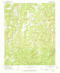
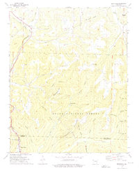
 1970 Rudy NE1972 Print · USGSCrawford County's mountain ridges and deep creek valleys are captured here in the early 1970s before modern expansion. Genealogists can trace family landmarks and burial sites like Oak Grove Cem, Kimbler Cem, and the high peak of Bradford Knob.3 unique versions available
 - 1970 Map of Strickler, 1972 Print
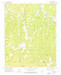
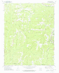
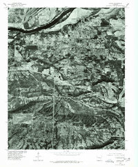
 1970 Strickler1972 Print · USGSThe Boston Mountains of Washington County are shown here in the early 1970s, just as the rural landscape of the Ozarks began to see modern shifts. Genealogists and local historians can locate many family landmarks, from Scott Cem and Dunkard Cem to Bee Scuffle Ch and the settlement of Strickler.4 unique versions available
 - 1973 Map of Delaney, 1976 Print
 1973 Delaney1976 Print · USGSThe rural valleys and ridges of Madison and Washington counties are captured here in the early 1970s. Researchers can trace the lineage of small upland settlements through sites like the Crosses Creek Ch Cem, Mountain Crest, and Montgomery Chapel.2 unique versions available
 - 1973 Map of Bidville, 1976 Print
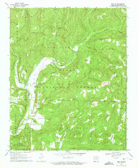
 1973 Bidville1976 Print · USGSThe Ozark highlands at the start of the 1970s are defined here by high knobs and the winding Mulberry River. Researchers can trace old family burial sites like Bidville Cem and Phillips Cem or find the remote Milton Ford river crossing.3 unique versions available
 - 1973 Map of Brentwood, 1976 Print
 1973 Brentwood1976 Print · USGSThe Ozark highlands around Brentwood and Sunset appear here in the early 1970s, as the rail and river corridors remained central to the landscape. Researchers can locate remote family landmarks like Millers Chapel Cem, the Black Oak Ch, and the Our Lady of the Ozarks Shrine.3 unique versions available
 - 1973 Map of Winslow, 1976 Print
 1973 Winslow1976 Print · USGSThe Boston Mountains and the St Louis-San Francisco rail line dominate this 1970s survey of the Arkansas Ozarks. Researchers can trace rural congregations like Bethlehem Ch and Oak Grove Ch or explore the wilder reaches of Devils Den State Park.3 unique versions available
 - 1976 Map of Fort Smith, 1978 Print
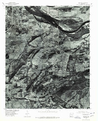
 1976 Fort Smith1978 Print · USGSFort Smith and the Oklahoma borderlands are captured in high-contrast detail in the mid-seventies, showing the region's transition from urban center to rural floodplain. Researchers can trace the layout of the city near Moffett or study the agricultural plots and timberlines surrounding Roland and Dora.
 - 1976 Map of Barling, 1978 Print
 1976 Barling1978 Print · USGSThe outskirts of Fort Smith and the massive military footprint of the mid-1970s are captured here through detailed aerial photography. Genealogists and historians can trace the development of Barling and Massard alongside the barracks and roads of Fort Chaffee.
 - 1976 Map of Alma, 1978 Print
 1976 Alma1978 Print · USGSCrawford County's river valley comes into sharp focus in the mid-1970s, showing the agricultural and industrial layout of the region. Researchers can trace the development of Alma and Dyer or examine the shoreline of the Ozark Reservoir.
 - 1976 Map of Van Buren, 1978 Print
 1976 Van Buren1978 Print · USGSThe Arkansas River valley in the mid-seventies shows a landscape of rapid change as interstate highways began to reshape the region. Local researchers can trace the urban interface between Van Buren and Fort Smith or locate the rural outpost of Concord.2 unique versions available
 - 1976 Map of Lavaca, 1978 Print
 1976 Lavaca1978 Print · USGSSebastian County is captured in the mid-seventies, showing the transition from the river lowlands to the inland settlements. Researchers can trace the development of Lavaca and Bloomer near the banks of Vache Grasse Creek.2 unique versions available
 - 1977 Map of Russellville
 1977 Russellville1977 Print · USGSThe Arkansas River Valley and surrounding Ozark Mountains are documented here during a period of significant postwar growth and infrastructure development. Genealogists and researchers can locate family landmarks such as Mount Carmel Cem, St Josephs Church, and several remote Coal Mine sites along the Missouri Pacific RR line.
 - 1978 Map of Fort Smith, 1979 Print
 1978 Fort Smith1979 Print · USGSThe Arkansas-Oklahoma borderlands in the late seventies show a landscape shaped by massive river reservoirs and sprawling military reservations. Trace the historic rail lines of the Missouri Pacific RR and locate regional landmarks like Fort Gibson, Tenkiller Ferry Lake, and Barling.2 unique versions available
 - 1978 Map of Fort Smith, 1979 Print
 1978 Fort Smith1979 Print · USGSThe Arkansas-Oklahoma borderlands in the late seventies show a region defined by river navigation, coal mining, and military expansion. You can trace industrial footprints like the Strip Mines and the vast Fort Chaffee Military Reservation.2 unique versions available
 - 1978 Map of Stilwell, 1979 Print
 1978 Stilwell1979 Print · USGSThe Oklahoma-Arkansas borderlands come alive in the late seventies, showing the transition from the Cherokee Nation hills to the Arkansas Ozarks. Researchers can trace the Kansas City Southern rail line through Stilwell, find Wrights Chapel, or locate the Northeastern State College campus in Tahlequah.
End of results
Showing maps 1-16 of 16
Top cities of Crawford County
- Van Buren historical maps
- Alma historical maps
- Mulberry historical maps
- Cedarville historical maps
- Kibler historical maps
- Dyer historical maps
See more
Frequently asked questions
- What are the different types of historical maps available for Crawford County?
- What is the oldest map of Crawford County?
- Where can I purchase historical maps of Crawford County for my home or office?
- Where can I download high-res historical maps of Crawford County?
- Are there historical topographic maps available for Crawford County?
- Is there historical aerial imagery available for Crawford County?
- Where are historical maps of Crawford County sourced from?