Old Maps of Dallas County, Arkansas for Metal Detecting
Plan your next treasure hunt with 145 historic maps of Dallas County. Find old homesites, ghost towns, trails, and gathering spots that may be lost to time — perfect for identifying promising metal detecting locations.
- Locate forgotten sites: Uncover places like long-lost settlements, abandoned rail lines, or gathering spots.
- Plan better hunts: Use map overlays combined with LiDAR or satellite views to narrow in on historically rich areas.
- Made for detectorists: Thousands of hobbyists use these maps to discover relics, coins, and hidden history.
Use these historic maps to boost your research and find new opportunities beneath the surface of Dallas County.
Dallas County, AR maps
(145)- 1903 Map of Camden
 1903 Camden1903 Print · USGSSouth Arkansas at the turn of the century reveals a landscape of river-bend commerce and emerging rail towns along the Ouachita River. Trace family roots in early settlements like Holly Springs, Bearden, and the industrial hub at Eagle Mills.3 unique versions available
 - 1953 Map of El Dorado, 1967 Print
 1953 El Dorado1967 Print · USGSSouth Arkansas in the mid-1960s was a landscape of industrial growth and river-fed commerce. Researchers can trace the extensive Oil and Gas Fields around Magnolia, the expansive U S Naval Ammunition Depot, and the busy rail lines of the Missouri Pacific.3 unique versions available
 - 1955 Map of Little Rock, 1978 Print
 1955 Little Rock1978 Print · USGSCentral Arkansas in the mid-fifties exhibits a landscape of growing cities, massive military installations, and mountain reservoirs. Genealogists and historians can trace the industrial Bauxite Mines, regional rail lines, and local landmarks like Antioch Church.
 - 1956 Map of Little Rock
 1956 Little Rock1956 Print · USGSCentral Arkansas in the mid-fifties shows a landscape defined by burgeoning military bases and the timber-and-mineral wealth of the Ouachitas. Genealogists and researchers can trace old rail lines like the Missouri Pacific and find established communities such as Bauxite, Sheridan, and Mabelvale.
 - 1957 Map of El Dorado
 1957 El Dorado1957 Print · USGSSouth Arkansas in the mid-1950s was a critical hub of military logistics and rail-river commerce. Genealogists and historians can trace family land across the Arkansas Louisiana border and locate sites like the U.S. Naval Ammunition Depot or the rail junctions at Magnolia and Camden.
 - 1958 Map of El Dorado
 1958 El Dorado1958 Print · USGSSouthern Arkansas and the Louisiana borderlands are shown during a period of heavy rail traffic and defense industry activity. Researchers can trace the legacy of the U. S. Naval Ammunition Depot or locate family roots in Smackover, Huttig, and Nashville.3 unique versions available
 - 1960 Map of El Dorado
 1960 El Dorado1960 Print · USGSSouth Central Arkansas in the late fifties was a hub of energy production and defense industry. Researchers can trace the extensive Oil and Gas Fields around El Dorado or locate family landmarks like Old Park Cem and New Hope Church.
 - 1960 Map of Little Rock
 1960 Little Rock1960 Print · USGSCentral Arkansas in the late fifties shows a landscape of growing military bases and massive new reservoirs. Local historians can trace the mid-century expansion of Little Rock and Hot Springs alongside the industrial works at Bauxite and the Pine Bluff Arsenal.
 - 1964 Map of Little Rock
 1964 Little Rock1964 Print · USGSCentral Arkansas in the mid-sixties is a landscape of mountain ridges, industrial rail lines, and growing military hubs. Researchers can trace the development of Bauxite and Hot Springs or locate rural landmarks like Sparkman and the Pine Bluff Arsenal.
 - 1964 Map of Staves, 1965 Print
 1964 Staves1965 Print · USGSThe Saline River bottoms of central Arkansas were sparsely settled but culturally rich in the early 1960s. Genealogists can trace family landmarks like Clement Cem, Bethany Ch, and the high ground at White Oak Bluff.3 unique versions available
 - 1964 Map of Donaldson, 1965 Print
 1964 Donaldson1965 Print · USGSHot Spring County’s river-and-rail landscape is captured here in the mid-sixties, centered on the activity of Donaldson and Friendship. Genealogists and local historians can trace rural roots through the locations of Mt Pleasant Cem, Riverside Ch, and the Ouachita High Sch.3 unique versions available
 - 1964 Map of Bunn, 1965 Print
 1964 Bunn1965 Print · USGSThe rural pine forests of south-central Arkansas are documented here in the early 1960s at the intersection of Dallas, Cleveland, and Grant counties. Family historians can locate several remote burial grounds and churches, including Lee Ridge Ch, Harrison Cem, and the rail stop at Bunn.3 unique versions available
 - 1964 Map of Millerville, 1965 Print
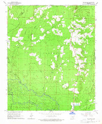 1964 Millerville1965 Print · USGSGrant County and the Saline River bottoms are captured here in the mid-1960s as a landscape of timber and gravel extraction. Genealogists can trace family roots at Shiloh Ch and Bethel Cem, or locate the historic Lookout Tower near Millerville.3 unique versions available
 - 1965 Map of Round Hill, 1966 Print
 1965 Round Hill1966 Print · USGSHot Spring and Dallas counties during the mid-1960s featured a network of logging trails and remote timberlands. Genealogists and hikers can trace the Clifton Tram, locate the Sardis Cem, or find rural landmarks like Pleasant Grove and Round Hill.2 unique versions available
 - 1965 Map of Leola, 1966 Print
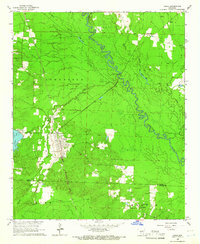 1965 Leola1966 Print · USGSLeola and the surrounding timberlands of Grant and Dallas counties are captured here in the mid-1960s. Genealogists and local historians can trace family-named sites such as Moores Chapel, Taylor Cem, and the rail stops at Thiel or Carver.3 unique versions available
 - 1965 Map of Willow, 1966 Print
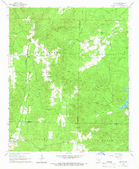 1965 Willow1966 Print · USGSThe mid-Arkansas timberlands near the tri-county corner of Hot Spring, Grant, and Dallas counties are captured here in the mid-1960s. Researchers can trace rural lineages through the Chicago Rock Island and Pacific rail stops at Rolla and local landmarks like Hunters Chapel and Lono Cem.3 unique versions available
 - 1965 Map of Dalark, 1966 Print
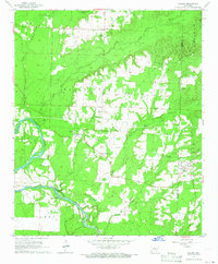 1965 Dalark1966 Print · USGSMid-century Clark County comes alive in this survey of the riverlands and rural townships. Genealogists and historians can trace family roots at Strong Cem and Jones Cem, or follow the path of the Old Railroad Grade near Griffithtown.
 - 1965 Map of Manning, 1966 Print
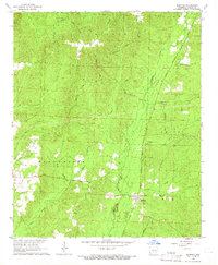 1965 Manning1966 Print · USGSDallas County was a landscape of timber and rail in the mid-sixties, centered on the small siding at Manning. Genealogists can locate family landmarks like Turner Cem, DeLamar Cem, and the Henry Lawrence Trail.2 unique versions available
 - 1965 Map of Carthage, 1966 Print
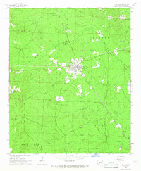 1965 Carthage1966 Print · USGSCarthage and its surrounding timberlands are captured here in the mid-1960s as the railroad remained a vital corridor. Researchers can locate family landmarks like Mt Zion Ch and Bethel Cem or trace the old Eagle Tram Road.2 unique versions available
 - 1965 Map of Tulip, 1966 Print
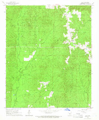 1965 Tulip1966 Print · USGSThe rural community of Tulip is shown in the mid-1960s, surrounded by the heavily wooded ridges of Dallas County. Genealogists and researchers can trace the drainages of West Fork Tulip Creek and find several active Gravel Pits that shaped the local landscape.2 unique versions available
 - 1966 Map of Kingsland, 1967 Print
 1966 Kingsland1967 Print · USGSKingsland and its surrounding timberlands are captured in the mid-1960s, a period when the river-and-rail economy still shaped south-central Arkansas. Researchers can trace family roots through several local landmarks like Kingsland Cemetery, Smith Church, and Morgan Cemetery.2 unique versions available
 - 1966 Map of Fordyce, 1967 Print
 1966 Fordyce1967 Print · USGSFordyce and the surrounding Dallas County countryside are captured in the mid-sixties at a peak of rail-based commerce. Researchers can trace family sites at Oakland Cemetery or locate the rural communities of Bucksnort and Thornton.2 unique versions available
 - 1969 Map of Ivan, 1972 Print
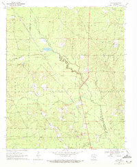 1969 Ivan1972 Print · USGSThe borderlands of Dallas and Cleveland Counties are captured here in the late sixties, centered on the communities of Ivan and Bunn. Researchers can trace the Chicago Rock Island and Pacific rail line and locate numerous family-named burial sites like Garner Cem and Tolson Cem.2 unique versions available
 - 1971 Map of Tates Bluff, 1973 Print
 1971 Tates Bluff1973 Print · USGSThe Ouachita and Little Missouri rivers converge here in the early 1970s, forming a complex network of wetlands and river bluffs. Genealogists can locate several family-named landmarks and burial grounds, including Easley Cem, Kansas Cem, and the rural community of Vaden.2 unique versions available
 - 1971 Map of Sparkman, 1973 Print
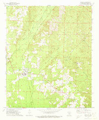 1971 Sparkman1973 Print · USGSDallas County in the early 1970s shows a landscape of timber-lined creeks and small railroad towns. Researchers can trace family sites at Holeman Cem, visit the local congregation at Mt Carmel Ch, or follow the Chicago and Rock Island Pacific tracks through Sparkman.2 unique versions available
Showing maps 1-25 of 145
Top cities of Dallas County
Frequently asked questions
- What are the different types of historical maps available for Dallas County?
- What is the oldest map of Dallas County?
- Where can I purchase historical maps of Dallas County for my home or office?
- Where can I download high-res historical maps of Dallas County?
- Are there historical topographic maps available for Dallas County?
- Is there historical aerial imagery available for Dallas County?
- Where are historical maps of Dallas County sourced from?