Old Maps of Greene County, Arkansas for Genealogy
Trace your family roots with 151 historic maps of Greene County. These high-res maps reveal old neighborhoods, homesites, landmarks, and streets — helping you uncover where your ancestors lived and how the area evolved over time.
- Explore historic neighborhoods: Identify where your relatives may have lived in the 1800s or 1900s.
- Compare maps over time: Trace the changes in streets, buildings, and landmarks for multi-generational research.
- Perfect for genealogy & ancestry research: Used by family historians and researchers to map out lineage and migration.
These maps are an incredible resource for exploring your personal connection to Greene County's past.
Greene County, AR maps
(151)- 1932 Map of Walnut Ridge
 1932 Walnut Ridge1932 Print · USGSLawrence and Randolph counties come alive in the early thirties at the critical rail junction of Walnut Ridge. Genealogists and researchers can trace dozens of rural landmarks, from the Old Walnut Ridge Sch and Hoxie High Sch to local crossings like Indian Ford.
 - 1934 Map of Kennett
 1934 Kennett1934 Print · USGSDunklin County and the Arkansas borderlands are captured here during a period of intensive drainage and reclamation. Researchers can trace early infrastructure and family landmarks like Johnson Mill, American Legion Airport, and Bark Camp Sch.
 - 1935 Map of Sedgwick, 1936 Print
 1935 Sedgwick1936 Print · USGSLawrence and Craighead counties are shown here during a period of extensive drainage and rural expansion in the mid-1930s. Genealogists can trace family roots through numerous small landmarks like Three Way Inn, Fifty Six Sch, and Herman Ch & Cem.2 unique versions available
 - 1935 Map of Rector, 1936 Print
 1935 Rector1936 Print · USGSClay County at the height of the 1930s drainage era shows a landscape being reshaped by massive flood control projects and rail expansion. Genealogists can locate family landmarks like Boydsville, the Trovillon Cem, and rural schoolhouses such as Turtle Knob Sch.3 unique versions available
 - 1935 Map of Knobel, 1938 Print
 1935 Knobel1938 Print · USGSDuring the mid-1930s, the Arkansas-Missouri borderlands were defined by the rail lines and river bends of the Black River valley. Researchers can trace family roots through Peach Orchard, Hopewell Ch, and cemeteries like Al McNaner Cem.
 - 1935 Map of Reyno, 1938 Print
 1935 Reyno1938 Print · USGSRandolph and Clay counties are shown in the mid-1930s, documenting a river-dependent economy as the Ozarks meet the alluvial valley. Researchers can trace historic river crossings like Biggers Ferry and rural sites such as Johnson Cem and Cochrum Sch.3 unique versions available
 - 1935 Map of Walnut Ridge, 1947 Print
 1935 Walnut Ridge1947 Print · USGSWalnut Ridge and Hoxie serve as a vital railroad crossroads during the mid-thirties, where the St. Louis-San Francisco and Missouri Pacific lines meet. Researchers can trace rural family roots through landmarks like Gum Stump Ch & Sch, Whitaker Cem, and the old settlement at Lesterville.2 unique versions available
 - 1939 Map of Jonesboro, 1942 Print
 1939 Jonesboro1942 Print · USGSJonesboro and its surrounding farmstead communities are captured in the late thirties, when railroads and rural schools defined the region. Researchers can trace family sites like Higginsbottom Hope Sch or the remote Doss Flag Stop along the rail lines.
 - 1940 Map of Gainesville, 1942 Print
 1940 Gainesville1942 Print · USGSGreene County was defined by its ridge and river bottomlands in the early 1940s, as rural communities thrived along the local railroads. Genealogists can trace family names through dozens of landmarks like Jones Ridge Cem, St Johns Ch & Cem, and Greene Co High Sch.2 unique versions available
 - 1940 Map of Marmaduke, 1942 Print
 1940 Marmaduke1942 Print · USGSThe lowland border between Arkansas and Missouri comes into focus in the early 1940s, showing a landscape of river islands and new drainage ditches. Researchers can locate vanished rural landmarks like Bonecamp Sch, the Reddick Cem, and the tracks of the St Louis Southwestern Railway.3 unique versions available
 - 1940 Map of Kennett, 1943 Print
 1940 Kennett1943 Print · USGSDunklin County and the Missouri-Arkansas border are mapped here during the early 1940s, showing a landscape defined by drainage ditches and rail lines. You can trace the St Louis Southwestern RR through Senath and Arbyrd, or locate family sites like Lula Ch & Cem and Johnson Mill.
 - 1941 Map of Leachville, 1943 Print
 1941 Leachville1943 Print · USGSNortheast Arkansas and the Missouri bootheel border region appear here in the early 1940s as a landscape of river-bottom settlements and new drainage canals. Genealogists can trace family roots through numerous local schools like Turkey Run Sch and churches such as Walnut Grove Ch & Cem.
 - 1941 Map of Knobel, 1946 Print
 1941 Knobel1946 Print · USGSClay County at the onset of the 1940s is defined by the winding Black River and the critical rail junctions that sustained its small towns. Researchers can trace family roots through numerous rural landmarks like Masterson Cem, Brazil Sch & Ch, and the river crossing at Bennetts Ferry Bridge.2 unique versions available
 - 1953 Map of Memphis, 1966 Print
 1953 Memphis1966 Print · USGSEastern Arkansas and the Memphis riverfront are shown here during the mid-century period of regional growth and river management. Local historians can trace the paths of the Chicago Rock Island & Pacific RR through Forrest City or locate river landmarks like President's Island.3 unique versions available
 - 1956 Map of Leachville
 1956 Leachville1956 Print · USGSThe Arkansas-Missouri borderlands in the mid-1950s show a region shaped by major drainage projects and the railroad economy. Genealogists and historians can trace family locations near Leachville, Black Oak, and several country schools like Milligan Ridge Sch.2 unique versions available
 - 1956 Map of Kennett
 1956 Kennett1956 Print · USGSThe Missouri Bootheel's agricultural and drainage transformation is on full display in the mid-fifties. Genealogists can trace family roots through numerous rural sites like Silverdale Ch & Cem, Harkeys Chapel, and the Oak Ridge Cem near Kennett.2 unique versions available
 - 1956 Map of Memphis
 1956 Memphis1956 Print · USGSThe Mississippi Delta and the bluffs of West Tennessee meet in the mid-fifties, showing a landscape defined by massive river systems and rail hubs. Researchers can trace the path of Crowleys Ridge or locate vanished river landings near Centennial Island and Island No 35.
 - 1957 Map of Poplar Bluff, 1968 Print
 1957 Poplar Bluff1968 Print · USGSThe Missouri-Arkansas border region is captured here as the timber and rail industries shaped the Ozark foothills. Genealogists and historians can trace the Missouri Pacific Railroad through river towns like Pocahontas, Greenville, and Van Buren.3 unique versions available
 - 1958 Map of Jonesboro
 1958 Jonesboro1958 Print · USGSJonesboro and the surrounding Crowley's Ridge area are captured in the late fifties as the regional center expanded around Arkansas State College. Researchers can trace early rural life through an extensive network of landmarks like Indian Mounds, Nettleton, and the Philadelphia Ch & Cem.2 unique versions available
 - 1958 Map of Marmaduke, 1962 Print
 1958 Marmaduke1962 Print · USGSThe Arkansas-Missouri borderlands come alive in this mid-century survey of the St. Francis River basin and the agricultural landscape of Greene County. Genealogists and historians can trace family locations through numerous rural landmarks like Harveys Chapel Cem, Nutt Chapel, and the stops along the St Louis Southwestern RR.2 unique versions available
 - 1958 Map of Gainesville, 1962 Print
 1958 Gainesville1962 Print · USGSGreene County in the late fifties was a landscape of ridges and river bottoms defined by small agricultural settlements and rural schools. Genealogists can trace family footprints across dozens of sites like Jones Ridge Cem, Evening Star Ch, and the community at Stanford.2 unique versions available
 - 1958 Map of Rector, 1962 Print
 1958 Rector1962 Print · USGSClay County at the edge of the Missouri Bootheel was a landscape of ridge-top settlements and engineered bottomlands in the late fifties. Genealogists can trace family footprints across dozens of local landmarks like Knob Sch, Boydsville, and the Crockett Cem.2 unique versions available
 - 1959 Map of Poplar Bluff
 1959 Poplar Bluff1959 Print · USGSThe Missouri Ozarks and Arkansas borderlands meet in this late 1950s study of the region's diverse terrain and rail-fed towns. Researchers can trace the path of the Missouri Pacific Railroad through Poplar Bluff or locate smaller settlements like Birch Tree and Myrtle.
 - 1959 Map of Marmaduke
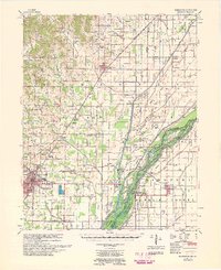 1959 Marmaduke1959 Print · USGSGreene County and the Missouri bootheel transition appear here in the late fifties, dominated by the rail-and-river economy. Researchers can trace rural lineages through dozen of landmarks like Old Liberty Cem, Alexander Sch, and the riverside settlement of Cardwell.
 - 1959 Map of Sedgwick, 1961 Print
 1959 Sedgwick1961 Print · USGSNortheast Arkansas in the late fifties shows a landscape of rail-connected farming towns and river bottomlands. Researchers can trace family history through local sites like Egypt Sch, Arnold Cem, and churches such as Little Brown Ch.
Showing maps 1-25 of 151
Top cities of Greene County
- Paragould historical maps
- Marmaduke historical maps
- Oak Grove Heights historical maps
- Lafe historical maps
- Delaplaine historical maps
Frequently asked questions
- What are the different types of historical maps available for Greene County?
- What is the oldest map of Greene County?
- Where can I purchase historical maps of Greene County for my home or office?
- Where can I download high-res historical maps of Greene County?
- Are there historical topographic maps available for Greene County?
- Is there historical aerial imagery available for Greene County?
- Where are historical maps of Greene County sourced from?