1960s Maps of Lawrence County, Arkansas
Explore 14 historic maps of Lawrence County from the 1960s. These maps offer a rare glimpse into what life looked like during the 1960s — showing old roads, neighborhoods, homes, and landmarks that have changed or disappeared over time.
Whether you're researching your family's past, planning a metal detecting trip, or studying how Lawrence County's landscape evolved across the 1960s, these high-resolution maps are a powerful tool for exploring the history of this region.
- Focus on a specific era: All maps on this page are from the 1960s, giving you a focused view of this time period.
- See what’s changed: Compare century-old streets, trails, and buildings to today's modern landscape using overlays and satellite layers.
- Research with precision: Use these maps for genealogy, historical research, land use analysis, or educational projects.
- View, download, or print: Maps are fully viewable online in high resolution, and can be downloaded or printed for your own records.
Start exploring Lawrence County's history through authentic maps from the 1960s. This is your window into the past.
Lawrence County, AR maps
(14)- 1960 Map of Gainesville
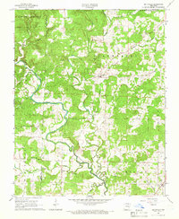
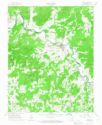
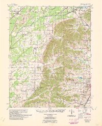 1960 Gainesville1960 Print · USGSNortheast Arkansas in the late fifties shows the sharp contrast between the managed Cache River bottoms and the heights of Crowleys Ridge. Genealogists can locate family landmarks like Bonds Cem, Pruitt Ch, and the original settlement at Gainesville.
 - 1960 Map of Sedgwick
 1960 Sedgwick1960 Print · USGSNortheast Arkansas in the late fifties was a landscape of river bottomlands and rail-hub towns like Sedgwick and Bono. Researchers can trace old family burial grounds and country parishes such as Manning Cem, Egypt Sch, and Little Brown Ch.
 - 1960 Map of Poplar Bluff
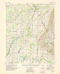
 1960 Poplar Bluff1960 Print · USGSSoutheast Missouri and Northeast Arkansas are captured here during the post-war era, showing the transition from the Ozark highlands to the Delta. Genealogists and historians can trace rail corridors like the St. Louis Southwestern RR and remote settlements such as Birch Tree and Warm Springs.
 - 1965 Map of Walnut Ridge SE, 1966 Print
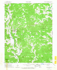
 1965 Walnut Ridge SE1966 Print · USGSNortheast Arkansas in the mid-sixties reveals an agricultural landscape shaped by a sophisticated network of drainage ditches and river sloughs. Genealogists and local researchers can trace family roots through sites like Whiskerville, Oak Grove Ch, and the Jenkins Cemetery.3 unique versions available
 - 1965 Map of O'Kean, 1966 Print
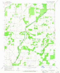
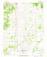
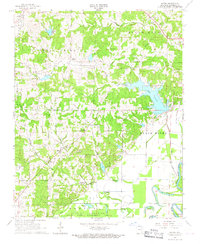
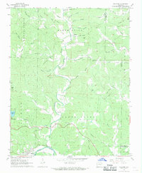
 1965 O'Kean1966 Print · USGSRandolph and Lawrence counties are captured here in the mid-1960s, a landscape defined by its winding river bottoms and the Missouri Pacific line. Genealogists can locate family-named sites like Sharum, Frye Cem, and Rickey Chapel.3 unique versions available
 - 1965 Map of Smithville, 1966 Print
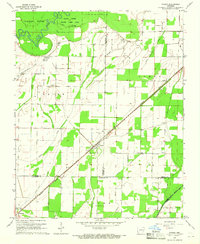
 1965 Smithville1966 Print · USGSNortheastern Arkansas in the mid-1960s is defined by its rural river valleys and small crossroads settlements. Genealogists can trace family names at Bratcher Cem and Massey Cem or locate the Union Missionary Ch near Jesup.3 unique versions available
 - 1965 Map of Walnut Ridge, 1966 Print
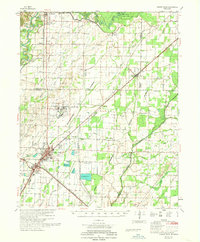
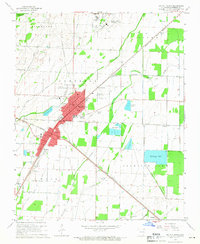 1965 Walnut Ridge1966 Print · USGSThe Lawrence County rail crossroads of Walnut Ridge and Hoxie are captured here in the mid-sixties at the junction of two major railroads. Genealogists and local historians can trace family sites like Whittaker Cem, Manning Cem, and the rural community at Ponders.3 unique versions available
 - 1965 Map of Manson, 1966 Print
 1965 Manson1966 Print · USGSRandolph and Lawrence Counties come alive in this mid-century survey as the river and rail network shaped local commerce. Genealogists and historians can trace family locations near College City, the St Louis-San Francisco railroad, and old burial sites like Mt Zion Cemetery.
 - 1966 Map of Ravenden Springs, 1967 Print
 1966 Ravenden Springs1967 Print · USGSRavenden Springs and the surrounding Ozark foothills are captured here in the mid-1960s, showing a landscape of small farms and family-led communities. Genealogists can trace deep local roots through several family burial grounds, including Wells Cem, Janes Cem, and Brown Cem.2 unique versions available
 - 1966 Map of Imboden, 1967 Print
 1966 Imboden1967 Print · USGSIn the mid-1960s, the riverside town of Imboden thrived along the St Louis - San Francisco rail line. Researchers can trace family history through numerous rural sites like Annieville, Pleasant Grove Ch, and the Nation Cem.2 unique versions available
 - 1966 Map of Eaton, 1967 Print
 1966 Eaton1967 Print · USGSNortheast Arkansas river country is captured here in the mid-sixties, where the Strawberry River meets the Black River wetlands. Researchers can trace rural lineages through local landmarks like New Hope Ch, the Old Bethel Cem, and the settlement of Eaton.2 unique versions available
 - 1968 Map of Walnut Ridge
 1968 Walnut Ridge1968 Print · USGSNortheast Arkansas in the late sixties reveals a landscape of industrial rail hubs and complex river drainage systems. Genealogists can trace family roots through rural landmarks like Surridge School, Rickey Chapel, and the Whittaker Cemetery near Hoxie.
 - 1968 Map of Ravenden, 1969 Print
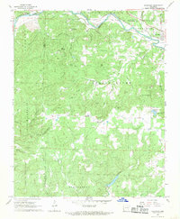 1968 Ravenden1969 Print · USGSIn the Ozark foothills during the late sixties, the railroad towns of Williford and Ravenden thrived along the banks of the Spring River. Researchers can trace rural lineages through family-named landmarks like Thacker Ridge and country landmarks including Friendship Ch and Dail Cem.3 unique versions available
 - 1968 Map of Williford, 1969 Print
 1968 Williford1969 Print · USGSSharp County land records and family histories come to life in the late 1960s as the Spring River passes through Williford. Trace ancestral sites at Bradford Chapel, Kellett Cem, and the historic St Louis - San Francisco rail line.2 unique versions available
End of results
Showing maps 1-14 of 14
Top cities of Lawrence County
- Walnut Ridge historical maps
- Hoxie historical maps
- Imboden historical maps
- Black Rock historical maps
- Portia historical maps
- Ravenden historical maps
See more
Frequently asked questions
- What are the different types of historical maps available for Lawrence County?
- What is the oldest map of Lawrence County?
- Where can I purchase historical maps of Lawrence County for my home or office?
- Where can I download high-res historical maps of Lawrence County?
- Are there historical topographic maps available for Lawrence County?
- Is there historical aerial imagery available for Lawrence County?
- Where are historical maps of Lawrence County sourced from?