1980s Maps of Lawrence County, Arkansas
Explore 9 historic maps of Lawrence County from the 1980s. These maps offer a rare glimpse into what life looked like during the 1980s — showing old roads, neighborhoods, homes, and landmarks that have changed or disappeared over time.
Whether you're researching your family's past, planning a metal detecting trip, or studying how Lawrence County's landscape evolved across the 1980s, these high-resolution maps are a powerful tool for exploring the history of this region.
- Focus on a specific era: All maps on this page are from the 1980s, giving you a focused view of this time period.
- See what’s changed: Compare century-old streets, trails, and buildings to today's modern landscape using overlays and satellite layers.
- Research with precision: Use these maps for genealogy, historical research, land use analysis, or educational projects.
- View, download, or print: Maps are fully viewable online in high resolution, and can be downloaded or printed for your own records.
Start exploring Lawrence County's history through authentic maps from the 1980s. This is your window into the past.
Lawrence County, AR maps
(9)- 1980 Map of Strangers Home
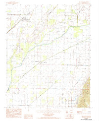
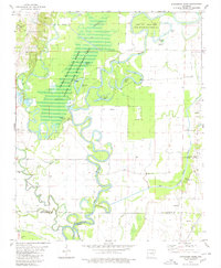 1980 Strangers Home1980 Print · USGSThe Black River lowlands of northeast Arkansas are shown here in the late twentieth century, where river bends meet managed wetlands. Family historians can locate several rural burial grounds including Pleasant Hill Cem and Ruffner Cem near the settlement of Strangers Home.
 - 1980 Map of Alicia
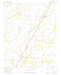 1980 Alicia1980 Print · USGSLawrence County and the Arkansas Delta are captured here in the late 1970s as the rail-and-creek economy maintained its traditional footprint. Researchers can trace family history through several burial sites like Clover Bend Cemetery and Davenport Cemetery or locate the community at Hopewell Church.
 - 1980 Map of Bono
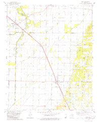 1980 Bono1980 Print · USGSNortheast Arkansas in the late seventies is marked by the unique topography of Crowleys Ridge and the winding Cache River. Genealogists and historians can trace rural lifeways through several country landmarks like Old Military Cem, Bells Chapel Ch, and the rail stop at Pauls Switch.
 - 1980 Map of Podo Creek
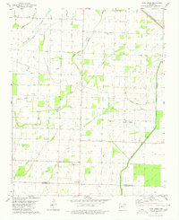 1980 Podo Creek1980 Print · USGSLawrence and Craighead counties in the late 1970s show a landscape shaped by drainage projects and rail transport. Genealogists can locate family-named sites like Markham Cem and Aldridge Cem or trace the old St Louis-San Francisco line.
 - 1983 Map of Cherokee Village
 1983 Cherokee Village1983 Print · USGSThe Ozark foothills and river valleys of Northeast Arkansas are captured in the early eighties as modern planned communities began to reshape the landscape. Genealogists and historians can trace family-named ridges and schools across Evening Shade, Melbourne, and the rail junction at Hoxie.
 - 1984 Map of Delaplaine
 1984 Delaplaine1984 Print · USGSThe rural lowlands of Greene and Lawrence Counties come into focus in the mid-1980s as the railroad and the river continue to define local geography. Genealogists can trace the small communities of Delaplaine and Evening Star, or locate Cem sites near the rise of Crowleys Ridge.2 unique versions available
 - 1984 Map of Paragould
 1984 Paragould1984 Print · USGSNortheast Arkansas and the Missouri Bootheel appear here in the mid-1980s as a landscape of ridge-top towns and engineered delta drainage. Genealogists and historians can locate rural landmarks like Oak Grove Church, trace the St Louis San Francisco RR, or explore the limits of Crowleys Ridge State Park.2 unique versions available
 - 1986 Map of Jonesboro
 1986 Jonesboro1986 Print · USGSNortheast Arkansas in the mid-eighties shows a landscape of intensive drainage and railroad junctions centered on the rise of Crowley's Ridge. Researchers can trace the rail corridors of the St Louis Southwestern Railway and explore the unique geography of Hatchie Coon Island and the Mississippi River floodplain.2 unique versions available
 - 1986 Map of Batesville
 1986 Batesville1986 Print · USGSNorth-central Arkansas in the mid-eighties shows a landscape of river-bend towns and Ozark foothills during a period of steady growth. You can trace family roots through numerous upland sites like Hickory Valley School, Sandtown Hill Cem, and the riverfront at Oil Trough.2 unique versions available
End of results
Showing maps 1-9 of 9
Top cities of Lawrence County
- Walnut Ridge historical maps
- Hoxie historical maps
- Imboden historical maps
- Black Rock historical maps
- Portia historical maps
- Ravenden historical maps
See more
Frequently asked questions
- What are the different types of historical maps available for Lawrence County?
- What is the oldest map of Lawrence County?
- Where can I purchase historical maps of Lawrence County for my home or office?
- Where can I download high-res historical maps of Lawrence County?
- Are there historical topographic maps available for Lawrence County?
- Is there historical aerial imagery available for Lawrence County?
- Where are historical maps of Lawrence County sourced from?