1930s Maps of Lawrence County, Arkansas
Explore 8 historic maps of Lawrence County from the 1930s. These maps offer a rare glimpse into what life looked like during the 1930s — showing old roads, neighborhoods, homes, and landmarks that have changed or disappeared over time.
Whether you're researching your family's past, planning a metal detecting trip, or studying how Lawrence County's landscape evolved across the 1930s, these high-resolution maps are a powerful tool for exploring the history of this region.
- Focus on a specific era: All maps on this page are from the 1930s, giving you a focused view of this time period.
- See what’s changed: Compare century-old streets, trails, and buildings to today's modern landscape using overlays and satellite layers.
- Research with precision: Use these maps for genealogy, historical research, land use analysis, or educational projects.
- View, download, or print: Maps are fully viewable online in high resolution, and can be downloaded or printed for your own records.
Start exploring Lawrence County's history through authentic maps from the 1930s. This is your window into the past.
Lawrence County, AR maps
(8)- 1932 Map of Strawberry
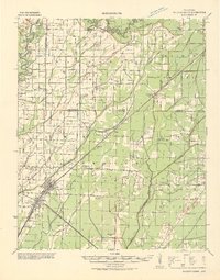
 1932 Strawberry1932 Print · USGSThe river bottoms of Northeast Arkansas are captured in the early 1930s, showing the intersection of the Strawberry River and Black River. Researchers can locate historic landmarks like the Pruitts Mill Site, Buck Cem, and local schools including Cord Sch.
 - 1932 Map of Walnut Ridge
 1932 Walnut Ridge1932 Print · USGSLawrence and Randolph counties come alive in the early thirties at the critical rail junction of Walnut Ridge. Genealogists and researchers can trace dozens of rural landmarks, from the Old Walnut Ridge Sch and Hoxie High Sch to local crossings like Indian Ford.
 - 1934 Map of Powhatan
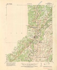 1934 Powhatan1934 Print · USGSLawrence and Randolph counties are mapped here in the early 1930s, showing a river-dependent landscape tied to the Black River. Researchers can trace old ferry crossings like Gibson Ferry and family-named landmarks such as Whitlow Cem and Lauratown.
 - 1935 Map of Powhatan
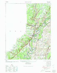 1935 Powhatan1935 Print · USGSThe confluence of the Black and Spring Rivers comes alive in the mid-1930s, documenting a time when river ferries and rail travel defined Lawrence County life. Genealogists can locate family landmarks like Lauderdale Ch Sch & Cem, Gibson Ferry, and the landing at Sissons Ld.4 unique versions available
 - 1935 Map of Sedgwick, 1936 Print
 1935 Sedgwick1936 Print · USGSLawrence and Craighead counties are shown here during a period of extensive drainage and rural expansion in the mid-1930s. Genealogists can trace family roots through numerous small landmarks like Three Way Inn, Fifty Six Sch, and Herman Ch & Cem.2 unique versions available
 - 1935 Map of Alicia, 1936 Print
 1935 Alicia1936 Print · USGSThe Black River bottomlands of the 1930s are captured here during a period of transition from river landings to rail and highway transit. Researchers can locate numerous family-named landmarks and vanished schools such as Clover Bend Sch, Vandy Cem, and the Old Martin Mill Place.3 unique versions available
 - 1935 Map of Strawberry, 1936 Print
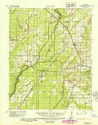
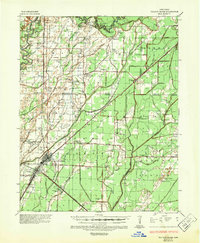
 1935 Strawberry1936 Print · USGSNortheast Arkansas in the mid-1930s shows a landscape of upland ridges and river bottomlands at the junction of four counties. Researchers can trace rural family life through many churchyards and schools, from Sulphur Rock up to the Pruitte Mill Site and Saffell.
 - 1935 Map of Walnut Ridge, 1947 Print
 1935 Walnut Ridge1947 Print · USGSWalnut Ridge and Hoxie serve as a vital railroad crossroads during the mid-thirties, where the St. Louis-San Francisco and Missouri Pacific lines meet. Researchers can trace rural family roots through landmarks like Gum Stump Ch & Sch, Whitaker Cem, and the old settlement at Lesterville.2 unique versions available
End of results
Showing maps 1-8 of 8
Top cities of Lawrence County
- Walnut Ridge historical maps
- Hoxie historical maps
- Imboden historical maps
- Black Rock historical maps
- Portia historical maps
- Ravenden historical maps
See more
Frequently asked questions
- What are the different types of historical maps available for Lawrence County?
- What is the oldest map of Lawrence County?
- Where can I purchase historical maps of Lawrence County for my home or office?
- Where can I download high-res historical maps of Lawrence County?
- Are there historical topographic maps available for Lawrence County?
- Is there historical aerial imagery available for Lawrence County?
- Where are historical maps of Lawrence County sourced from?