1970s Maps of Lonoke County, Arkansas
Explore 8 historic maps of Lonoke County from the 1970s. These maps offer a rare glimpse into what life looked like during the 1970s — showing old roads, neighborhoods, homes, and landmarks that have changed or disappeared over time.
Whether you're researching your family's past, planning a metal detecting trip, or studying how Lonoke County's landscape evolved across the 1970s, these high-resolution maps are a powerful tool for exploring the history of this region.
- Focus on a specific era: All maps on this page are from the 1970s, giving you a focused view of this time period.
- See what’s changed: Compare century-old streets, trails, and buildings to today's modern landscape using overlays and satellite layers.
- Research with precision: Use these maps for genealogy, historical research, land use analysis, or educational projects.
- View, download, or print: Maps are fully viewable online in high resolution, and can be downloaded or printed for your own records.
Start exploring Lonoke County's history through authentic maps from the 1970s. This is your window into the past.
Lonoke County, AR maps
(8)- 1970 Map of Wright, 1972 Print
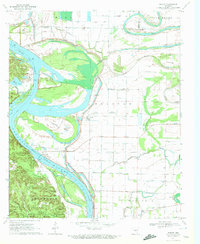 1970 Wright1972 Print · USGSJefferson and Pulaski counties meet along the winding Arkansas River in the early seventies. Genealogists and local historians can trace family landmarks like Watkins Chapel, the Pastoria Sch, and the riverside Tar Camp Public Use Area.2 unique versions available
 - 1971 Map of Stuttgart
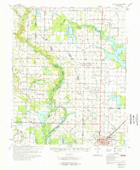 1971 Stuttgart1971 Print · USGSThe Grand Prairie region of Arkansas comes alive in the early 1970s, showing the meeting of three counties and two major railroads. Researchers can trace the heritage of local communities like Slovak and Fairmount or locate family plots at Geridge Cemetery and Tate Cemetery.
 - 1975 Map of England NE, 1977 Print
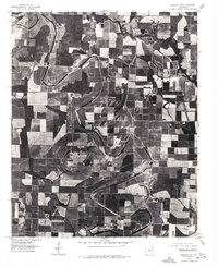
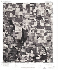 1975 England NE1977 Print · USGSLonoke County agricultural lands are captured in sharp detail during the mid-1970s through rectified aerial imagery. Researchers can trace the winding path of Bayou Meto and locate the rural settlement at Culler amidst the grid of farm fields.
 - 1975 Map of England SE, 1977 Print
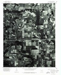
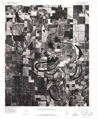 1975 England SE1977 Print · USGSLonoke County agricultural lands appear in sharp detail during the mid-seventies, showing the precise intersection of delta farming and ancient watercourses. Researchers can trace the meandering path of Crooked Creek past the settlements of Seaton and Humnoke.
 - 1975 Map of England NW, 1977 Print
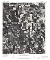
 1975 England NW1977 Print · USGSLonoke County agricultural lands and drainage systems are captured in detail during the mid-seventies. Local historians and land researchers can trace property lines and water features near Pettus, Bakers Bayou, and Crooked Cr.
 - 1975 Map of Lonoke SW, 1977 Print
 1975 Lonoke SW1977 Print · USGSLonoke and the surrounding Arkansas farmland are captured in high detail in this mid-seventies aerial survey. Researchers can trace the developed grid of Lonoke, the rural settlement at Furlow, and the drainage patterns of Baker and the local Bayou.
 - 1975 Map of England SW, 1977 Print
 1975 England SW1977 Print · USGSIn the mid-1970s, the fertile Arkansas Delta around Lonoke County was a landscape of precision-cut fields and winding waterways. Researchers can trace the layout of England and identify rural landmarks along Bakers Bayou and near Coy.
 - 1977 Map of Russellville
 1977 Russellville1977 Print · USGSThe Arkansas River Valley and surrounding Ozark Mountains are documented here during a period of significant postwar growth and infrastructure development. Genealogists and researchers can locate family landmarks such as Mount Carmel Cem, St Josephs Church, and several remote Coal Mine sites along the Missouri Pacific RR line.
End of results
Showing maps 1-8 of 8
Top cities of Lonoke County
- Cabot historical maps
- Lonoke historical maps
- Ward historical maps
- England historical maps
- Carlisle historical maps
- Austin historical maps
See more
Frequently asked questions
- What are the different types of historical maps available for Lonoke County?
- What is the oldest map of Lonoke County?
- Where can I purchase historical maps of Lonoke County for my home or office?
- Where can I download high-res historical maps of Lonoke County?
- Are there historical topographic maps available for Lonoke County?
- Is there historical aerial imagery available for Lonoke County?
- Where are historical maps of Lonoke County sourced from?