1980s Maps of Lonoke County, Arkansas
Explore 19 historic maps of Lonoke County from the 1980s. These maps offer a rare glimpse into what life looked like during the 1980s — showing old roads, neighborhoods, homes, and landmarks that have changed or disappeared over time.
Whether you're researching your family's past, planning a metal detecting trip, or studying how Lonoke County's landscape evolved across the 1980s, these high-resolution maps are a powerful tool for exploring the history of this region.
- Focus on a specific era: All maps on this page are from the 1980s, giving you a focused view of this time period.
- See what’s changed: Compare century-old streets, trails, and buildings to today's modern landscape using overlays and satellite layers.
- Research with precision: Use these maps for genealogy, historical research, land use analysis, or educational projects.
- View, download, or print: Maps are fully viewable online in high resolution, and can be downloaded or printed for your own records.
Start exploring Lonoke County's history through authentic maps from the 1980s. This is your window into the past.
Lonoke County, AR maps
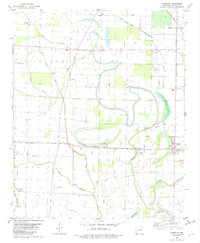
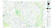
(19)- 1982 Map of Oak Grove
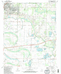
 1982 Oak Grove1982 Print · USGSLonoke County in the early eighties shows a detailed landscape of rural settlements and historic burial grounds. Researchers can trace family history through sites like the Camp Nelson Confederate Cem, Old Austin Cem, and the Sylvania Church.
 - 1982 Map of Humnoke
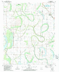
 1982 Humnoke1982 Print · USGSThe Lonoke and Arkansas county line in the early 1980s reveals a precision-engineered agricultural landscape of siphons, flumes, and landing strips. Genealogists can trace family roots through rural landmarks like Gumwood Cem, Rowes Chapel, and the community at Coy.
 - 1982 Map of Lonoke
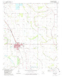
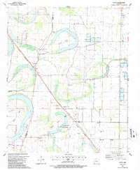
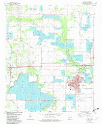 1982 Lonoke1982 Print · USGSLonoke and the surrounding Grand Prairie landscape are captured here in the early eighties as aquaculture transformed the terrain. Genealogists and local historians can trace rural communities like Furlow, locate the Concord Ch, or find family burial sites at Beard Cem and Hester Cem.
 - 1982 Map of Pettus
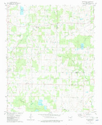
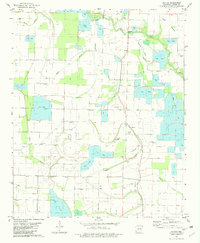 1982 Pettus1982 Print · USGSLonoke County in the early 1980s reveals a sophisticated agricultural landscape defined by its managed waterways and bayous. Researchers can locate family landmarks such as Sullivan Cem and Green Olive Cem, or trace rural centers like Pettus and New Zion Ch.
 - 1982 Map of Culler
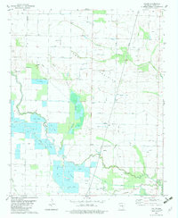 1982 Culler1982 Print · USGSLonoke and Arkansas counties are captured here in the early eighties as a hub of specialized aquaculture and rural life. Local historians can trace the Fish Farm developments along Bayou Meto and locate the Legate Cem or Richwood Ch.
 - 1982 Map of England
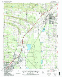
 1982 England1982 Print · USGSThe rural landscapes of Lonoke County are meticulously documented here in the early eighties, centered on the railroad town of England. Researchers can trace old family roots at Mulberry Cem, Tomberlin Cem, and country congregations like Union Valley Ch.
 - 1982 Map of Pocket Prairie
 1982 Pocket Prairie1982 Print · USGSThe Grand Prairie region of Lonoke County appears here in the early eighties as a hub of specialized aquaculture and transport. Researchers can locate Carlisle, trace the Two Prairie Bayou, and find local sites like Chambers Ch.
 - 1982 Map of Wattensaw
 1982 Wattensaw1982 Print · USGSLonoke and Prairie counties are captured in the early eighties as a landscape of rural crossroads and aquaculture. Genealogists can trace family landmarks and local congregations at Sunnyside Ch, Harper Cem, and the settlement of Butlerville.
 - 1983 Map of Conway, 1984 Print
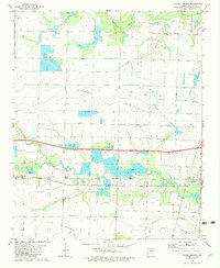
 1983 Conway1984 Print · USGSThe Arkansas River valley in the early eighties shows a landscape of river-bend settlements and expanding wildlife areas. Genealogists and historians can trace the Missouri Pacific RR through old river towns like Toad Suck, Morrilton, and Menifee.
 - 1984 Map of Russellville
 1984 Russellville1984 Print · USGSThe Arkansas River valley was undergoing significant change in the 1950s as transportation and water management reshaped the region from Russellville to Conway. Researchers can trace the era's rail networks like the Missouri Pacific RR and explore landmarks like Magazine Mountain and Petit Jean State Park.
 - 1985 Map of Malvern
 1985 Malvern1985 Print · USGSCentral Arkansas in the mid-eighties shows a landscape of timberlands and river valleys anchored by the industrial hubs of Malvern and Pine Bluff. Genealogists can locate family landmarks and rural institutions like Social Hill Sch, Magnet Cove, and Pine Bluff Arsenal.2 unique versions available
 - 1985 Map of Little Rock, 1988 Print
 1985 Little Rock1988 Print · USGSLittle Rock and its surrounding river valley are shown in the mid-eighties as the region balanced urban expansion with its industrial and military roots. Genealogists and historians can locate dozens of institutions and family landmarks, including Mount Holly Cem, the Bauxite Mines, and Central High Sch.
 - 1986 Map of De Witt
 1986 De Witt1986 Print · USGSThe Arkansas Delta in the mid-1980s was a landscape defined by massive river locks, state prison farms, and the rail-side grain towns of Arkansas County. Researchers can trace the path of the St Louis Southwestern Railway through settlements like De Witt, Altheimer, and Humphrey.2 unique versions available
 - 1986 Map of Brinkley
 1986 Brinkley1986 Print · USGSThe Grand Prairie and White River basin come to life in the mid-1980s, showing the intersection of heavy rail and interstate travel through eastern Arkansas. Genealogists can locate family sites near Sylvania Cem, Oak Grove Ch, and the rural community of De Valls Bluff.
 - 1986 Map of Searcy
 1986 Searcy1986 Print · USGSWhite County and its neighbors reached a period of established agricultural and rail prosperity by the mid-1980s. Local researchers can trace the routes of the Missouri Pacific RR and locate rural communities like Velvet Ridge, Sunnydale, and Cotton Plant.2 unique versions available
 - 1987 Map of Keo
 1987 Keo1987 Print · USGSThe Lonoke and Pulaski county lines meet in this agricultural corridor during the late eighties, where rail and water dictate the landscape. Researchers can trace rural life through landmarks like Alexander Cem, the St Louis Southwestern tracks in Keo, and Millers Chapel.
 - 1987 Map of Scott
 1987 Scott1987 Print · USGSThe Arkansas River bottomlands in the late eighties reveal a landscape of oxbow lakes, ancient earthworks, and rural rail stops. Genealogists and historians can locate family landmarks like Walkers Corner, Le Grande Cem, and the notable Toltec Mounds State Park.
 - 1987 Map of Cabot
 1987 Cabot1987 Print · USGSCabot and Jacksonville were expanding rapidly in the late eighties as the local landscape transitioned from military airbase to residential suburb. Genealogists can locate family landmarks like Concord Cem, Mt Tabor Ch, and the rural homesteads along Backbone Ridge.2 unique versions available
 - 1987 Map of Jacksonville
 1987 Jacksonville1987 Print · USGSJacksonville and the surrounding wetlands of Pulaski and Lonoke counties are shown here in the late 1980s. Researchers can trace family sites like Lone Cypress Cem, the small community of Union Valley, and historic Military Road.2 unique versions available
End of results
Showing maps 1-19 of 19
Top cities of Lonoke County
- Cabot historical maps
- Lonoke historical maps
- Ward historical maps
- England historical maps
- Carlisle historical maps
- Austin historical maps
See more
Frequently asked questions
- What are the different types of historical maps available for Lonoke County?
- What is the oldest map of Lonoke County?
- Where can I purchase historical maps of Lonoke County for my home or office?
- Where can I download high-res historical maps of Lonoke County?
- Are there historical topographic maps available for Lonoke County?
- Is there historical aerial imagery available for Lonoke County?
- Where are historical maps of Lonoke County sourced from?