Old Maps of Lonoke County, Arkansas for Genealogy
Trace your family roots with 199 historic maps of Lonoke County. These high-res maps reveal old neighborhoods, homesites, landmarks, and streets — helping you uncover where your ancestors lived and how the area evolved over time.
- Explore historic neighborhoods: Identify where your relatives may have lived in the 1800s or 1900s.
- Compare maps over time: Trace the changes in streets, buildings, and landmarks for multi-generational research.
- Perfect for genealogy & ancestry research: Used by family historians and researchers to map out lineage and migration.
These maps are an incredible resource for exploring your personal connection to Lonoke County's past.
Lonoke County, AR maps
(199)- 1891 Map of Little Rock
 1891 Little Rock1891 Print · USGSLittle Rock and the central Arkansas river valley are shown in detail during the 1890s, when rail travel and river trade dominated the local economy. Genealogists can trace early homesteads and communities near Argenta, the Indian Mounds at Toltec, and Sweet Home.
 - 1893 Map of Little Rock
 1893 Little Rock1893 Print · USGSLittle Rock and the Arkansas River valley are shown here in the early 1890s, just as the regional rail network was maturing. Genealogists can trace family roots through old settlements like Argenta, Shilcott, and Collegeville, or locate archaeological sites such as the Indian Mounds.5 unique versions available
 - 1932 Map of Pastoria, 1965 Print
 1932 Pastoria1965 Print · USGSThe Arkansas River valley comes alive in the mid-1930s, showing a landscape defined by deep river bends and rural institutional life. Genealogists can trace family roots through numerous sites like Haywood College, Pastoria Ch & Cem, and the State Penal Farm.2 unique versions available
 - 1935 Map of Altheimer
 1935 Altheimer1935 Print · USGSJefferson County in the mid-1930s is a landscape of complex waterways and growing rail towns along the St. Louis Southwestern line. Genealogists can trace family roots through numerous sites like St Lukes Ch & Cem, Barrett High Sch, and the Penal Farm.2 unique versions available
 - 1935 Map of Hazen, 1936 Print
 1935 Hazen1936 Print · USGSPrairie and Lonoke Counties come into focus during the mid-thirties, showing the rail-and-road corridor that linked central Arkansas. Genealogists can trace family roots through numerous rural landmarks like Whippoorwill Cem, Hickory Plains Sch, and Morris Chapel.
 - 1935 Map of Pastoria, 1937 Print
 1935 Pastoria1937 Print · USGSJefferson County's riverfront landscape in the mid-1930s shows a complex network of bayous, schools, and small post offices. Researchers can trace family history at Haywood College, locate the State Penal Farm, or find long-standing community landmarks like Morris Chapel Sch & Ch.2 unique versions available
 - 1937 Map of Stuttgart
 1937 Stuttgart1937 Print · USGSThe Grand Prairie region of Arkansas is captured here in the mid-1930s, showing the early infrastructure of the rice-growing heartland. Genealogists can trace family roots through numerous country schools and landmarks like Rice Junction, Slovac, and the Gum Pond Cem.3 unique versions available
 - 1937 Map of England
 1937 England1937 Print · USGSThe Arkansas Delta south of Lonoke comes alive in the late 1930s, showing a landscape of small farming townships and dense rural school districts. Genealogists can trace family roots through numerous sites like Zion Chapel, Mulberry Cem, and the Macedonia Sch.3 unique versions available
 - 1939 Map of Keo
 1939 Keo1939 Print · USGSThe Arkansas Delta comes alive in the late thirties as a network of rail-side settlements and oxbow lakes. Genealogists and local historians can trace the foundations of rural life through sites like Keo, Macedonia Chapel, and the St Louis Southwestern Railway.3 unique versions available
 - 1939 Map of Stuttgart, 1947 Print
 1939 Stuttgart1947 Print · USGSThe Grand Prairie region of Arkansas is captured here in the late 1930s, showing the agricultural heartland around the rail hub of Stuttgart. Genealogists and historians can trace defunct rural school districts like Fairmount Sch and Hamilton Sch or the early rail alignments of the St Louis Southwestern Ry.
 - 1940 Map of Lonoke
 1940 Lonoke1940 Print · USGSThe Lonoke County interior during the late Depression era shows a landscape of rail-dependent towns and prairie farmsteads. Researchers can trace the early road network and family history through sites like Butlerville, the Confederate Cemetery, and Carlisle.
 - 1941 Map of Keo
 1941 Keo1941 Print · USGSThe river bottomlands of Lonoke and Pulaski County are revealed here just before the war, dominated by the serpentine curves of the Arkansas River. Genealogists can trace the rural community through numerous local landmarks like Paradise Ch, Millers Chapel, and the settlement at Wampoo.
 - 1941 Map of Hazen, 1942 Print
 1941 Hazen1942 Print · USGSThe Grand Prairie region of Arkansas is captured here during the early 1940s, showing a landscape defined by the arrival of the Chicago Rock Island and Pacific railroad. Genealogists can locate family sites among numerous rural hubs like Philadelphia Ch, Hazen, and Barrettsville Sch.2 unique versions available
 - 1941 Map of Goldman, 1944 Print
 1941 Goldman1944 Print · USGSThe Arkansas delta landscape comes alive in this early 1940s record of a river-bound territory. Researchers can trace family history through dozens of rural landmarks, including Flynn Ch & Cem, Goldman School, and the scattered settlements of Ricusskey and Humphrey.2 unique versions available
 - 1941 Map of Cabot, 1945 Print
 1941 Cabot1945 Print · USGSLonoke and Pulaski counties are captured in detail during the early 1940s, showing a landscape defined by prominent ridges and the Missouri Pacific rail line. Researchers can trace family sites near Concord Cem or locate historic rural centers like Holland and Mt Tabor Ch.2 unique versions available
 - 1942 Map of Scott
 1942 Scott1942 Print · USGSThe alluvial plains east of Little Rock come to life in this early 1940s survey of the Arkansas River oxbows. Researchers can pinpoint the Toltec Mounds and trace a dense network of country schools and churches like Banes Chapel Sch and Mt Hope Ch.2 unique versions available
 - 1943 Map of England
 1943 England1943 Print · USGSLonoke County comes into focus just before the mid-century, showing a landscape of delta farming communities and vital rail links. Trace family roots and vanished landmarks through a dense network of country schools and churches like Oldham Sch, Coy, and Zion Chapel.
 - 1943 Map of Jacksonville
 1943 Jacksonville1943 Print · USGSJacksonville and the Pulaski-Lonoke county line appear here in the early 1940s, revealing a landscape of rail junctions and rural homesteads. Genealogists can trace early family sites like Mc Graw Cem, the South Bend Sch, and the route of the Old Military Road.2 unique versions available
 - 1948 Map of Helena
 1948 Helena1948 Print · USGSEastern Arkansas and the Mississippi Delta are captured here just after the war, showing a landscape defined by its great rivers and rail lines. Genealogists can trace family locations near Bemis Plantation, Helena, and smaller rail stops like Wheatley and Moro.
 - 1949 Map of Lonoke
 1949 Lonoke1949 Print · USGSLonoke and Carlisle are captured in the late thirties, when the Chicago Rock Island and Pacific railroad defined the local corridor. Genealogists can trace family footprints at the Camp Nelson Confederate Cem and rural schools like Pittman Sch or Bethlehem Sch.
 - 1950 Map of Helena
 1950 Helena1950 Print · USGSMid-century Phillips County and the surrounding Delta region are shown at a peak of rail and river commerce. Genealogists and historians can trace family locations through numerous rural communities like Old Austin, Cotton Plant, and West Helena, or follow the routes of the Missouri Pacific RR across Grand Prairie.2 unique versions available
 - 1950 Map of Lonoke, 1952 Print
 1950 Lonoke1952 Print · USGSLonoke and Carlisle are centered in this mid-century survey of central Arkansas, highlighting a landscape shaped by rail and river. Genealogists can trace family roots at Camp Nelson Confederate Cem or locate rural landmarks like Jacksons Store and Sylvania.2 unique versions available
 - 1953 Map of Memphis, 1966 Print
 1953 Memphis1966 Print · USGSEastern Arkansas and the Memphis riverfront are shown here during the mid-century period of regional growth and river management. Local historians can trace the paths of the Chicago Rock Island & Pacific RR through Forrest City or locate river landmarks like President's Island.3 unique versions available
 - 1954 Map of Keo, 1957 Print
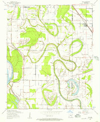 1954 Keo1957 Print · USGSThe Arkansas River lowlands and the Lonoke-Pulaski county line come to life in the mid-1950s, showing a landscape of fertile bottoms and winding oxbows. Researchers can trace rural lineages through numerous landmarks like Estes Church, Bredlow Corner, and the Keo Cemetery.2 unique versions available
 - 1954 Map of Scott, 1957 Print
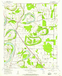 1954 Scott1957 Print · USGSThe oxbows and river bends of the Arkansas lowlands are captured here in the mid-fifties, just as rural communities like Scott and Toltec were evolving. Researchers can trace ancestral footprints at Toltec Mounds, La Grande Cemetery, and old rural hubs like Walkers Corner.3 unique versions available
Showing maps 1-25 of 199
Top cities of Lonoke County
- Cabot historical maps
- Lonoke historical maps
- Ward historical maps
- England historical maps
- Carlisle historical maps
- Austin historical maps
See more
Frequently asked questions
- What are the different types of historical maps available for Lonoke County?
- What is the oldest map of Lonoke County?
- Where can I purchase historical maps of Lonoke County for my home or office?
- Where can I download high-res historical maps of Lonoke County?
- Are there historical topographic maps available for Lonoke County?
- Is there historical aerial imagery available for Lonoke County?
- Where are historical maps of Lonoke County sourced from?