Old Maps of Joiner, Arkansas for Academic Research
Study the evolution of Joiner with 24 high-resolution historic maps. Whether you're teaching, researching, or modeling changes in land use, these maps provide essential visual documentation of urban, environmental, and geographic change.
- Analyze long-term change: Track patterns in development, transportation, and natural features.
- Ideal for environmental or urban studies: Support academic projects with primary historical map data.
- Use in the classroom or lab: Educators and researchers rely on these maps to bring historical context to life.
These maps are a powerful tool for teaching, research, and visualizing how Joiner has changed over the decades.
Joiner, AR maps
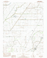
(24)- 1931 Map of Jericho
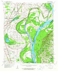
 1931 Jericho1931 Print · USGSThe Arkansas-Tennessee borderlands appear here in the early 1930s, defined by the winding Mississippi and its evolving islands. Genealogists and researchers can trace old river landings like Pecan Point, rail stops at Jericho, and the rural Mt Vernon Church.
 - 1939 Map of Jericho, 1941 Print
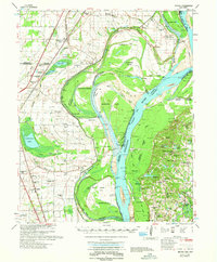
 1939 Jericho1941 Print · USGSThe shifting Mississippi River bottomlands come to life in this late 1930s survey of the Arkansas-Tennessee border. Researchers can trace historical river landings like Happy Valley Ldg, see the vanished tracks of the St Louis San Francisco RR, and locate rural landmarks such as Mt Olive Ch & Sch.
 - 1939 Map of Evadale, 1954 Print
 1939 Evadale1954 Print · USGSMississippi County, Arkansas, at the end of the 1930s was a landscape being reshaped by the drainage of the Sunk Lands. Local historians can trace the foundations of several communities and rural landmarks, including Little Bethlehem Ch & Cem, the company town of Wilson, and the early settlement of Dyess.
 - 1952 Map of Jericho
 1952 Jericho1952 Print · USGSThe Mississippi River's shifting course defines this borderland during the early 1950s, where Arkansas and Tennessee meet in a maze of chutes and islands. Researchers can trace rural lineages through numerous local sites like St Pauls Ch & Cem, Meneshea, and the Clarkedale Post Office.
 - 1953 Map of Memphis, 1966 Print
 1953 Memphis1966 Print · USGSEastern Arkansas and the Memphis riverfront are shown here during the mid-century period of regional growth and river management. Local historians can trace the paths of the Chicago Rock Island & Pacific RR through Forrest City or locate river landmarks like President's Island.3 unique versions available
 - 1956 Map of Evadale
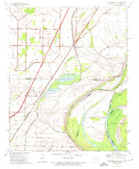
 1956 Evadale1956 Print · USGSMississippi County, Arkansas, appears in the early 1950s as a productive agricultural landscape secured by an extensive system of levees and drainage ditches. Genealogists can locate family names at Pittman Cem, Louise Chapel & Cem, and the industry at Creamery Package.
 - 1956 Map of Memphis
 1956 Memphis1956 Print · USGSThe Mississippi Delta and the bluffs of West Tennessee meet in the mid-fifties, showing a landscape defined by massive river systems and rail hubs. Researchers can trace the path of Crowleys Ridge or locate vanished river landings near Centennial Island and Island No 35.
 - 1961 Map of Jericho, 1963 Print
 1961 Jericho1963 Print · USGSThe Mississippi River delta at the start of the 1960s reveals a world of island farming and rail-side settlements along the Arkansas-Tennessee border. Genealogists can trace family roots through numerous local landmarks, including Jericho, Clarkedale, and the St Paul School and Church.
 - 1962 Map of Jericho
 1962 Jericho1962 Print · USGSThe riverfront border of Arkansas and Tennessee is captured here in the early sixties, showing a landscape shaped by the Mississippi River. Genealogists and local historians can trace family roots through sites like Jericho, James Mill, and Lambethville, or locate rural landmarks such as Pecan Point Cem and the Shawnee Sch.
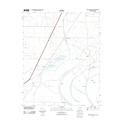
 - 1970 Map of Frenchmans Bayou, 1974 Print
 1970 Frenchmans Bayou1974 Print · USGSThe Arkansas-Tennessee borderlands appear here in the early 1970s, defined by the river’s winding chutes and protected agricultural bottoms. Researchers can locate vanished rural landmarks like St Pauls Ch, Shawnee Sch, and the riverside community of Lambethville.2 unique versions available
 - 1975 Map of Jericho
 1975 Jericho1975 Print · USGSThe Mississippi River meanders through the Arkansas and Tennessee borderlands in the mid-seventies, documenting a landscape shaped by massive river bars and drainage ditches. Trace family sites at Jericho, Frenchmans Bayou, and small country landmarks like St Paul Cem or Paradise Ch.
 - 1983 Map of Joiner, 1984 Print
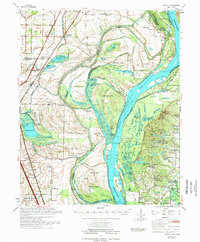
 1983 Joiner1984 Print · USGSThe Mississippi County Delta in the late seventies and early eighties shows an intensive agricultural landscape shaped by a massive network of drainage canals. Genealogists and local historians can trace rural family sites like Ashburn Cem, New Bethel Ch, and the community of Dyess.
 - 1986 Map of Jonesboro
 1986 Jonesboro1986 Print · USGSNortheast Arkansas in the mid-eighties shows a landscape of intensive drainage and railroad junctions centered on the rise of Crowley's Ridge. Researchers can trace the rail corridors of the St Louis Southwestern Railway and explore the unique geography of Hatchie Coon Island and the Mississippi River floodplain.2 unique versions available
 - 1986 Map of Memphis West
 1986 Memphis West1986 Print · USGSThe Mississippi River delta and the rise of Crowleys Ridge define this mid-1980s look at the Mid-South. Researchers can trace the development of West Memphis and Marion or locate landmarks like Crittenden Mem Cem and Village Creek State Park.2 unique versions available
 - 2011 Map of Frenchmans Bayou, 2011 Print
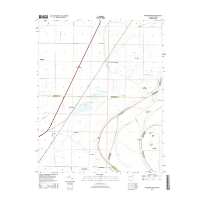
 2011 Frenchmans Bayou2011 Print · USGSCovers Joiner, including Gilmore, Meneshea, and other nearby areas
 - 2011 Map of Joiner, 2011 Print
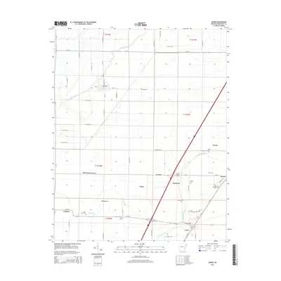
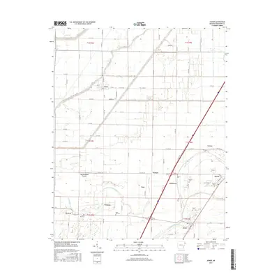
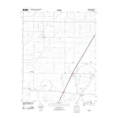 2011 Joiner2011 Print · USGSCovers Joiner, including Dyess, Bassett, and other nearby areas
 - 2014 Map of Joiner, 2014 Print
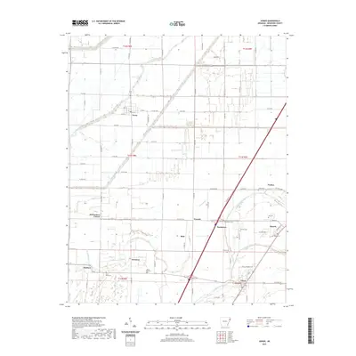
 2014 Joiner2014 Print · USGSCovers Joiner, including Dyess, Bassett, and other nearby areas
 - 2014 Map of Frenchmans Bayou, 2014 Print
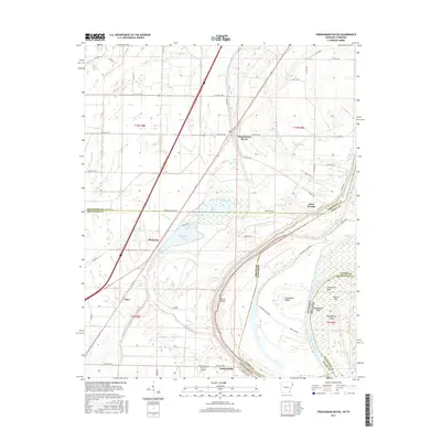
 2014 Frenchmans Bayou2014 Print · USGSCovers Joiner, including Gilmore, Meneshea, and other nearby areas
 - 2017 Map of Joiner, 2017 Print
 2017 Joiner2017 Print · USGSCovers Joiner, including Dyess, Bassett, and other nearby areas
 - 2017 Map of Frenchmans Bayou, 2017 Print
 2017 Frenchmans Bayou2017 Print · USGSCovers Joiner, including Gilmore, Meneshea, and other nearby areas
 - 2020 Map of Joiner, 2020 Print
 2020 Joiner2020 Print · USGSCovers Joiner, including Dyess, Bassett, and other nearby areas
 - 2020 Map of Frenchmans Bayou, 2020 Print
 2020 Frenchmans Bayou2020 Print · USGSCovers Joiner, including Gilmore, Meneshea, and other nearby areas
 - 2024 Map of Joiner, 2024 Print
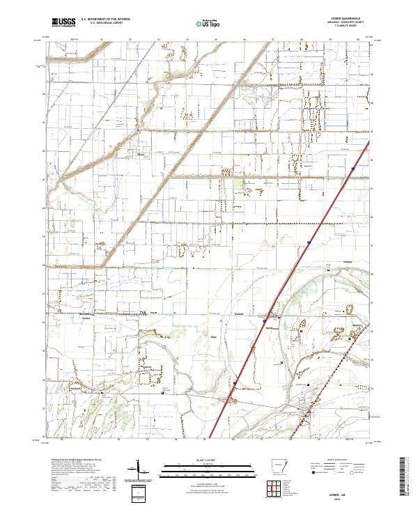 2024 Joiner2024 Print · USGSMississippi County at the modern day continues to reflect its deep agricultural roots and Delta heritage. Genealogists and historians can trace family land and rural communities via landmarks like Mount Pisby Cem, Dyess, and McClendons Corner.
 - 2024 Map of Frenchmans Bayou, 2024 Print
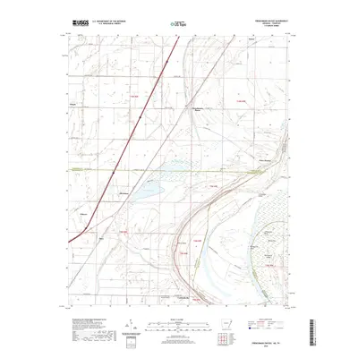
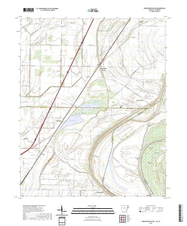 2024 Frenchmans Bayou2024 Print · USGSThe Mississippi River delta in the twenty-first century reveals a intricate landscape of oxbow lakes and rural hamlets. Researchers can trace the modern layout of settlements like Frenchmans Bayou, Joiner, and Lambethville alongside the historic Rupe Cem.
End of results
Showing maps 1-24 of 24
Top cities near Joiner
- Millington historical maps
- Osceola historical maps
- Lepanto historical maps
- Wilson historical maps
- Keiser historical maps
- Tyronza historical maps
See more
Frequently asked questions
- What are the different types of historical maps available for Joiner?
- What is the oldest map of Joiner?
- Where can I purchase historical maps of Joiner for my home or office?
- Where can I download high-res historical maps of Joiner?
- Are there historical topographic maps available for Joiner?
- Is there historical aerial imagery available for Joiner?
- Where are historical maps of Joiner sourced from?