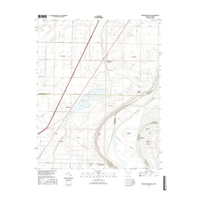
2017 Map of Frenchmans Bayou
USGS Topo · Published 2017About this map
The alluvial plains of the Mississippi River define this 2017 survey along the Arkansas and Tennessee border. Small agricultural communities such as Frenchmans Bayou and Saint Thomas dot the landscape, connected by a network of rural roads like State Hwy 308 and Levee Rd. The dynamic nature of the river is evident in the complex hydrography of the eastern portion of the map, where Brandywine Chute separates Brandywine Island from the mainland. The presence of features like Centennial Island and Centennial Bend suggest a shifting river course over generations, creating a landscape of oxbows and sloughs including Meneshea Lake and Bellhammer Slough. For genealogists and local historians, the inclusion of Rupe Cem and smaller settlements like Lambethville and Stacy provides specific points for locating family homesteads in this river-driven economy.
Find a feature on this map
61 named features on this map. Tap any name to fly to it.
Don’t see what you’re looking for? This feature index may not catch every label — zoom into the map to look around manually.
Map Details
Editions of this 2017 Frenchmans Bayou Map
This is the sole edition of this map. No revisions or reprints were ever made.
Other maps of this area

1931 · Jericho
USGS Topo · 1:62,500

1939 · Jericho
USGS Topo · 1:62,500

1939 · Evadale
USGS Topo · 1:62,500

1940 · Deckerville
USGS Topo · 1:62,500

1941 · Marked Tree
USGS Topo · 1:62,500

1952 · Jericho
USGS Topo · 1:62,500

1953 · Memphis
USGS Topo · 1:250,000

1956 · Evadale
USGS Topo · 1:62,500

1956 · Marked Tree
USGS Topo · 1:62,500

1956 · Memphis
USGS Topo · 1:250,000